Archive for the ‘Minneapolis Parks: General’ Category
Lost Minneapolis Parks: The Complete List, Part I
Filed under: Lost Minneapolis Parks, Minneapolis Parks: General | Tags: Brownie Lake, Elwell Field, The Gateway, Theodore Wirth Park
 Comments (3)
 I’ve written about several parks in Minneapolis that are no more. Since then I’ve been asked if there is a list of those “lost” parks. The short answer is, “Not until now.” Here’s the first part of an alphabetical list I’ve compiled from park board proceedings and annual reports.
19th Avenue South and South 1st Street. 1.0 acre. The park board’s 1948 annual report noted that the site near Seven Corners had been graded and frames had been installed for swings, teeter-totters and slides for small children. The plan was to complete the playground in 1949. This parcel was leased specifically for use as a playground. I don’t know the terms of the lease, but it was still included in park inventory as leased land in the 1964 annual report. The U of M’s West Bank softball fields are now near the site. 19th Avenue South at that point is the approach to the 10th Avenue Bridge over the Mississippi River.
Bassett Triangle. 7th Avenue North and 7th Street North, 0.03 acre. Acquired from the city council December 3, 1924. Returned to the city council in 1968, after the board hired appraisers in 1967 to try to sell the property. The site is now occupied by a Wells Fargo Bank. The property was named for Joel Bean Bassett, who owned much of the land in the vicinity in the 1800s. Bassett’s Creek, underground not far away, is also named for him.
Bedford Triangle. Orlin Avenue SE and Bedford Avenue SE, 0.01 acre. This little triangle in Prospect Park was still carried on the park board’s inventory the last time I checked, but it was listed as “paved.” There is no visual evidence of the triangle. Read more about this and other triangles in the meandering streets below Tower Hill.
Brownie Lake (partial). Theodore Wirth Park west of Brownie Lake and south of Highway 12, 32 acres. The land was sold in 1952 to the Prudential Insurance Company for $200,000 and some additional land.
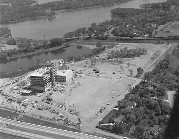
The southern end of Theodore Wirth Park west of Brownie Lake got a makeover when the Prudential Insurance Company purchased the land for its regional headquarters in 1952. It was the largest section of park land the Minneapolis park board has ever sold. Construction is underway in this 1954 photo. (Minneapolis Star Journal Tribune, Minnesota Historical Society)
The park board bowed to intense public pressure to sell the land beside the lake. Prudential had made it clear that the site adjacent to the lake was the only site it would consider for its offices in the city. Ultimately the park board was convinced that the benefit to the Minneapolis economy was a greater good than keeping the land as a park. The board justified its action in part by asserting that with the growth of traffic on Highway 12 (now I-394) and the widening of that road, the land west of Brownie Lake had already been isolated from the rest of Wirth Park anyway.
Cedar Avenue Triangle. Cedar Avenue and 7th Street South, 0.02 acre. The triangle was offered to the park board by Edmund Eichorn on April 15, 1891. After delaying a decision for a couple of months, the board agreed to pay Eichhorn $2,394 over ten years without interest. The triangle, adjacent to what is now the Cedar Avenue exit ramp from I-94 westbound, was sold to the state highway department in 1965 for $1,000. In April of that year the board approved a resolution to sell the property for $1,000 plus “other valuable considerations.” Later that year the board approved dropping the “other valuable considerations” clause.
Crystal Lake Triangle. West Broadway and 30th Avenue North, 0.05 acre. The triangle was supposedly purchased July 21, 1910 and sold to the state in 1962 for $2,700. It once sat at the edge of what is now the hideous intersection of Theodore Wirth Parkway, West Broadway (County Highway 81) and Lowry Avenue. Imagine if Phelps Wyman’s 1921 plan for that complex intersection had been used. What a difference it would have made in that part of Minneapolis. It would’ve been gorgeous.
Dell Place. Dell Place between Summit and Groveland avenues, 0.04 acre. Transferred from the city council April 27, 1883 when the park board was created. Citizens near the tiny lot petitioned the park board in 1907 to plant and maintain the grounds, which the park board agreed to do — if residents of the area would first pay to have the parcel curbed and filled to street grade. The street triangle was sold to the Minnesota highway department for I-94 interchanges in 1964 for $1,350. The park board had rejected the state’s first offer of $450. The park board’s appraisers valued the land at $2,250, but the park board accepted an internmediate figure instead of proceding to court with litigation.
Elwell Field I. East Hennepin and 5th Avenue SE, 3.7 acres. Purchased in 1939 from the Minneapolis Furniture Company for $5,000. Sold to Butler Manufacturing in 1952 for $55,000. The somewhat isolated field, surrounded by industrial buildings, was sold with the promise to the neighborhood to acquire another playground nearer Holmes School. Eventually the land adjacent to the school was purchased as a playground. The school on the former Holmes site, built in 1992, is now named Marcy Open School.

The first Elwell Field, 1952. Across the field is a building of the Butler Manufacturing company, which purchased the field the year the picture was taken. (Norton and Peel, Minnesota Historical Society)
Elwell Field II. 9th Avenue SE between SE 4th Street and SE 5th Street, 1 acre. The former site of Trudeau School was acquired February 4, 1953 in a trade with the school board. The park board gave up Sheridan Field next to Sheridan School at Broadway and University Avenue NE for the Trudeau property. The second Elwell Field was condemned by the state highway department for I-35W in 1962. The park board accepted a negotiated payment of $125,000 for the park in 1966.
Franklin Triangle. Franklin Terrace and 30th Avenue South, 0.05 acre. Transferred to the park board from the city council August 13, 1915 and accepted and named by the park board September 6, 1916. Taken by the state highway department for I-94 in 1962 in exchange for $1 and “other valuable considerations” again.

The beautiful cover of the park board’s 1915 annual report depicted the fountain at The Gateway. (Minneapolis Park and Recreation Board)
The Gateway. Hennepin and Nicollet avenues, 1.22 acres. There is still a Gateway park property at Hennepin and 1st Street South, but it’s not in the same location, so I consider this original Gateway a lost park. I have already provided the outline of the story for the original Gateway on the history pages of the Minneapolis Park and Recreation Board’s website at minneapolisparks.org.
Groveland Triangle. Groveland and Forest avenues, 0.21 acre. The triangle was purchased in November 1910 for $8,979. It was sold to the state highway department for the construction of I-94 in 1964 for $8,900.
That’s all for Part I of Lost Minneapolis Parks. Part II — H-R — will be out soon.
Historical profiles of all existing Minneapolis parks can be found at the website of the Minneapolis park board. Each park has its own page with a “History” tab.
If you remember anything about any of the lost parks mentioned here, please send me a note so we can preserve something of those parks — especially the property beside Brownie Lake. Any memories before Prudential moved in?
David C. Smith
© David C. Smith
The Re-creation of Hall’s Island: Part I
Filed under: Minneapolis Parks: General, Mississippi River | Tags: Dr. P. M. Hall, Hall's Island, Minneapolis Beaches, Mississippi River, RiverFIRST
Comments (8) Before he saved enough money to go to medical school, Pearl Hall’s job as a teenager in the mid-1870s was pitching wood onto a cart at a lumber yard near the Plymouth Avenue Bridge on the east bank of the Mississippi River. He remembered vividly from those days of hard labor what he called a little steeple of land sticking out of the Mississippi near the bridge. He could see the tiny patch of ground when he stood on top of his loaded wagon–and he saw the little steeple gradually grow.

Hall’s Island in 1903 plat book (John R. Borchert Map Library, University of Minnesota)
What Pearl Hall saw from his perch of pine was the beginning of Hall’s Island, the island that as Dr. P. M. Hall he would eventually acquire and turn over to the city, the island that became the site of a popular municipal bath house, the island that eventually was dredged onto the east bank of the great river, and the island that the Minneapolis park board will soon begin to re-create as the first step in its RiverFIRST development plan.
Hall didn’t think about that little speck of land again until he was elected to be Minneapolis’s Health Officer in 1901. Then he wrestled with the problem all health officers everywhere wrestled with and usually lost to: how to dispose of garbage. Not just coffee grounds, melon rinds, and chicken bones, but real garbage — offal, dead horses, night soil — where death could take took root and grow. Read more
University of Minnesota Honorary Degrees and Minneapolis Park Names
Filed under: Grand Rounds, Minneapolis Park Names, Minneapolis Parks: General | Tags: Edward Foote Waite, Thomas Sadler Roberts, William Watts Folwell
Comments (2) Here’s an exclusive club: William Watts Folwell, Thomas Sadler Roberts and Edward Foote Waite. Each has had a Minneapolis park property named for him, and each also received an honorary degree from the University of Minnesota.
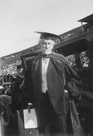
William Watts Folwell
1925 was a big year for Folwell when, at age 92, he received the first honorary Doctor of Laws degree ever awarded by the University of Minnesota and Folwell Park was dedicated in his honor. The name for the park had been chosen in 1917, but it took eight years for the park to be finished and dedicated.
Folwell was hired as the first president of the University of Minnesota in 1869. He was elected to the Minneapolis park board in 1888 and served on the board — many years as its president — until 1906. He was the first to propose the name “Grand Rounds” for the city’s ring of parkways.
He is pictured in 1925 when he received his honorary degree, apparently in ceremonies at Memorial Stadium. Photo: Minnesota Historical Society.
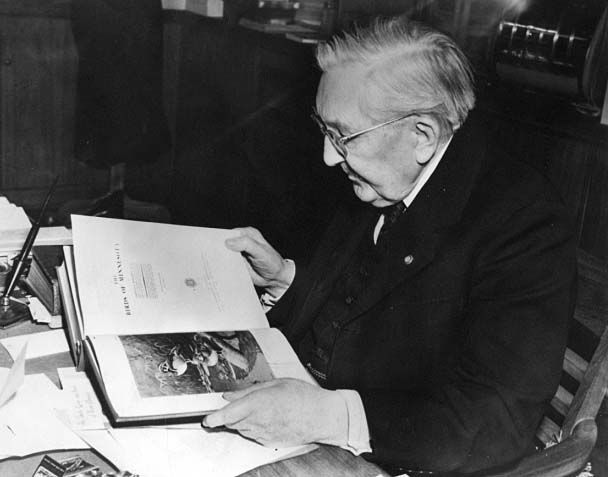 Thomas Sadler Roberts
Roberts was awarded an honorary Doctor of Science degree by the University of Minnesota in 1940, when he was 82. In the photo, taken sometime that year, he is perusing a book of Audubon prints.
The Thomas Sadler Roberts Bird Sanctuary in Lyndale Park near the north shore of Lake Harriet was named in his honor in 1947, a year after his death.
Roberts was a doctor known for his extraordinary capacity to diagnose unusual diseases and illnesses largely due to his prodigious memory. He retired from medicine in his 50s and devoted his time to ornithology. He taught at the University of Minnesota and was a director of the Museum of Natural History. Photo: Minnesota Historical Society.
 Edward Foote Waite
Waite received his honorary degree from the University of Minnesota and had a Minneapolis park named for him in the same year — 1949 — when he was 89. His Doctor of Science degree honored a legal career best known for years of service as a juvenile court judge in Minneapolis. But he was far more than a wise and compassionate judge; he helped shape the field of juvenile law in the United States.
Waite is less well-known for his five-month stint as Minneapolis’s police chief in 1902. It was not an easy job in the wake of a scandal known nationally as the “Shame of Minneapolis,” centered around corrupt Mayor Albert Ames and his brother Fred, whom he had appointed police chief. David P. Jones was appointed mayor to replace the fugitive Mayor Ames and turned to his friend, Waite, an assistant district attorney with no police experience, to clean up a corrupt police force and restore public faith in law enforcement.
Waite Park was developed along with Waite Elementary School as a joint project between the park board and school board from 1949-1951. The park and school opened for the 1950 school year but final improvements to the site were not completed until the following year.
Waite is pictured snowshoeing in about 1945 at the age of 85. Photo: Minnesota Historical Society. (See another photo of Waite at the school named for him.)
From this very exclusive list it would appear that the good do not die young.
David C. Smith
Horace Cleveland’s Friends: Five of Clubs
Filed under: Landscape Architects, Longfellow Field Park, Minneapolis Parks: General | Tags: Cornelius C. Felton, Five of Clubs, George Stillman Hillard, H.W.S. Cleveland, Henry Russell Cleveland, Henry Wadsworth Longfellow, Horace Cleveland, Longfellow Park, Sumner Field
Comments (1) Trivia to delight and amaze.
Can you name two Minneapolis parks named for members of the “Five of Clubs,” an informal sort of book club?
The “Five of Clubs” met informally at the suburban Boston home of Horace W. S. Cleveland’s brother, Henry, in the early 1840s. Horace lived with his older brother for a time and sat in on those “club” gatherings.
Answer: Sumner Field and Longfellow Field.
Sumner Field was named for Sumner Place, the street in north Minneapolis on which the park was built in 1911. Sumner Place was named for U. S. Senator Charles Sumner, famous for his opposition to slavery and for ensuring the rights of freed slaves during Reconstruction. Before he was elected to the Senate from Massachusetts, he was an attorney in Boston — and a member of the “Five of Clubs.”

Longfellow statue in a field near Longfellow Garden upstream from Minnehaha Falls, 2011. (Ursula Murray Husted, flickr.com)
Longfellow Field was named for Henry Wadsworth Longfellow, the poet and professor of modern languages at Harvard in the 1840s and also a member of the “Five of Clubs.” In 1855, Longfellow published his epic poem “Song of Hiawatha,” which made Minnehaha Falls famous around the world. Longfellow never visited Minnehaha Falls and the book was written 17 years before Horace Cleveland first saw the Falls.
Imagine Horace Cleveland’s astonishment if he would have been told that 110 years after his death he would be more respected in his field than Longfellow is in his.
The other members of the “Five of Clubs” were Cornelius C. Felton, professor and future president of Harvard University, and George Stillman Hillard, Sumner’s law partner and author and publisher.
A reminder: Minneapolis should have a park along the Mississippi River gorge named for Horace Cleveland.
For much, much more on Horace Cleveland, click on his name in the tag cloud at right. For the whole story of Horace Cleveland and Minneapolis parks read City of Parks.
Just curious. Any future Sumners or Longfellows or Clevelands in your book club?
David C. Smith
City Ordinance Restricts Building Height Around Minneapolis Lakes
Filed under: Minneapolis Parks: General | Tags: Gates Mansion, Lake Calhoun, Lake of the Isles, Loring Park, Washburn Fair Oaks
Comments (1) If you’re a long-time follower of Minneapolis politics, you might think this headline came from the 1988 fight to prevent a high-rise building from being constructed next to the Calhoun Beach Club facing Lake Calhoun. But you have to go back much farther in history to get to the first city ordinance to restrict construction on parkways encircling Minneapolis lakes.
I wrote a few weeks ago about Theodore Wirth’s description of the Calhoun Beach Club as a “disfigurement.” In that post I noted that Charles Loring was the first to warn the park board of the likelihood of commercial encroachment on the lake following the highly successful opening of the Lake Calhoun Bath House in July, 1912. Loring urged the park board to acquire the property across Lake Street from the bath house to prevent commercial development there. The fear, I’m sure, was the opening of saloons or dance halls. (Just two years earlier, in June 1910, the park board expanded Riverside Park when a dance hall was planned for land facing the park. The board preempted the dance hall plans by acquiring the land through condemnation.)
Since I wrote that post I’ve learned that by the time Loring made his suggestion in August 1912, the city had already passed an ordinance limiting construction on parkways around the lakes. And it had nothing to do with the Lake Calhoun Bath House. The purpose of the ordinance was essentially to facilitate the construction of this castle. Continue reading
Another Colorful Name Lost
Filed under: Minneapolis Park Names, Minneapolis Parks: General | Tags: Birch Pond, Glenwood Park, Theodore Wirth Park
Comments (3) The official record of the Minneapolis park board, the published “proceedings,” often don’t tell the whole story. Example: the proceedings of the park board meeting of June 6, 1910 record that the board voted that the “small lake in Glenwood Park between Western Avenue and Superior Avenue” be named “Birch Pond.” That’s been the name ever since.

What the official proceedings didn’t tell us I learned by accident while researching another issue. The June 7, 1910 Minneapolis Tribune noted the previous name of Birch Pond — the vastly more intriguing “Devil’s Glen.” I wonder how the little lake got that name. Probably a good story. But I imagine it was more offensive to some people than a lake named for John C. Calhoun.
The pond was renamed as the parkway beside it was being built by a crew of forty railroad workers imported from Hungary. The previous year, scheduled construction at North Commons and East River Parkway was postponed due to a labor shortage in Minneapolis. The park board took no chance with its new parkway through what was then Glenwood Park, now Theodore Wirth Park, and imported the workers to build it.
David C. Smith
Triangle Followup: Prospect Park, Laurel and Sibley Triangles
Filed under: Minneapolis Parks: General, Prospect Park, Sibley Field | Tags: Laurel Triangle, Prospect Park, Sibley Field, Sibley Triangle
Comments (3) Summer gardens are gone and I never got a good picture of another beautiful park triangle: Sibley Triangle located in northeast Minneapolis where Washington Street NE and Fifth Street NE meet. (For earlier posts on park triangles see this one on small triangles and this one on triangles in Prospect Park.) Every time I was in the neighborhood I was without camera, so if any readers have photos I’d like to post them. The garden is planted and maintained by volunteer Robin Russell, who has done a fantastic job. Sibley Triangle is another of Minneapolis’s six triangles that are listed as 0.01 acre. The park board acquired the little triangle from the city in 1920.
Like Sibley Field in south Minneapolis, it was named for Henry Hastings Sibley, but the triangle was named first. Apparently having a little street triangle named for Sibley did not sufficiently honor Minnesota’s first governor, so the larger neighborhood park was named for him too — three years later. (The larger park had previously been referred to as Cedar Avenue Heights Park. See more here.)
I was also informed by Michelle Kellogg of the park board that the volunteer who deserves the credit for maintaining the tranquil gem of Laurel Triangle in Bryn Mawr is Patty Wycoff. Thanks Patty!

Laurel Triangle 2011
Finally, I spent an enjoyable evening in July with the Prospect Park Garden Club at the home of Mary Alice Kopf talking about triangles and other parks in the neighborhood. Thanks to Julie Wallace who dug up the info from neighborhood association documents that Bedford Triangle and Clarence Triangle were altered in 1979. Bedford Triangle was obliterated and the street on one side of Clarence Triangle was removed so it now appears to be part of the yard on the northwest corner of the Bedford and Clarence intersection. The only thing that suggests it is not private property is a boulder on the corner — as in the other Prospect Park triangle parks. I learned that night that the boulders were unearthed during the construction of I-94 through the neighborhood.
David C. Smith
The Seven Squares
No one has answered correctly my challenge of a couple weeks ago to name the seven “squares” that are parks in the Minneapolis park system. The illion-dollar prize will, therefore, not be awarded, but perhaps will be rolled over into a new contest sometime in the future.
The seven Minneapolis park “squares” are Murphy Square, Jackson Square, Bryant Square, Franklin Steele Square, Stevens Square, Lovell Square and Chute Square.
Two squares were named only for the streets on which they are situated: Bryant Square in south Minneapolis and Jackson Square in northeast. Neither street name had anything to do with Minneapolis. William Cullen Bryant was a poet and Andrew Jackson was President of the US of A.
Perhaps it is coincidence, but the only two squares not named for local heroes were also the only of the seven that were used as garbage dumps.
In the case of Bryant Square it was with the blessing of the park board. The land for Bryant Square was well below street grade — 20 feet in some places — so before the park board agreed to buy the land for a park in 1904 it set the condition that no improvements would be made until the neighborhood filled the land. So the neighborhood dumped its garbage there. It wasn’t enough. Finally, after eight years, the park board spent $6,000 to purchase fill for the park. A few trees were planted and a bit of playground equipment was installed in 1913 and 1914. Drive past the park today and you will see that the playing fields are still below the grade of the streets around them. Bryant Square is the largest of the parks named squares at 3.66 acres.
Jackson Square’s use as a garbage dump was not so well received by the park board. Only a year after it was acquired in 1906, park superintendent Theodore Wirth requested permission to erect a fence around the still-unimproved park to prevent neighbors from dumping garbage there. But that’s not as sad as the naming of the park. Before the park board acquired the land and chose such a bland name, the block was referred to as Long John Pond. Long John Square: doesn’t that sound more fun? Years later the city realized that the old Long John Pond had once served a useful purpose and recreated a drainage pond in the block south of the park, across from Edison High School. It’s not named for Long John either. Anyone in the neighborhood want to start a campaign? Can anyone tell us the story of Long John?
Another square, Stevens, was also named for an adjacent street, but Col. John Stevens, for whom the street was named, was one of the pioneers of Minneapolis. His house, the first frame house on the Minneapolis side of St. Anthony Falls, now stands restored in Minnehaha Park. Stevens’ statue stands watch outside his old homestead. The statue was a gift to the city from his daughter Katharine Stevens Winston, whose husband, P. B. Winston, was once mayor of Minneapolis. The statue was placed in Stevens Circle, at Portland and Sixth Avenue South, in 1911. It lived there until that park was taken to widen streets in 1935. I think the statue should have been moved to Stevens Square, instead of Minnehaha.

Stevens Square in 1936. (Minnesota Historical Society)
If you’re looking for some fun, place the statue of Stevens below into the park above and see where it looks good. You might also tinker with the hat. When the Municipal Art Commission gave its approval to place the statue on public land, it recommended that in keeping with the “natural dignity” of the character, the hat be removed from the sculpture. The commission also recommended that the statue be given some architectural backdrop instead of being a free standing sculpture, probably something more like the Thomas Lowry monument built a few years later. Obviously neither recommendation was followed.

Stevens Statue at Portland and Sixth in 1912 shortly after it was installed. The park name was changed from Portland Triangle to Stevens Circle in honor of the event. Stevens was moved to Minnehaha Park in 1935 when the city needed this land to enlarge the street to accommodate more traffic. (Charles Hibbard, Minnesota Historical Society)
Murphy Square was the first park in Minneapolis, donated by Edward Murphy to the city in 1857. I’ve already written about Murphy Square here.
Like Murphy Square, Franklin Steele Square and Lovell Square were donated by the people or families whose names they carry. Franklin Steele Square was donated by the three daughters of Franklin Steele in 1882, a year before the Minneapolis Board of Park Commissioners was created. They donated the land on the condition that Charles Loring take charge of improving the park, which he agreed to do. (Loring had just lost his bid to become mayor of Minneapolis and the park board, of which he became the first president, had not yet been created, so he had some time on his hands — and he was well-known around the city for his interest in landscaping and horticulture.) Franklin Steele built the first bridge across the Mississippi River, among other notable pioneering achievements.
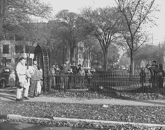
Looks like some sort of groundbreaking at Franklin Steele Square in 1947. In 1949 a new shelter was built at the park to serve also as a warming house for skaters in winter. (Minnesota Historical Society)
Seven years after Steele’s daughters donated land for the park, they were opponents of an effort to create another new park when the state of Minnesota purchased by condemnation the land for Minnehaha Park, which included the falls. Two of the daughters owned land taken at that time and appealed the case to the courts, where they lost. Franklin Steele Square, now hemmed in on two sides by freeways, is nothing like it once was. The freeways nipped 0.14 acres from the park in the 1960s.
Lovell Square in north Minneapolis was a gift to the park board in 1887 from C. P. Lovell, Elwood Corser and William Barnes, influential real estate developers in the city. The three also deeded the land for nearby Barnes Place. Elwood Corser had also donated land for Lake of the Isles Parkways. Corser and Barnes were often appointed by the park board as appraisers in land condemnation proceedings for parks.
Chute Square, the smallest of the squares at 1.1 acres, is the site of the Ard Godfrey House in old St. Anthony. It is named for Richard Chute an early landowner in St. Anthony. In an unusual twist, the square was named not for someone who donated land, but from whom some of the land was purchased. Richard and his brother Samuel, who served on the first park board, had owned some of the land that was converted into park in 1903. Surrounded now mostly by condos and townhouses, the square once had a more imposing neighbor, the Exposition Building.

The Exposition Center looms behind the Godfrey House in Chute Square in 1936. The Exposition Building was the site of the 1892 Republican Party national convention. (Minnesota Historical Society.)
The Hennepin County Historical Society proposed in 1955 to build a history museum on Chute Square, but the park board rejected the idea because the square was too small.
Over the years the Minneapolis park board has lost two squares, too. Market Square was given up to build the Exposition Center in 1886. Pioneer Square which occupied the land across from the downtown post office was taken over by the city in the 1960s as a part of urban renewal.
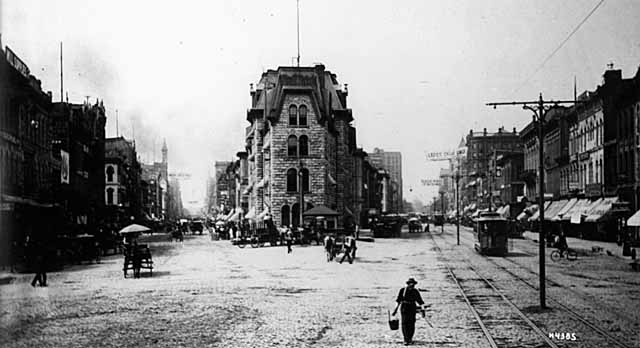
You’re looking across Bridge Square from the Hennepin Bridge to City Hall, the future location of The Gateway. Hennepin Avenue is on the right, Nicollet Avenue on the left in 1885. (Charles Hibbard, Minnesota historical Society)
Probably the most famous square in Minneapolis history, Bridge Square, at the intersection of Nicollet and Hennepin in front of the Hennepin Avenue Bridge — the hub of the city — was never a park, but the old Gateway park nosed up to it from the west on the City Hall site. The original Gateway was also demolished for urban renewal.
The Gateway was a big triangle and a big failure as a park. And it remains a cautionary tale for those who wish to create downtown parks.
Many other Minneapolis parks, in fact most neighborhood parks in the city, are in the shape of a square or rectangle, but for some reason only the seven parks above were named “squares.”
David C. Smith
The Big Bowl: Seven Oaks Oval
It’s a steep descent into Minneapolis’s cheapest park, more than twenty-five feet down from the street. And it contains no river or creek bed; at least there’s no water in it anymore. It’s a huge bowl full of wild greenery one block west of West River Parkway and East 34th Street. There are many little parks in Minneapolis that no one but neighbors really knows about, like the triangles I wrote about earlier this summer. But this park covers more than two acres, more than half the size of a typical city block. And the only evidence that the park board has ever spent a penny on the interior of the park is the dreaded orange paint ring around the tree trunk in the picture: a park board forester has been here. Someone is watching.

Seven Oaks Oval: The cheapest park in Minneapolis, twenty-five feet below street grade
Seven Oaks Oval has to be the cheapest park in the city measured by the cost-per-acre to acquire and maintain the property during its life as a park. Seven Oaks Oval officially became a park in 1922, at least that’s when the park board accepted the property as a park. Park board proceedings claim it was platted as a park in the original plat of Seven Oaks River Lots in 1913, but that plat already shows up with a park in the middle on the 1903 plat map of the city. Regardless, it cost the park board nothing to acquire.
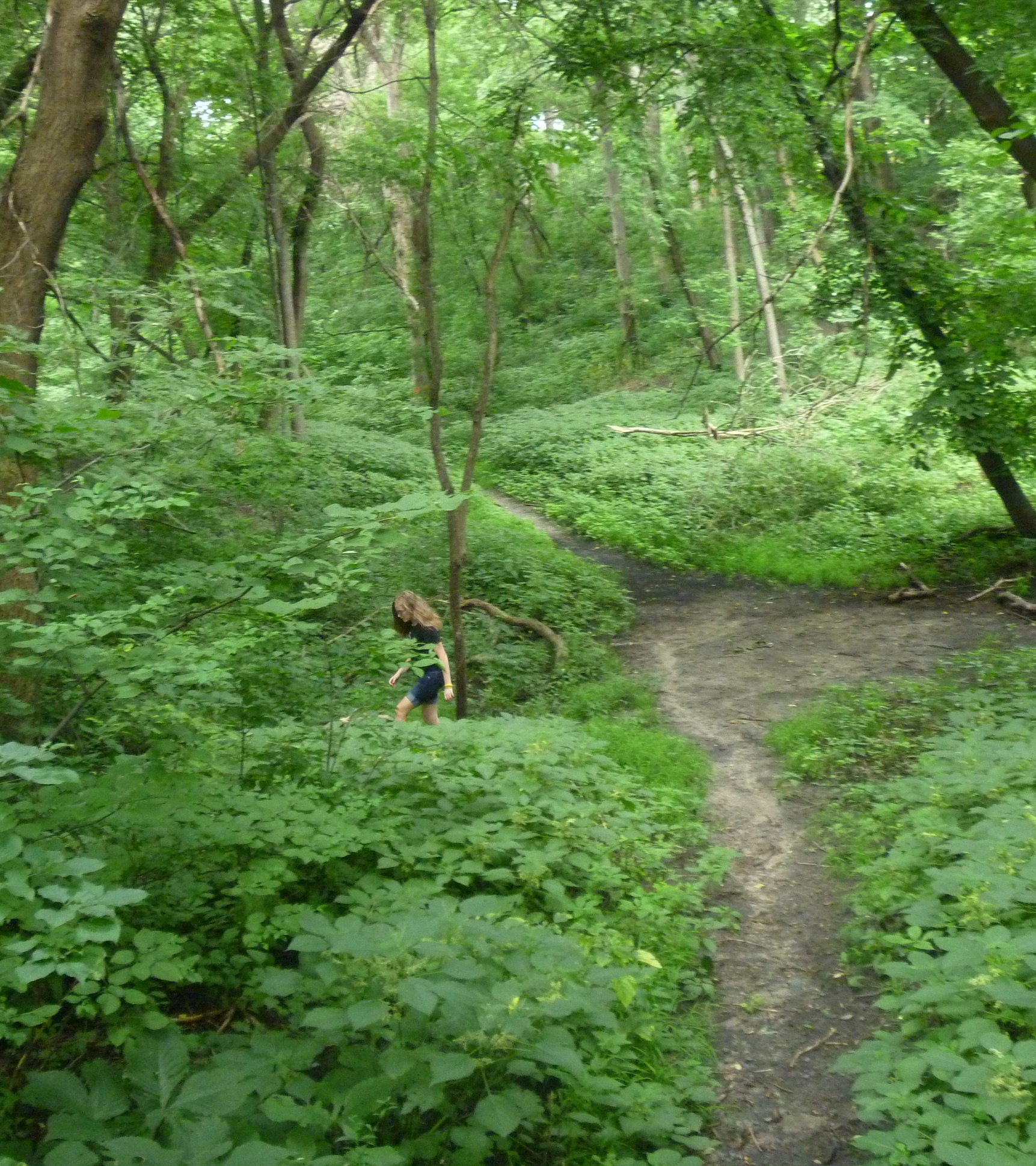
A young woman, maybe a phantom, darted through the green and disappeared.
The year the park was acquired, 1922, was such a busy one at the Minneapolis park board that the acquisition wasn’t even mentioned in the park board’s annual report for the year. Park superintendent Theodore Wirth included a modest plan for the park in the 1928 annual report, a few criss-crossing paths and two campfire sites for the Boy Scouts and Campfire Girls, but nothing ever came of it. Perhaps the park board placed the boulders in a small bit of grass border around the bowl, but what they cost to place there might have been the only money ever spent on the park beyond mowing the thin fringe of grass beside the curb.
It seems a place to exercise the imagination, a kind of spooky hideaway, the kind of I-dare-you place kids tell their visiting cousins scary stories about. When I visited, old branches had been stacked to form a crude shelter halfway down the hill, a pirate’s lair or the shelter of a shipwrecked sailor. I’m sure once inside that one would hear lions or tigers sniffing about the entrance. Perhaps someone who lived in the neighborhood can provide an account of the odd park. I’d love to know more. If any geologist out there could explain this topographical oddity to me, I’d also appreciate that.
Odd Shapes
What I know for sure is that Seven Oaks Oval is one of only two park properties named for shapes that don’t have angles. The other is Caleb Dorr Circle on the east end of the Franklin Avenue Bridge. Ironically, Caleb Dorr Circle has for many years actually been a triangle. There used to be other ovals and circles, but they’ve been lost to streets and traffic.
By my last count there are 33 “triangles” and 7 “squares” remaining in the Minneapolis park system. The squares are nearly evenly distributed throughout the city. How many can you name?
David C. Smith
More Flying Merkel v. Horse: Depreciation
Filed under: Lake Harriet, Minneapolis Parks: General | Tags: Flying Merkel, Lake Harriet
Comments (1) Another element in the debate over whether a motorcycle or a horse is a more efficient means of conveyance for park police officers, which I introduced last week in a post about Flying Merkels, is the depreciation of each. I was forced to consider that by an entry in the Proceedings of the Minneapolis Board of Park Commissioners for February 5, 1919.
 In January of that year a hired horse pulling an ice scraper over the ice skating rink on Lake Harriet had plunged through the ice and drowned. The owner of the horse submitted a bill for $125 to the park board to compensate him for the loss, which the park board paid. But knowing that in 1911 a Flying Merkel had cost the park board $238.50, I wondered if the horse was maybe old and worn out. $125 doesn’t seem like much for a horse; the price must have reflected considerable depreciation. What would a used Flying Merkel have been worth? And were there children skating on the lake the day the horse broke through the ice? Did the ice crack like a pistol shot or simply submerge with a gurgle. Did the horse make a sound or did it confront death with equine-imity? The Flying Merkel would have sunk quickly and quietly—but wouldn’t have been worth a damn pulling an ice scraper.
David C. Smith
The Flying Merkel: Minneapolis Park Police Motorcycles
Filed under: Minneapolis Parks: General | Tags: Flying Merkel, Minneapolis Park Police
Comments (2) When the Minneapolis Board of Park Commissioners decided to purchase motorcycles they went with the best. On March 20, 1911 the park board approved the purchase of four “Flying Merkel” motorcycles. The specifications included “four horsepower with magneto and belt drive” at a cost of $238.50 each.

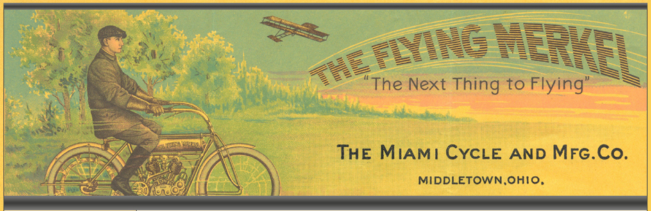
Almost like flying. This image is from theflyingmerkel.com, a web site loaded with info on one of the premier early motorcycles. Jos Ritzen, the administrator of the web site, reports that the image is from the company’s letterhead in 1912.
The Merkel Company was established in Milwaukee, Wisc. in 1902 by Joseph Merkel, a bicycle maker. His company was purchased by the Miami Cycle and Manufacturing Co. in 1911. An interesting history of the motorcycle is here, including the stories of Margaret Gast, early motorcycle racer and stunt driver, and Maldwyn Jones, a national champion racer who helped establish the Flying Merkel as a premiere speed machine. The Flying Merkel was apparently known for its bright orange color.

The 1911 Flying Merkel. The Minneapolis park board purchased four. (Photo auto.howstuffworks.com)
How did the park board use the Flying Merkels? We know the first recreation director, Clifford Booth, had used a motorcycle in previous years to speed from one playground to another, so he may have gotten one. Also in April 1910 the park board approved the purchase of a motorcycle or a horse — with a “recommendation” for the horse — for the park board’s forester. Perhaps the forester got the horse in 1910 and it was upgraded in 1911. But this photo from the 1912 annual report of the park board shows how at least two of the Flying Merkels were used.
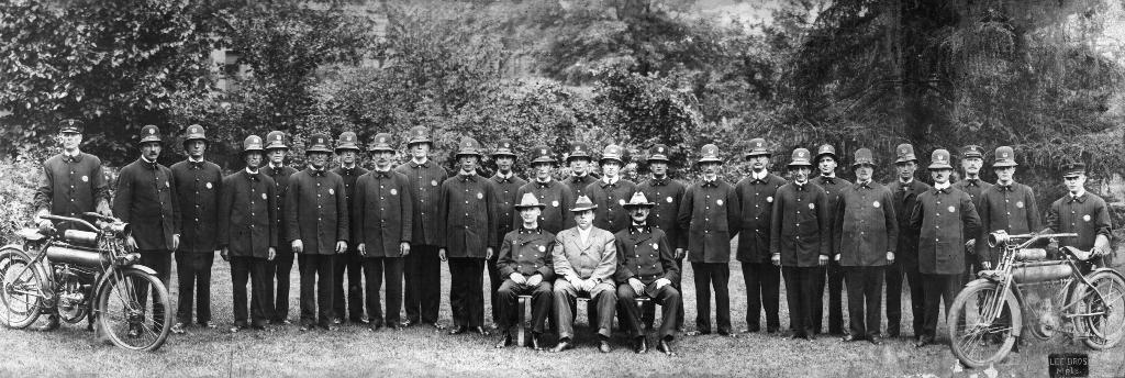
Minneapolis park police in the 1912 annual report of the Minneapolis Board of Park Commissioners. At least two “Flying Merkels” were used by the police. An independent park police force has often been cited as one reason for the great success of the Minneapolis park system. (Minneapolis Park and Recreation Board)
Park police chief Burton Kingsley, seated at the center of the photo, who later was elected as a park commissioner, asked to have the motorcycles replaced by horses. He argued that horses could be used in any weather, but motorcycles were useless in Minnesota for much of the year. He also claimed that police officers got more respect on horses. Perhaps orange wasn’t the best color for police work. But no horse could have had a cooler name.
Despite Kingsley’s preference for horses he reported that the police force logged 50,000 miles on their Flying Merkels in 1912. That’s a lot of oats.
David C. Smith
Did You Know? Tower Hill is not named for the “Witch’s Hat” tower.
Filed under: Minneapolis Parks: General | Tags: Prospect Park, Tower Hill Park, Witch's Hat
Comments (5) The park was named “Tower Hill” in 1909 four years before the water tower with the tall roof was built.
After purchasing the land for the park in 1906, the park board named the park “St. Anthony Heights.” Residents of the area petitioned the board to change the name to “Tower Hill,” which it did finally in 1909. The name was based on a long-gone observation tower built on the hill by an entrepreneur: for a dime anyone could climb the tower.
In the annual report for 1908 park superintendent Theodore Wirth presented his plan for improving the park, which included a suggestion to build an observation tower on what he called the “small plateau” at the center of the park. He continued: “This tower should be built of stone or steel and ought to be from 50 to 60 ft. high.” The park board never built that tower, but gave permission to the Minneapolis water department to build a water tower in the park in 1913 — the Witch’s Hat tower that still stands.
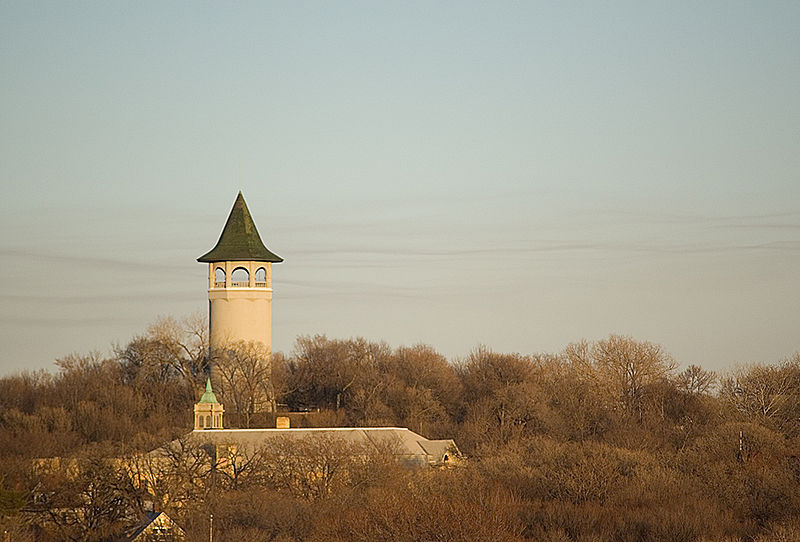
The Witch’s Hat photographed beautifully from Stadium Village by April M. King, aka Marumari. Pratt School is in the foreground.
The expansive viewing area at the top of the tower certainly fulfilled Wirth’s desire for an observation tower, although park board records do not indicate that it was a condition for granting permission to build the water tower in a park. In 1914 the city council asked the park board to provide a caretaker for the park, so people could climb the tower. The park board complied, providing a caretaker who opened the tower to the public five days a week.
As with so many park programs over the years it is easier to pinpoint when a service or program began than when it ended. There is no indication in park board records of when it stopped providing a caretaker to open the tower to the public.
David C. Smith