Archive for the ‘Mississippi River’ Category
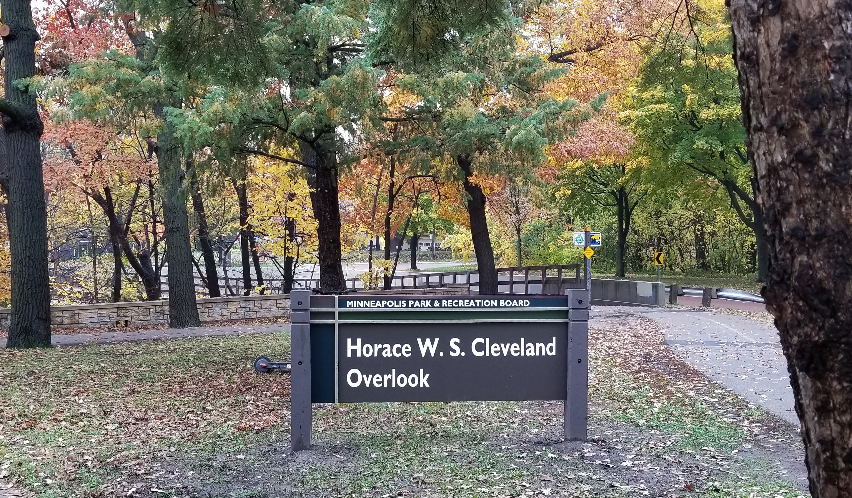
After Careful Consideration: Horace W. S. Cleveland Overlook
Filed under: Minneapolis parks, Mississippi River | Tags: H.W.S. Cleveland, Horace Cleveland, Mississippi National River and Recreation Area
 Comments (7)
 The man who first suggested putting Horace William Shaler Cleveland’s name on something in the Minneapolis park system was William Folwell, the president of the Minneapolis Park Board in 1895. Folwell noted in the annual report of that year that due to Cleveland’s advanced age, then 81, he was no longer able to assist in the development of park plans. Folwell then recommended, “In some proper way his name should be perpetuated in connection with our park system.”
Last week the Minneapolis Park Board acted on Folwell’s advice and named a river overlook near East 44th Street on West River Parkway the “Horace W. S. Cleveland Overlook.”
Cleveland was already 58 years old when he was invited to come to Minneapolis from Chicago to give a public lecture at the Pence Opera House on Bridge Square in 1872. He spoke on how to improve the city through landscaping. He was a big hit and his advice was sought in St. Paul and Minneapolis on how to improve the cities. He wrote an influential book based on his lectures, Landscape Architecture as Applied to the Wants of the West. That began his association as an influential advisor to both cities. When the Minnesota legislature created the Minneapolis Park Board in 1883, one of its first acts was to hire Cleveland to give his advice on what needed to be done.
He produced a report complete with a map, which he called Suggestions for a System of Parks and Parkways for the City of Minneapolis. His map showed a continuous parkway connecting Lake Harriet with Loring Park, then north to Farview Park, directly east past Logan Park in northeast Minneapolis, then south back to the Mississippi River Gorge near the University. His parkway continued on both sides of the river from Riverside Park out to Lake Street and then all the way back west to what is now Bde Maka Ska. It was the brilliant original imagining of what would become the Grand Rounds. It helped instill the notion that parks are not isolated parcels of land but form a part of a “system” that is integral to the quality of life and well-being in a city.
Cleveland had seen the struggles of older Eastern cities such as Boston and New York to create parks in already crowded urban areas. He had worked in the park system in Chicago and saw the same struggles to create open spaces in built environments. He had long argued in Minneapolis and St. Paul to create parks while undeveloped land could still be acquired at reasonable cost and features of natural beauty could still be preserved for public enjoyment. That we have such wonderful open spaces and preserved nature in our cities today owes much to Cleveland’s vision.
It is especially appropriate that an overlook of the river gorge be connected with Cleveland’s legacy. He had an affection and admiration for the beauty of the unique river gorge above all other of “nature’s gifts” to Minneapolis and St. Paul. He argued eloquently for the preservation of the natural riverbanks, calling the heavily wooded, still-unscarred river gorge a setting “worthy of so priceless a jewel” as the mighty river. Both St. Paul and Minneapolis heeded his advice.
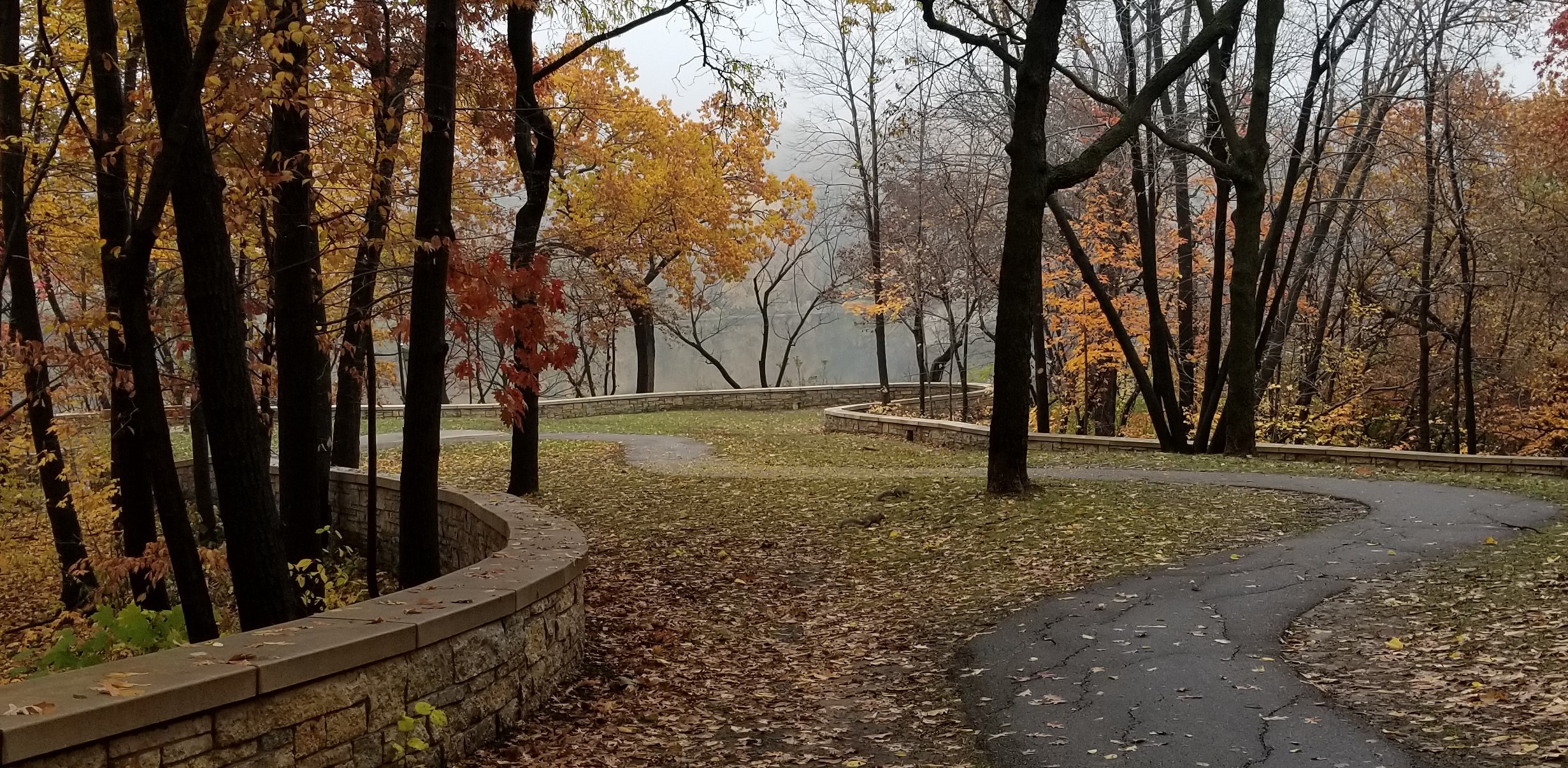
The setting is still worthy of the jewel. Even though most of the color is gone from the wooded river banks, you might want to visit the Mississippi River overlook. Or at least cross over one of the river bridges and marvel at the beauty that has been preserved in part due to the vision and persistence of Horace William Shaler Cleveland, which is finally properly acknowledged.
David C. Smith
What Year Was It? Vaccinations, Assault, Free Trade and Snow Shoveling
Filed under: Minneapolis parks, Mississippi River | Tags: Dr. P. M. Hall, smallpox
Comments (7) I’ve been researching several park topics lately in archival newspapers and stumbled across peripheral incidents that made me double-check the date of publication. These aren’t directly park-related, but fascinating if you’re interested in the arcs of history. I consider myself an optimist, mostly because I think our kids are smarter than we are, but sometimes you wonder whether we learn. See if you can guess when these events occurred.
What year was it when…
Minneapolis’s Health Officer made a concerted effort to vaccinate more citizens against a potentially lethal disease only to be opposed by activists who claimed the vaccine was more dangerous than the disease it was meant to prevent?
1902
The Health Officer was Dr. Pearl Hall who was battling an outbreak of smallpox that was worse in Wisconsin and Minnesota than the rest of the nation. He was joined in his vaccination campaign by Dr. Ohage, the chief health officer of St. Paul. They were opposed by Anti-Vaccination Societies in both cities. The common refrain of those societies was that smallpox had killed thousands but the vaccine had killed tens of thousands. That claim, as pointed out by a letter writer to one newspaper, was attributed to “they say.”

A caricature of Dr. Hall. The issue he “explains” here was why the city should build a garbage burner on an island in the river he had acquired and given to the city, hence the name Hall’s Island. (Minneapolis Journal, September 12, 1902.)
Hall said he had two job openings at the Minneapolis quarantine hospital and he invited the anti-vaxers to provide two workers for those jobs who had never been vaccinated to measure their health against the rest of the staff, all of whom had been vaccinated and had not contracted smallpox. The offer was declined because the jobs were for a laundry worker and a housekeeper at low pay. The Tribune opined that the city attorney would never have allowed such an experiment to go forward anyway.
Hall claimed that of the 1000 patients who had been treated at the smallpox hospital only five had been vaccinated and four of those probably had been vaccinated incorrectly. Hall estimated that 70-80% of Minneapolitans had been vaccinated at that time.
The argument raged for much of the winter of 1902 with the Minneapolis and St. Paul newspapers carrying multiple articles many days on the disease and the debate. Editorially all the papers sided with Dr. Hall.
The last known case of smallpox—in the world—was reported in 1977, after a coordinated campaign of vaccination worldwide. Gee, maybe vaccines work. And, yet, here we are a century of knowledge later with vaccine “doubters.”
(Sources: St. Paul Daily Globe, Minneapolis Morning Tribune, Minneapolis Evening Journal, February, 1902; World Health Organization)
What year was it when…
A woman who was verbally accosted in downtown Minneapolis asked a policeman to arrest the man for assault. He did and the next day she testified about the incident in court and the offensive man was given 20 days in the workhouse for disorderly conduct?
1912
Katherine Halvorson was walking along Nicollet Avenue when she stumbled on an imperfection in the sidewalk. Charles Canington, who was standing nearby, then made “several rude and indelicate remarks and waxed familiar,” in the words of the Morning Tribune. Halvorson walked to a nearby patrolman and said, “That man insulted me. Won’t you please arrest him?” The patrolman complied and Canington was charged and convicted. Miss Halvorson’s closing thought on the incident: “It will be nice when girls can walk the streets in Minneapolis without having men call out to them.”
Are we closer to that day?
(Source: Minneapolis Morning Tribune, July 25, 1912)
What year was it when…
An influential group of Minneapolis business people urged Congress to secure a commercial treaty that would facilitate free trade with Canada?
1888
The Minneapolis Board of Trade (the Chamber of Commerce of its time) passed a resolution urging the “present congress” to “use their influence” to secure such a treaty because “in the opinion of this board, free trade and uninterrupted trade and intercourse between the people of the United States and the people of the Dominion of Canada… would be alike advantageous to both.”
We’ve known trade barriers were a bad idea for quite a while.
(Source: St. Paul Daily Globe, Jan. 24, 1888)
What year was it when…
Minneapolis threatened to charge property owners for shoveling their sidewalks if they didn’t do it themselves.
1897
The most famous case of refusing to shovel was the eccentric millionaire lawyer Levi Stewart who lived on the corner of Hennepin and 4th. He claimed it was the city’s responsibility to clear the walks the same as it was to clear the streets. (The city had sued Stewart in 1871 to force him to put in a sidewalk—which were then made of planks—so he considered it the city’s responsibility to maintain it.) An article in 1885 claimed slippery sidewalks were a particular hazard at Stewart’s property because the fence he put around his yard was made of barbed wire.
Minneapolis had tried to create a shoveling ordinance in 1891 but due to technicalities it had to be rewritten. In 1897 Stewart suggested that they take the issue to the courts again to determine the legality of the rewritten ordinances. The City must not have accepted Stewart’s challenge then because in 1905 a Journal editorial urged the City to take Stewart to court to test the new/old ordinance because he still wasn’t shoveling his walks. That’s as far as I’ve gotten into investigating that particular argument between Stewart and the City, there were many others, but I hope to tell much more in a forthcoming longer piece on Levi Stewart.
I saw what looked like a city crew out shoveling and plowing a sidewalk in my neighborhood this week in the most recent crackdown on snowy walks.
(Sources: St. Paul Daily Globe, Feb. 1, 1885; Minneapolis Morning Tribune, March 9, 1897; Minneapolis Journal, Dec. 19, 1905)
While snow-covered sidewalks might not be in the same category of threat to the common good as infectious disease, verbal assault and protectionism, accessibility is a much more serious issue today than 120 years ago—and evidence of how public opinion and policy have changed significantly over time.
David C. Smith
100 Years Ago: Altered Electoral Map and Shorelines
Filed under: Grand Rounds, Minneapolis Golf Courses, Minneapolis Park Board, Minneapolis Parks: General, Mississippi River | Tags: Dr. Martin Luther King Park, Folwell Park, Lake Calhoun, Lake Nokomis, Phelps Park, St. Anthony Boulevard, Theodore Wirth
Comments (10) What has changed in 100 years? A few times on this site, I have looked back 100 years at park history. I’ll expand my scope this year because of extraordinary political developments. Politics first, then parks.
The national electoral map flipped. The electoral map of the 1916 Presidential contest is astonishing. Woodrow Wilson, a Democrat, won a close re-election against Republican candidate Charles Hughes, a Supreme Court Justice. Compare red and blue states below to today. Nearly inverted. The Northeast, Upper Midwest and Far West — well, Oregon — voted alike. Republican. And lost.

The 1916 electoral map was nearly opposite of the 2016 electoral map in terms of party preference. Unlike 2016, President Wilson won both the popular vote and the electoral vote, but his electoral-vote margin was smaller than Donald Trump’s. If the total of votes cast in 1916, fewer than 19 million, seems impossibly low even for the population at that time, keep in mind that only men could vote. (Source: Wikipedia)
While Minnesota’s electoral votes were cast for the Republican — although Hughes received only 392 more votes than Wilson out of nearly 400,000 cast — Minneapolis elected Thomas Van Lear as its mayor, the only Socialist to hold that office in city history. One hundred years later, Minneapolis politics are again dominated by left-of-center politicians.
The population of Minneapolis in 1916 and 2016 was about the same: now a little over 400,000, then a little under. Minneapolis population peaked in mid-500,000s in mid-1950s and dropped into mid-300,000s in late 20th Century. One hundred years ago, however, Minneapolis suburbs were very sparsely populated.
The world 100 years ago was a violent and unstable place. World War I was in its bloody, muddy depths, although the U.S. had not yet entered the war, and Russia was on the verge of revolution. Now people are killed indiscriminately by trucks, guns, and bombs. People worldwide debated then how to address the excesses of capitalists, oligarchs and despots unencumbered by morality. We still do.
One notable change? Many Americans campaigned in 1916 to put women in voting booths, in 2016 to put a woman in the Oval Office.
Continuing Park Growth: North and South
How about progress in parks? The Minneapolis park board added significantly to its playground holdings in 1916 and 1917 as public demand for facilities and fields for active recreation increased. In North Minneapolis, Glenwood (Theodore Wirth) Park was expanded and land for Folwell Park was acquired. In South Minneapolis, Nicollet (Rev. Dr. Martin Luther King, Jr.) Park and Chicago Avenue (Phelps) Park were purchased and land for Cedar Avenue Park was donated. In 1917, the first Longfellow Field was sold to Minneapolis Steel and steps were initiated to replace it at its present location.
One particular recreational activity was in park headlines in 1916 for the very first time. A nine-hole course was opened that year at Glenwood (Theodore Wirth) Park, the first public golf course in Minneapolis. Golf was free and greens weren’t green, they were made of sand. In less than ten years, the park board operated four 18-hole courses (Glenwood [Wirth], Columbia, Armour [Gross], and Meadowbrook) and was preparing to add a fifth at Lake Hiawatha.
The Grand Rounds were nearly completed conceptually, when first plans for St. Anthony Boulevard from Camden Bridge on the Mississippi River to the Ramsey County line on East Hennepin Avenue were presented in 1916. Park Superintendent Theodore Wirth also suggested that the banks of the Mississippi River above St. Anthony Falls might be made more attractive with shore parks and plantings, even if the railroads maintained ownership of the land. One hundred years later we’re still working on that, but have made some progress including the continuing purchase by the Park Board of riverfront lots as they have become available.These have been the only notable additions to park acreage in many years.
One important result of the increasing demand for playground space in Minneapolis one hundred years ago was the passage by the Minnesota legislature in 1917 of a bill that enabled the park board to increase property tax collections by 50%. In 2016, the Park Board and the City Council reached an important agreement on funding to maintain and improve neighborhood parks.
Altered Shorelines
In a city blessed with water and public waterfronts, however, some of the most significant issues facing the Minneapolis park board in 1917 involved shorelines — beyond beautifying polluted river banks.
The most contentious issue was an extension of Lake Calhoun, a South Bay, south on Xerxes Avenue to 43rd Street. Residents of southwest Minneapolis wanted that marshy area either filled or dredged — dry land or lake. There was no parkway at that time around the west and south shore of Lake Calhoun from Lake Street and Dean Parkway to William Berry Parkway. As a part of plans to construct a parkway along that shoreline, the park board in 1916 approved extending Lake Calhoun and putting a drive around a new South Bay as well.
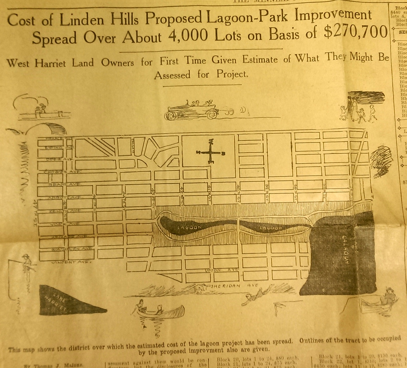
This drawing from a 1915 newspaper article shows the initial concept of a South Bay and outlines how it would be paid for. (Source: Minneapolis Sunday Tribune, June 20, 1915)
The challenge, of course was how to pay for it. The park board’s plan to assess property owners in the area for the expensive improvements was met with furiuos opposition and lawsuits. Many property owners thought that assessments they were already paying for acquisitions and improvements over the years at Lake Calhoun, Lake Harriet and William Berry Park were too heavy. The courts eventually decided in favor of the park board’s right to assess for those improvements, but by then estimated costs for the project had increased and become prohibitive and the South Bay scheme was abandoned.
Instead land for Linden Hills Park was acquired in 1919 and the surrounding wet land was drained into Lake Calhoun in the early 1920s. Dredged material from the lake was used to create a better-defined shoreline on the southwestern and northwestern shores of the lake in 1923 in preparation for the construction of the parkway.
Flowage Rights on the Mississippi River and a Canal to Brownie Lake
Minneapolis parks also lost land to water in 1916. The federal government claimed 27.6 acres of land in the Mississippi River gorge for flowage rights for the reservoir that would be created by a new dam to be built near Minnehaha Creek. Those acres, on the banks of the river and several islands in the river, would be submerged behind what became Lock and Dam No. 1 or the Ford Dam. In exchange for the land to be flooded, the park board did acquire some additional land on the bluffs overlooking the dam.
The other alteration in water courses was the dredging of a navigable channel between Cedar Lake and Brownie Lake, which completed the “linking of the lakes” that was begun with the connection of Lake of the Isles and Lake Calhoun in 1911. The land lost to the channel was negligible and probably balanced by a slight drop in water level in Brownie Lake. (A five-foot drop in Cedar Lake was caused by the opening of the Kenilworth Lagoon to Lake of the Isles in 1913.)
Another potential loss of water from Minneapolis parks may have occurred in 1917. William Washburn’s Fair Oaks estate at one time had a pond. I don’t know when that pond was filled. The estate became park board property upon the death of Mrs. Washburn in 1915. Perhaps in 1917 when the stables and greenhouses on the southwest corner of the property were demolished, the south end of the estate was graded and the pond was filled. Theodore Wirth’s suggestion for the park, presented in 1917, included an amphitheater in part of the park where the pond had once been.
The Dredge Report
The year 1917 marked the end of the most ambitious dredging project in Minneapolis parks — in fact the biggest single project ever undertaken by the park board until then, according to Theodore Wirth. The four-year project moved more than 2.5 million cubic yards of earth and reduced the lake from 300 shallow acres to 200 acres with a uniform depth of 15 feet.
That wasn’t the end of work at Lake Nokomis, however. The park surrounding the lake, especially the playing fields northwest of the lake couldn’t be graded for another five years, after the dredge fill had settled.
Dredging may again be an issue in 2017 if the Park Board succeeds in raising funds for a new park on the river in northeast Minneapolis. Dredges would carve a new island out of land where an old man-made island once existed next to the Plymouth Avenue Bridge. But that may be a long time off — and could go the way of South Bay.
Park Buzz
One other development in 1917 had more to do with standing water than was probably understood at the time. The Park Board joined with the Real Estate Board in a war on mosquitoes. However, after spending $100 on the project and realizing they would have to spend considerably more to achieve results, park commissioners terminated the project. It was not the first or last battle won by mosquitoes in Minneapolis.
As we look again at new calendars, it’s always worth taking a glance backward to see how we got here. For me, it is much easier to follow the course of events in Minneapolis park history than in American political history.
David C. Smith
Comments: I am not interested in comments of a partisan political nature here, so save those for your favorite political sites.
The Demise of the 10th Avenue Bridge
In response to the previous post on Charles Tenney’s photos of Highland Avenue and the 10th Avenue Bridge, MaryLynn Pulscher sent her favorite photo of the 10th Avenue Bridge. It’s a fascinating bit of history itself. We don’t know the origin of the photo but believe it’s from a newspaper. If anyone knows who took it or where it was published, please let us know so we can give proper attribution.
David C. Smith
Encore at the Library: The Jewel of Minneapolis
I hope you’ll be able to come to the Minneapolis Central Library on Saturday afternoon, October 3, from 2-3 pm for my encore presentation on how the Mississippi River Gorge in Minneapolis became a park. I first addressed the topic last winter in the Longfellow neighborhood.
Smith – Mississippi River Gorge
I think many people overlook what a spectacular asset has been preserved for our health and enjoyment. So often the emphasis on the Mississippi River in Minneapolis is on reclaiming the river at and above St. Anthony Falls—and that is an exciting development that is overdue—but I think we take for granted the truly unique resource that was preserved for us below the falls. I don’t know that a similar riverfront exists in an urban environment anywhere else in the world. Come and say “thanks!” with me to some people with extraordinary vision and persistence more than 100 years ago.
We would welcome any of our friends across the river in St. Paul to join us, because while my focus is on Minneapolis park history, St. Paul deserves equal credit in preserving the river gorge. As always, there will be plenty of time after my remarks to discuss park and river history.
David C.Smith
Minneapolis Park History Update
Filed under: Minneapolis parks, Minnehaha Falls, Mississippi River | Tags: Minnehaha Falls, Mississippi River Gorge, St. Peder's Danish Evangelical Lutheran Church
Leave a comment I enjoyed seeing many of you last Monday night at St. Peder’s Church for the Longfellow Community presentation on the Mississippi River Gorge. I promised Carolyn Carr that I would provide a brief synopsis of my presentation and post a few of the photos here. And I will. But first I wanted to post a photo I forgot to include in my presentation.
As a tribute to our hosts on Monday night, I wanted you to see this wonderful photo from the Hennepin County Library special collection. I haven’t given a proper plug to the library or the historical society in a while. They remain marvelous resources. If you haven’t visited Special Collections at the Central Library or the library at the Minnesota History Center in St. Paul, you really should. Take some time for the exhibits at the history center too. And for those of you who prefer to shop locally, you can buy your copy of City of Parks in their book store instead of online! Can’t beat that.

The congregation of St. Peder’s Danish Evangelical Lutheran Church at Minnehaha Falls in 1886 — before the falls became a park. Some parishioners must have had large families of daughters. (Hennepin County Library, Special Collections)
Thanks to the descendants of those in the picture, physically or spiritually, for providing the venue for last Monday’s meeting.
Speaking of special collections at the Central Library, it looks as if I may reprise—and embellish—my presentation on the Mississippi River Gorge at the Library on October 3. I hope to travel this summer to libraries in other parts of the country to continue my research into the life and work of H.W.S. Cleveland, so I may have some new nuggets for that presentation. I’ll keep you posted.
David C. Smith
Minneapolis Park History Live!
Filed under: Minneapolis parks, Mississippi River | Tags: City of Parks, H.W.S. Cleveland, Minneapolis River Gorge
Leave a comment One of my favorite Minneapolis park history topics, the Mississippi River Gorge, will be the subject of an illustrated presentation by yours truly next Monday night, March 23, at St. Peder’s Lutheran Church, 4600 E. 42nd St. The curtain rises at 7 p.m.
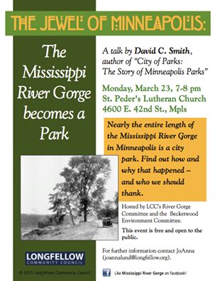
And if you want to hear more, on a different topic, I’ll be speaking at the Minneapolis Institute of Arts, Saturday, May 9. Click the link above and put it on your calendar. I’ll remind you!
I hope you’ll stop by, introduce yourself, ask the burning question that’s been nagging you about parks, or tell me your park story.
Copies of City of Parks will be for sale with all proceeds going to the Minneapolis Park and Recreation Board. I’d be happy to sign one for you.
David C. Smith
Mississippi River flood
Filed under: Minneapolis parks, Minnehaha Creek, Minnehaha Falls, Mississippi River | Tags: Ford Dam, Minnehaha Falls, Mississippi River
Leave a comment Saturday afternoon I spent a bit more time looking at high water around the city. On that gorgeous afternoon, Minneapolis parks were heavily patronized, partly because of the beautiful day and partly because people were curious about the effects of our summer deluge.
The banks of the Mississippi River that I helped clean in April were under water again. Maybe when these flood waters subside, Friends of the Mississippi River should sponsor another trash pick up. Or we could each take a trash bag along when we go out for riverside hikes.
More evidence of high water on the big creek at the Ford Dam.

High water over the Ford Dam, June 21, 2014. Late last summer, there was no water flowing over the dam and below the dam was mostly dry land. (David C. Smith)

Last summer you could walk from the locks to the island where the submerged trees are now. The Ford Dam is just to the left of this photo. (David C. Smith, June 21, 2014)
Both photos were taken from the bluff at Minnehaha Park and the Soldiers Home. Water levels in Minnehaha Creek had subsided little, if at all, from Thursday to Saturday. Water was still thundering over Minnehaha Falls.
David C. Smith
Friday Photo: Forgotten Field on Nicollet Island
Filed under: Minneapolis parks, Mississippi River | Tags: DeLaSalle High School, Nicollet Island
Comments (2) Funny that in all the debate a few years ago about the football “stadium” for DeLaSalle High School on Nicollet Island, I don’t recall seeing the photo below of the island in 1947. I discovered this photo in Borchert Library’s Minnesota Historical Aerial Photos Online that I wrote about last week.
Nicollet Island clearly had a baseball field adjacent to the high school long before the park board acquired much of the island.

Detail of Nicollet Island, 1947, with a baseball field in the middle. For the full image go here, then click on the green push-pin north of Nicollet Island. (John R. Borchert Map Library, University of Minnesota)
I do recall great distress caused by the possibility of closing “historic” Grove Street across the center of the island in order to install the football field. But no one mentioned then that the eastern half of Grove Street that was to be closed had been historically (among other things) the left field fence of a baseball field. I had no idea. The things you learn from photos.
The photo demonstrates that some claims from both sides of the football field argument were wrong. Those who opposed the field in part for fear of losing a historic street were more than 60 years late to that argument. On the other hand, those who claimed that DeLaSalle, in its 100-year history, had never had a home athletic field were wrong, too. Maybe they didn’t have a football field to call home, although it looks as though one might have been squeezed in there in the ’40s, but they obviously did have a home baseball field at one time.
For the earliest plans for a park on Nicollet Island see previous posts on Horace Bushnell, the first person to suggest it, and the first ideas for parks upriver from St. Anthony Falls.
I don’t know who actually owned or maintained the field in the 1940s. Something to investigate. Some old “D” yearbooks must have more photos.
David C. Smith
© 2013 David C. Smith
Friday Photo: Before the Mills Were Ruins
Filed under: Mill Ruins Park, Minneapolis Parks: General, Mississippi River | Tags: Mill Ruins Park, Mississippi River, Stone Arch Bridge
Comments (8) Let’s go down to the river one more time. I have many favorite pictures of the riverfront when it was the economic engine of Minneapolis, but this is probably at the top of my list.

The west bank of the Mississippi River in downtown Minneapolis, just below St. Anthony Falls, in 1885. (Minnesota Historical Society)
You can see just a dash of the still-new Stone Arch Bridge on the right margin of the photo. The channel here is all tail race — the water that ran out of the mills after generating power.
My favorite part of this photo though is the trestle and railroad tracks that ran between the mills and the river at essentially the level of city streets. Those tail races coming out of the mills are now a part of Mill Ruins Park. The trestle and tracks are gone, but I don’t know when they were torn down. Anybody?
Below are two shots (a 3-for-1 Friday Photo!, the biggest Friday Photo discount ever) of the tail races as they appeared probably in the 1950s.

Tail races, some of which are now visible in Mill Ruins Park. (MPRB)

A closer look at the trail races and water returning to the river after its work was done. (MPRB)
Both photos are undated. They show the water coming out of the tail races. They give a much better sense of the management of water power. I’m not sure of the functions of structures and workers at this point in the water power process.
These structures were razed and covered when the Upper St. Anthony Falls Lock and Dam was built in the 1960s.
For a marvelous 360-degree panorama of Mill Ruins Park and the adjacent lock and dam go here, courtesy of the National Park Service. Learn much more about the lock and dam — one of the biggest mistakes Minneapolis and the U. S. Army Corps of Engineers ever made — at the pages of the Mississippi National River and Recreation Area.
Have a look around the park — if spring ever comes. The transformation is amazing — and thought-provoking.
David C. Smith
© Copyright 2013
Friday Photo: How A Stone Arch Was Made
Filed under: Minneapolis parks, Mississippi River | Tags: Father Hennepin Bluffs, Mill Ruins Park, Stone Arch Bridge
Comments (5) The Stone Arch Bridge over the Mississippi River in downtown Minneapolis is becoming one of the iconic images of the city. Have you ever wondered how those arches were made? I have. So I found this photo of the bridge under construction. The deck of the bridge is maintained by the Minneapolis Park and Recreation Board, so let’s call it a park. Day and night the bridge provides the best views of the city. A hike over the bridge between Mill Ruins and Father Hennepin Bluffs, in either direction, is a must for visitors and residents.
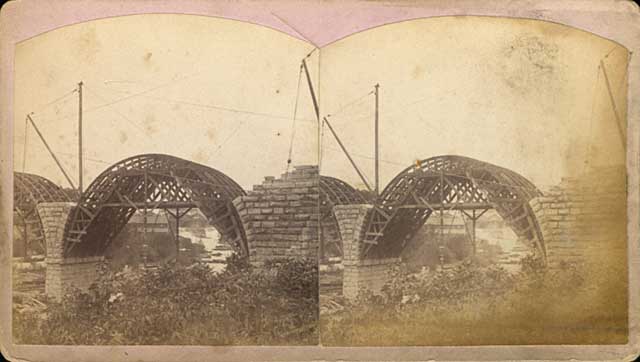
This stereoscope image shows the stone arches being built over forms in 1883. (Henry Farr, Minnesota Historical Society)
The two-track railroad bridge was being built at the time the park board was created in 1883.

The Stone Arch Bridge being completed in 1883. (Burlington Northern, Minnesota Historical Society)
This is another favorite shot of the bridge as it neared completion
David C. Smith
Fear in the Hearts of Children: More from the Autobiography of Francis A. Gross
Filed under: Minneapolis parks, Mississippi River | Tags: 1862 US-Dakota War, Francis A. Gross, North Minneapolis
Leave a comment Last weekend I read Mni Sota Makoce: The Land of the Dakota and Our Way or the Highway: Inside the Minnehaha Free State. That followed a recent rereading of Folwell’s History of Minnesota, Volume I, and I also had read Spirit Car recently. They were part of my continuing research into the history of Minnehaha Falls. (More on that project soon.)
With the sad story of the disintegration of relations long ago between American Indians and whites fresh in mind, I recalled a passage in the unpublished autobiography of former park commissioner Francis Gross. (Background on Gross and his autobiography.) Gross was born in Minnesota in 1870 and lived near the intersection of Plymouth (13th) Avenue and Washington Avenue North in north Minneapolis from 1875 into his teen years. Among his memories of childhood on the north side was this:
“Until shortly after 1880, the shore lands of the Mississippi river were grandly beautiful. Other than a small sawmill at the bridge on Plymouth Avenue, there stood virgin timber of many varieties. For a few years after our coming to the northside, each spring many Indians, their squaws and papooses, would travel from the north on the river in canoes and locate their camp at about 14th Avenue North on the river flat there. The many Indians, young and old, their tepees, boiling pots, the furs and beaded leather goods and trinkets they had brought to trade or sell was an interesting sight. Each evening they would entertain their white visitors with war dances. Made their drums taut by the heat of the campfire, painted their faces in most hideous designs and wore their best and most beautifully patterned and beaded dress. As this time was not long after the most serious of the wars with Indians in this territory, fear of the Indian was in the heart of every child. It can therefore be easily guessed that the sight of these hideously painted, tomahawk-swinging savages, performing at night in the sinister-appearing light given by a few torches, was a scene as exciting as any small boy could wish for.” (Emphasis added.)
I wonder if that fear may have been heightened for Gross as a child because he grew up in a community of predominantly German immigrants. In another section of his hand-written autobiography he recalled:
“On the north side until after 1885, it was common to hear German spoken whenever people congregated. The early settlers of the north side were mostly of German birth…When German immigrants came to Minneapolis, very few spoke English, hence it was necessary that they were met on their arrival by an American. Often, my father would meet those immigrant German families with his grocery delivery wagon.”
The connection between the fear and the immigrants is that many of the settlers in the Minnesota River Valley—the violent epicenter of the 1862 U.S.-Dakota War—were also German immigrants. I suspect the violence of that war was painfully felt by many in the German community in Minneapolis, too. While that war was 13 years in the past by the time Gross’s family moved to north Minneapolis, local newspapers carried many stories in the later 1870s of continuing battles between American Indians and U.S. forces not far to the west, including lurid accounts of battles featuring such famous names as Custer, Sheridan, Sitting Bull and Crazy Horse.
I hadn’t planned to write here about this passage in Gross’s autobiography when I first read it, because it did not relate to parks or early land use in Minneapolis, nor do I believe it reflects on Gross whom I have always admired as a fair, just, and humane man. But I was drawn back to it in the convergence of my research. Gross’s description had power and it had nothing to do with some anachronistic terms. Rather, the power comes from the poignant phrase: “fear of the Indian was in the heart of every child.”
It is not the object of the fear that impressed me—I can imagine as well fear of the White Man in the hearts of Indian children—but the sad realization that fear in the hearts of children can take lifetimes to conquer.
The greatest injustices, the greatest atrocities grow from fear of some monolithic, broadly-defined “Other” instilled young—a conviction reinforced last night as my daughter described watching the film Hotel Rwanda in her geography class.
The dangers of implanting fear in the hearts of children are as great today as ever. Let’s keep that seed from being planted and nourished in our children’s hearts.
David C. Smith
If you know of accounts or pictures of American Indian encampments along the Mississippi River in North Minneapolis in the 1870s-1880s, such as Gross described, I’d like to learn more.
© David C. Smith

