Archive for the ‘Minneapolis parks’ Category
The Street with the Most Parks?
Filed under: Minneapolis parks | Tags: Alexander von Humboldt, Bethune Park, Creekview Park, Folwell Park, Humboldt Triangle, Lynnhurst Park
 Comments (2)
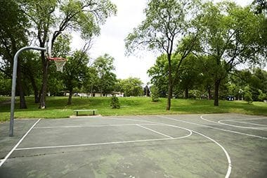
 Last week the park board sent out notifications of the official opening of new facilities at two parks. First, on Wednesday there was a ribbon cutting at the new skate park at Folwell Park in north Minneapolis. Then on Friday, the ribbon was cut for a new playground at Lynnhurst Park in south Minneapolis. The ceremonies were attended by the park commissioner for each district, Charles Rucker at Folwell and Cathy Abene at Lynnhurst.
Google Maps tells me the parks are about 7.6 miles apart as the crow flies — and that crow would be flying almost exactly due north or south, because the two parks are both on Humboldt Avenue. Or its equivalent. Humboldt Avenue South on the east side of Lynnhurst Park is now called West Minnehaha Parkway which connects Lake Harriet to Minnehaha Creek south of 50th Street and the Lynnhurst Recreation Center.
Coincidentally, I visited Folwell Park the Sunday before the ribbon cutting. It is one of the most underappreciated and on that perfect Sunday afternoon one of the most underused parks in the city. I visited the park precisely because of its location on Humboldt Avenue. I had recently read a fascinating biography of Alexander von Humboldt, the man for whom the avenue was named. The book is a powerful reminder of the interconnectedness of everything on the planet.
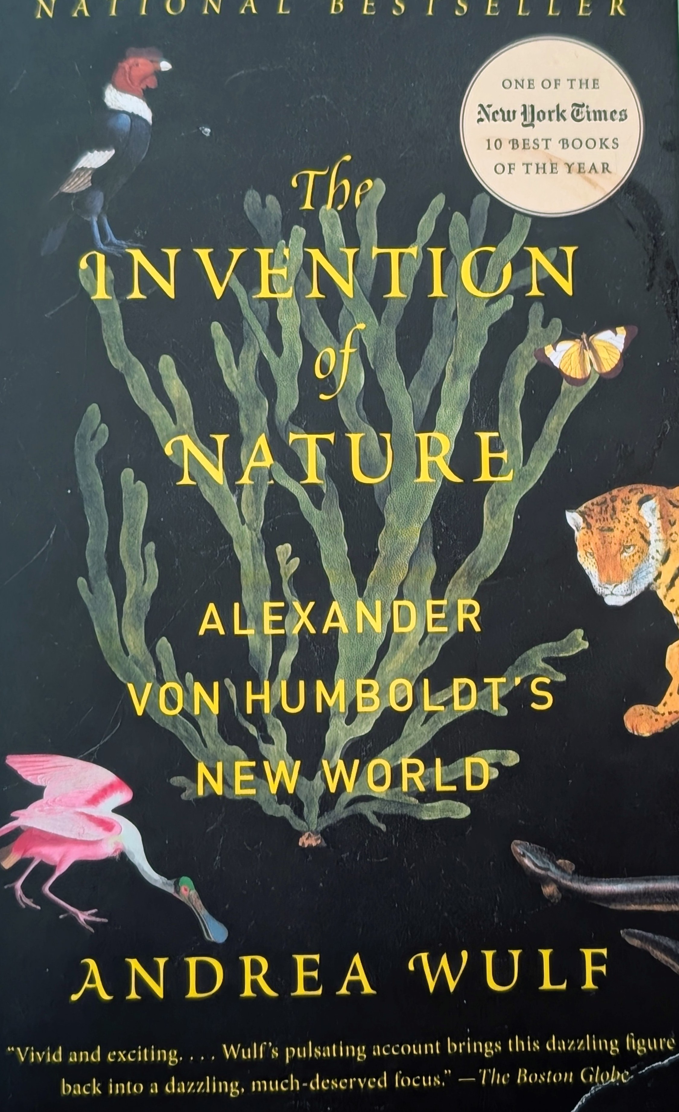
Humboldt was a German scientist known and revered around the world (when nearly all people still believed in science!) in the early 1800s. St. Paul’s Humboldt High School is also named for him as are many places, natural features around the globe, and many species of flora and fauna — as well as an asteroid, a mineral, and a geographical feature of the moon.
Folwell and Lynnhurst are not the only parks that sit along Humboldt Avenue. The avenue also runs on the west side of Bethune Park and on the east side of Shingle Creek and Creek View Park.
There’s also the modest Humboldt Triangle on Humboldt Avenue North which played a role in the impending fight between the park board and the Minnesota highway department over the taking of park land for highways. You can read about that in my history of the triangle on the Park Board’s website. (Yikes! Note my error in calling von Humboldt by the wrong first name there; he was Alexander, not Friedrich.)
The improvements to Folwell and Lynnhurst were both part of the Minneapolis Park and Recreation Board’s 20-year Neighborhood Park Plan in partnership with the City of Minneapolis. A Youth Activities Grant from Hennepin County also contributed to the skate park at Folwell.
David Carpentier Smith
A Red Post Post
Filed under: Minneapolis parks, Minneapolis Parks: General | Tags: Lake Harriet, William Berry Parkway
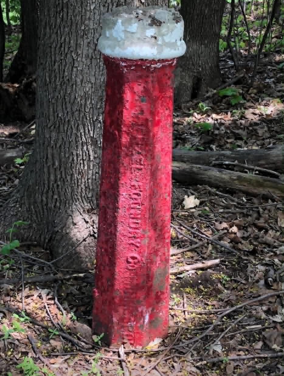
Comments (3) A reader asked about these red posts with white tops located along William Berry Parkway near Lake Harriet south of the trolley tracks. Two on the east side and one on the west. There are others in the city, too.
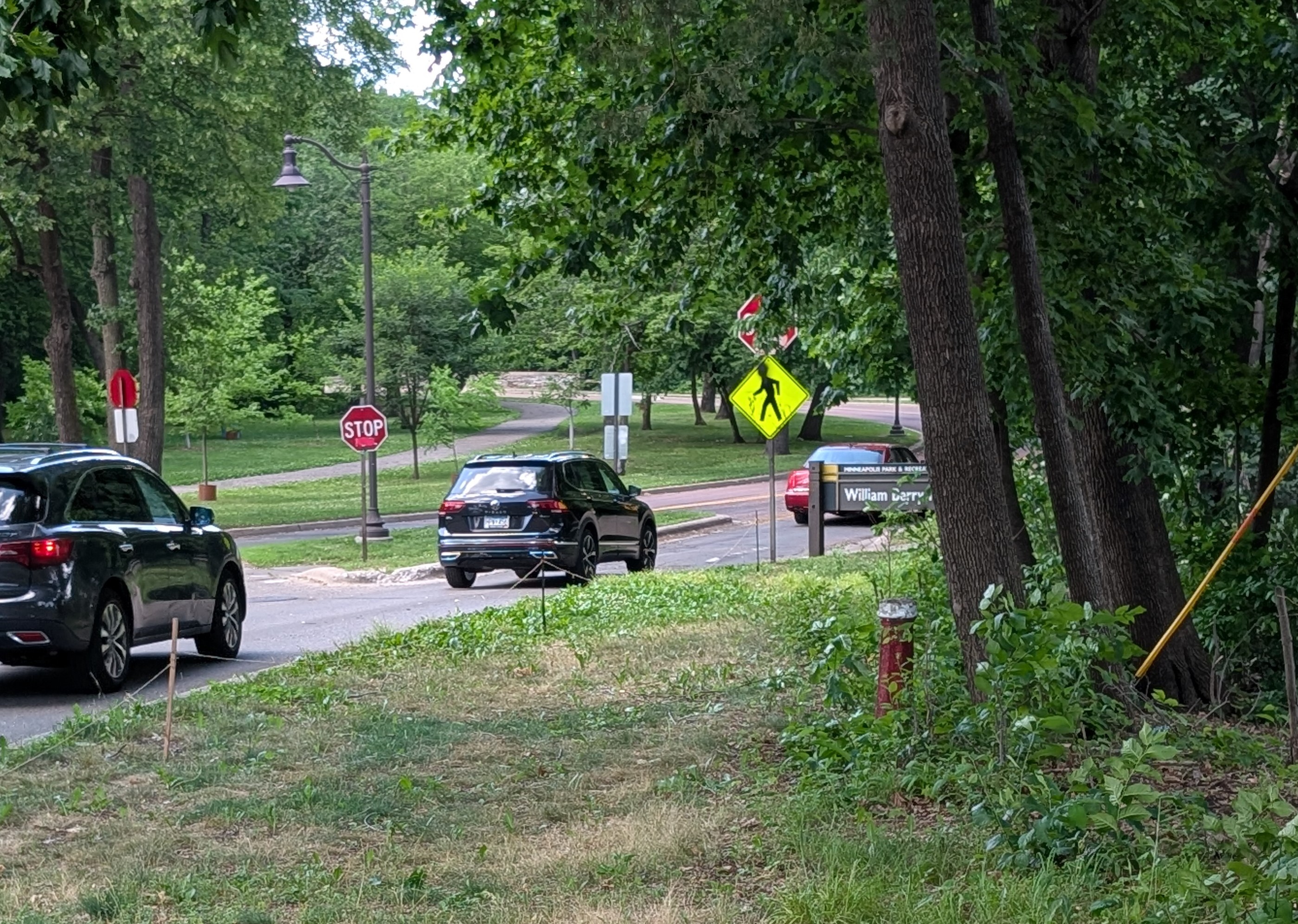
The photo above shows the location of the post near the stop sign leading away from the boat launch parking lot. Another post is across the street to the left.
This is the third post which is closer to Lake Harriet and near Lakewood Cemetery’s fence. The cover in the foreground reads “Water Gate” and is likely related. This post has a plate on it that marks a “42 in. No. 10 Pipe Line.” Each of the posts is capped with cement which suggests they may have been vents that are now sealed.
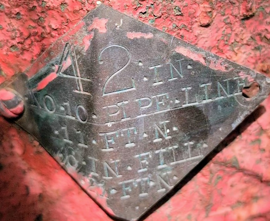
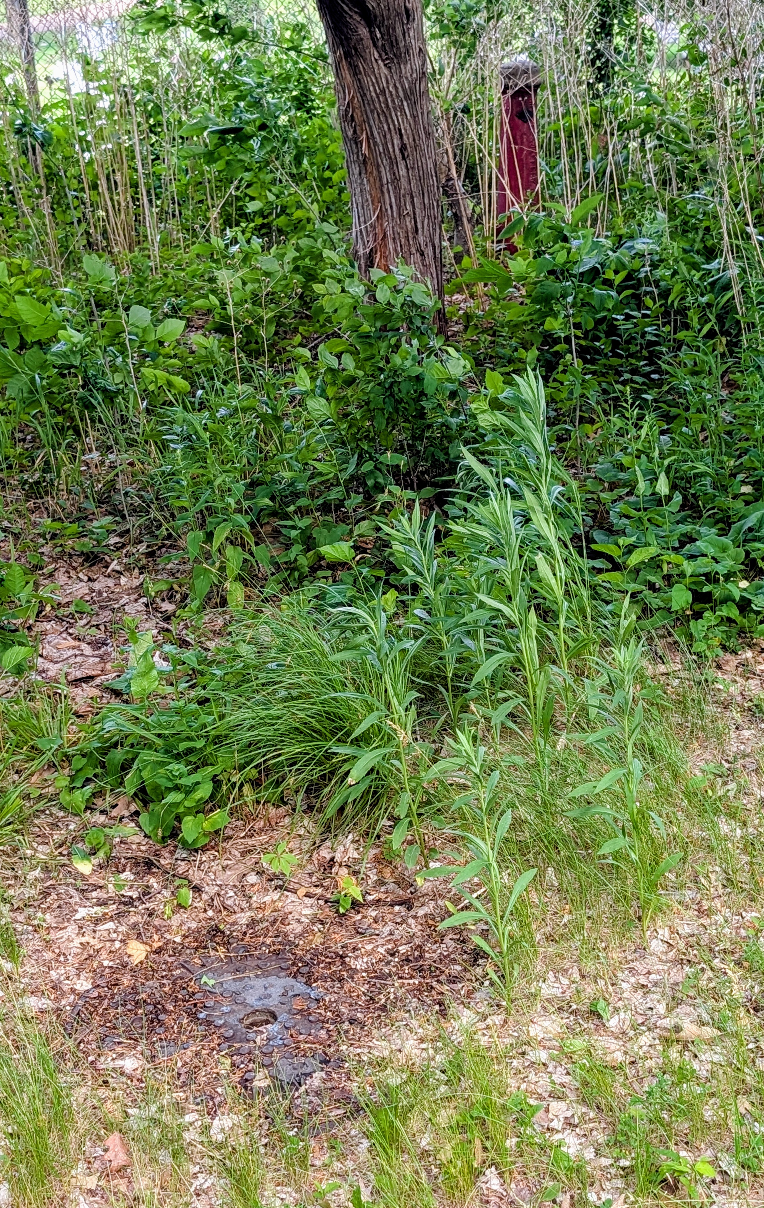
The mystery of the red posts is solved, I believe, by the photo below of another red and white post of sorts taken another 20 yards closer to the lake. I’m a bit puzzled why there is a fire hydrant here as there are no buildings nearby and to my knowledge never have been in this space beween lake, park and cemetery.
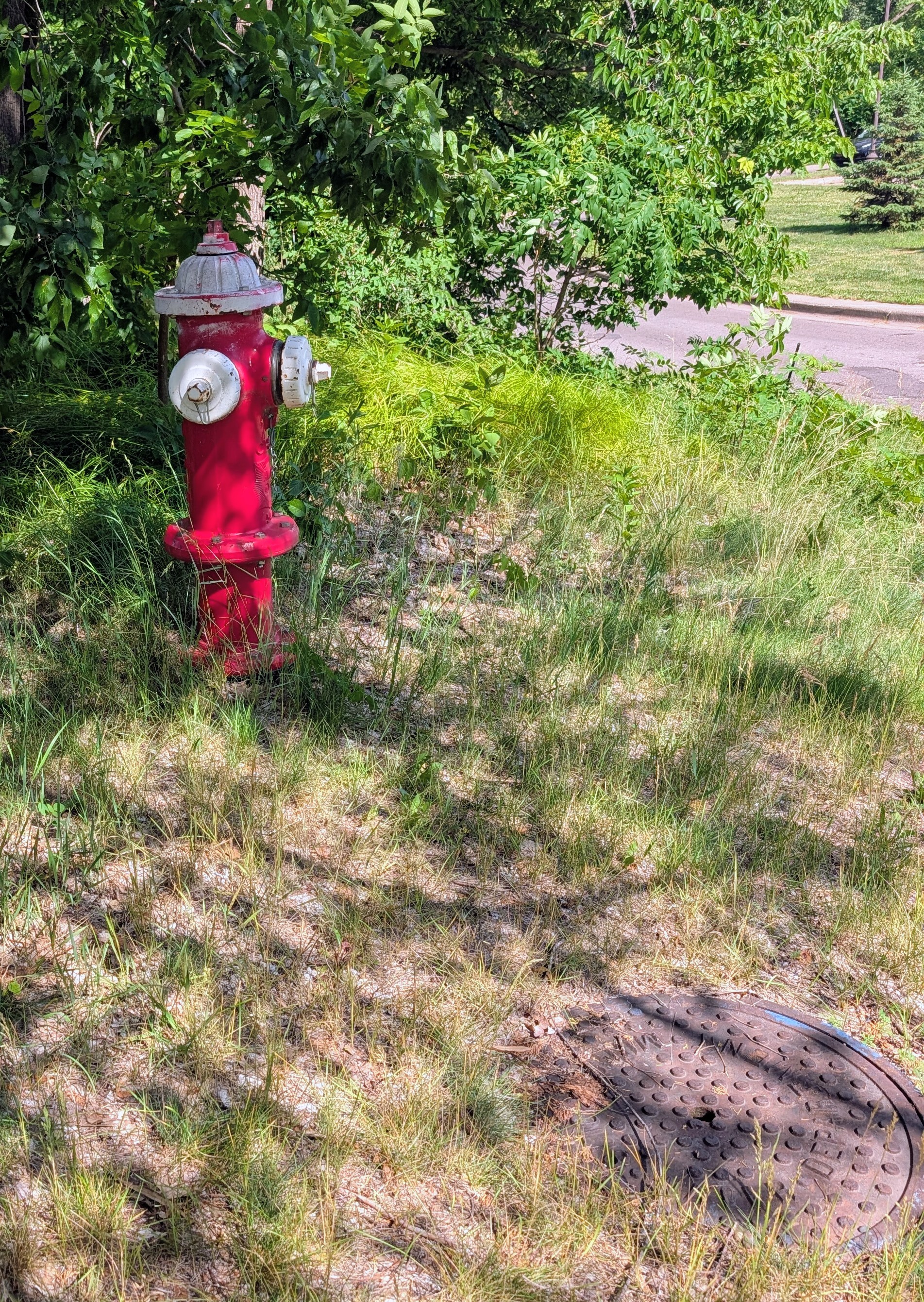
From the placement of the posts it appears that the pipeline may come from the west where there are houses on Queen Avenue and Linden Hills Parkway beyond and it crosses under William Berry Parkway. Why it is placed there however — where it goes — is puzzling. Any explanations?
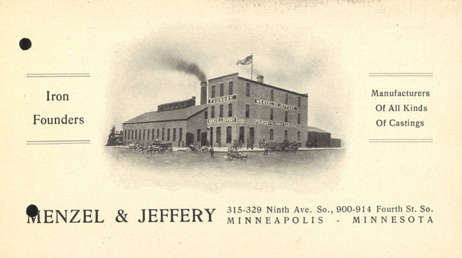
The embossed letters on the side of the posts read, “Menzel & Jeffery,” which was an iron foundry in Minneapolis in the late 1800s and early 20th Century.
Still haven’t heard anything about Eloise Butler’s mystery man mentioned in last post.
David Carpentier Smith
Hermit at the Wildflower Garden?
Filed under: Minneapolis parks, Wirth Park | Tags: Eloise Butler Wildflower Garden, Friends of the Wildflower Garden
Comments (5) I received this question from a reader. Does anyone have an answer? I don’t.
Do you know anything about the hermit “Old Andrew” who lived in a cave/dugout in a hillside adjacent to the Wildflower Garden, before Eloise’s time? The hill was called “Old Andrew’s Mount”. Volunteers with the Friends of the Wildflower Garden are clearing buckthorn there and re-establishing the name. Eloise tells a story of his ghost chopping wood. I’m looking for any information about him outside of Eloise’s stories. She says a decayed body was found that may have been him, but I found newspaper references to a body found around that time, but don’t sound anything like an old hermit. He disappeared right around the time the area was platted for development, so I suspect he was chased off or left due to too much attention. Keegan’s Lake was getting more rowdy then, much reported on in the papers.
David Carpentier Smith
Minneapolis Elections: All the Results
I was recently asked about a website that provided complete election results for Minneapolis city offices from City Council to Park Board, Library board and more. I first mentioned it in a post in 2011 and it’s bigger and better than ever.
It’s Minnesota Election Trends Project, which was created by Neal Baxter in 2004. For political geeks and policy wonks, it’s priceless. You can find not only fascinating anecdotes about city elections but a list of every elected official and the results of every city referendum since “Mni” and “polis” were mashed together. The site has also expanded to cover elections in more municipalities in the state.
The site might be a good place to start if you’re curious about past park commissioners and their roles in the issues addressed in my last post. What did they stand for? What motivated them? The site will have all the names to get you started. If you find something interesting, send it to me as a comment here.
Even if you aren’t interested in historical research but have already finished the NYT crossword and don’t have the stomach for more doomscrolling, take a look.
David Carpentier Smith
The Minneapolis Park Board Has Never Been and Shouldn’t Be the Deed Police
Horrors! The Minneapolis Park Board bought 49 acres of land near Lake Hiawatha and Minnehaha Parkway for $1. How dare they? They should have known the donor, er… seller, was a real estate developer who inserted racial covenants on the deeds to the surrounding property that prohibited ownership or occupancy by non-whites. Let’s cancel that sale from 100 years ago!
I recently wrote a letter to the editor of the Minnesota StarTribune, published November 29, in which I praised the Mapping Prejudice Project which identifies racial covenants in property deeds. The project has examined property deeds in Hennepin County to identify those that contain racial covenants inserted between 1910 and 1955. The covenants prohibited ownership or even residence by Black people on those properties. The project identified more than 8,000 racial covenants in Minneapolis deeds and three times that many in suburban Hennepin County.
Writing racial covenants in deeds was a deplorable practice, especially by the developers and realtors who created those covenants, and deserves to be exposed. They should be called out and held to account. If their heirs or successors have an explanation, let’s hear it. I urged caution, however, in what we attribute to those covenants.
I am writing today to explain in greater length than an editorial page in a newspaper permits why I objected to some claims in the StarTribune column and in the sources cited in that piece.
I took issue with a column “The link between racial covenants and the development of Minneapolis parks” in the November 16 paper that argued “agreements between land developers and the Minneapolis Park Board created a network of exclusive whites-only neighborhoods with ample public land.” I saw no evidence in the column that supported the claim that the park board agreed with anyone to create such neighborhoods. I don’t believe there is any evidence, at least I haven’t seen any. The acceptance of free or cheap land for parks proves nothing.
The claim in the StarTribune column was based in part on a deceptive graphic presentation on the Mapping Prejudice website entitled “Greenspace, White Space: Real estate, racial segregation, and the Minneapolis Park and Recreation Board.” Much of the same material is presented in articles at Landscape and Urban Planning and Annals of the American Association of Geographers.
In those pieces the authors justly castigate realtors and developers, particularly Edmund Walton and Samuel Thorpe, for promoting whites-only enclaves. Walton and the company he created, led by Henry Scott after Walton’s death in 1919, was responsible for racial covenants primarily in developments near Cedar Lake and in the Longfellow neighborhood near West River Parkway. Thorpe promoted racial exclusivity in his projects across southern Minneapolis, especially in Shenandoah Terrace just north of Minnehaha Creek between Chicago Avenue and 12th Avenue South, and even more prominently in Edina, most notably in the Country Club neighborhood.
As I pointed out in my letter to the StarTribune, however, “Throughout the period when racial covenants were used by some developers and realtors, the park board was acquiring land for parks wherever it could as cheaply as possible — as it always had done.”
The Context
From the creation of the park board in 1883, park commissioners tried to preserve open spaces and features of the landscape that were then considered especially attractive and worthy of preservation. They were also trying to locate parks in every neighborhood in the city, another laudable goal. Should they have ignored neighborhoods with some houses built or sold by racists? What would the city look like now if the park board had exercised such discrimination then?
Free or nearly free parkland helped make Minneapolis the city it is today, with ample open space for anyone who chooses to live here. Much of Minneapolis’s waterfront — creeks, lakes, and river — for instance, was donated or bought very cheaply for parks. The same is true for parts of the celebrated Grand Rounds, the parkways for pedestrians, bicycles, and cars that nearly encircle the city. No doubt some donors hoped the creation of parks would make their other land in the vicinity more valuable. But whether it did or not was beyond the park board’s mission. The park board was created to provide parks throughout the city, not police real estate transactions. The demand for parks was great, the supply of money to buy them wasn’t.
Park proponents at the time certainly argued that the creation of parks would increase the value of surrounding land, which would in time pay for the acquisition through higher property tax receipts. It was no secret that people would want to live near a park and would pay more to do so. Nothing nefarious about it. Supply and demand. Better views, it has been said, are one of the only things that money can buy. And land speculation in Minneapolis was rampant in the 19th and early 20th Century — with or without parks.
It was widely understood when the park board was created that the acquisition in the 1850s of the country’s most famous urban park, Central Park in New York, had increased surrounding property values so much that property tax revenue did pay for the park. The challenge for a younger city like Minneapolis was to acquire land for parks before it got too expensive, but also to provide parks near where people lived. Naturally, that meant acquiring land near more crowded neighborhoods first, which the park board did in the twenty-seven years before the first deed with a racial covenant. And they did so for the most part, Logan Park was an exception, without taking people’s homes.
Did some speculators or investors make money from giving land to the park board? Without a doubt — likely including some park commissioners, some of whom were in the real estate business. But did we all get a more livable city in return? I think we did. Should we care if someone made a few bucks by giving most of Lake Harriet, the Mississippi River banks, Minnehaha Creek, or many other acres of land to the people of Minneapolis, to us? More than 100 years later, we collectively still own that land and we get to argue over how to use it even as the city has become dramatically more diverse over the last century.
Admirable Objective
The exposure of racial covenants (some covenants in the 1910s also banned sale to Jews) takes on added importance today as some people insist on white-washing American history, refusing to acknowledge anything that is less than admirable in our nation’s past.
That effort is sad especially because what is most laudable in our history are efforts to overcome the errors, to correct the mistakes, to right the wrongs of those who came before us while maintaining the best of what they imagined.
The continuing struggle to expand their vision and ensure rights for all people, to bring “all are created equal” into the present day where it applies to every man, woman and child regardless of differences is what we should be most proud of. How can we be proud of that fight and the progress we have made if we can’t admit why the battles had to be fought. And still need fighting.
I appreciate that the intentions of the authors of pieces with which I disagree in part likely have the objective of getting us to match our actions with our lofty words. But the demand to acknowledge history, even its shameful moments, requires us to assess with clear eyes and some depth of understanding, context, and nuance the events of the past. I believe claims such as those made in the StarTribune, as well as some on Mapping Prejudice’s own website, fail that test.
A Fuller Picture
Mapping Prejudice identified more than 8,000 deeds in Minneapolis that contained racial covenants. What the project doesn’t tell us is what percentage of deeds that represents. A square mile in the most “gridlike” residential neighborhoods in north and south Minneapolis hold over 3,000 parcels of land. (That’s 8 blocks north-south by 16 blocks east-west, assuming 24-30 lots per block.) Minneapolis’s total land area is about 54 square miles. I won’t attempt to guess how much of that land is categorized as residential for the purposes of the mapping endeavor.
Complicating the calculations is that, to my eye (I haven’t counted), in the map that Mapping Prejudice has published it appears that perhaps nearly half of the covenanted deeds within Minneapolis city limits are located south of 54th Street on the southern border of the city. That’s an issue because the section of Minneapolis from 54th Street to 62nd Street (roughly the Crosstown Highway) was annexed from Richfield in 1927. A random sampling of the properties that had racial covenants in those areas suggest that many of them predated the annexation, which hardly implicates the Minneapolis Park Board in colluding to favor whites-only neighborhoods. Perhaps Mapping Prejudice has a breakdown of those numbers; it would be useful. If my observations are accurate, that would reduce the share of covenanted deeds in the rest of the city, perhaps considerably.
While even one racial covenant is deplorable, their frequency may be useful in understanding the scope of the problem, particularly when indicting decades of park planning and acquisition as racist or claiming problems are or were systemic or structural. The question “How common?” matters because it gets to the issue of whether people cherry-pick data to buttress an argument. Is confirmation bias at work? Are researchers looking only for data or anecdotes that confirm their biases and ignoring what doesn’t?
These are my biases: I admire the efforts and foresight of park proponents over a century-and-a-half who helped to create a park system that makes life better in this city; I believe their overall contributions to our lives are praiseworthy; I don’t believe all of them were greedy profiteers; I believe they could have done some things better. I try not to let those biases interfere with my writing about parks, but they may creep in.
The StarTribune column and Mapping Prejudice site claim that “three-fourths” of the parks created between 1910 and 1955, were in neighborhoods with racial covenants. The parameter they establish is a park within a half mile of a property with a racial covenant in the deed is in what they call a racial-covenant neighborhood. A racial covenant anywhere within a square mile around a park, therefore, would doom that park to the scorned heap of parks allegedly created to entrench white supremacy — or provide green space exclusively for white people.
By that measure, one per square mile, just 54 racial covenants could be enough to condemn every park in Minneapolis. What lends a bit of irony to the “half mile” measure is that the park boards of that time were trying to meet a goal of having a neighborhood park within a half mile of every residence in the city because a half mile was judged about the farthest a mother could walk with two young children to play in a park. (Yes, it was a different time.) There was no effort to determine if that hypothetical mother of two was worthy of having a park to walk to.
In the two journal articles I cited, the authors use a different measure of racially restricted neighborhoods. Those studies define a “racial covenant neighborhood” as one in which one property within roughly a city block (0.1 mi.) has a racial covenant in a deed. If one racist nut lived near a park and put a covenant in their deed does that mean the park board entered into “agreements” to create green space for exclusively white neighborhoods? And that park would get lumped together with any other park with a racist nut within a stone’s throw of it (if it were Shohei Ohtani making the throw).
To adjust for the narrower definition of a racial covenant neighborhood in the journal articles, the authors opt for a different claim: not that three-fourths of new parks were in such a neighborhood, but three-fourths of new park acreage was in a “racial covenant neighborhood.” A big difference, but equally misleading.
The journal article cited in the StarTribune column claims that park acreage acquired within city limits in the racial covenant years was 1,163 acres of which 846 were in a “racial covenant neighborhood.” Those numbers overstate the impact of large acquisitions like 234 acres at Lake Hiawatha, which was abutted at the time of acquisition on the southeast corner by a Thorpe Realty development that included racial covenants.
Samuel Thorpe’s company began development of that property after the park board had already spent considerable effort defining the shores of nearby Lake Nokomis. The park board had dredged the lake to make it deeper and to fill the lowland around the lake to make it usable as recreation space. (MaryLynn Pulscher’s description is “land dry enough to drive on and water deep enough to sail on.”) The park board waited years for that muck to dry and settle before creating playing fields, a beach and parkway west of the lake. That’s when Thorpe sold the park board 49 acres of land to the east along Minnehaha Creek for a buck.
The change in measurement from the number of parks to park acreage maintains the appearance of racist acquisition even as the definition of a racial covenant neighborhood is narrowed to a less ludicrous distance than half a mile. Because by the measure of a covenant within a city block of a park, the park board created many more parks in those 45 years in neighborhoods that were not racially restricted than those that were. So we get park acreage as a measure instead, which looks worse — but on closer examination doesn’t hold up either.
To understand the distortion of the acreage measurement, compare Lake Hiawatha’s 234 acres, for instance, with Sumner Park, a 4.5-acre park in north Minneapolis that was acquired in 1915 at the request of Associated Jewish Charities. Sumner was not in a racial covenant neighborhood. It would take more than 50 Sumners to balance one Lake Hiawatha by the acreage measure cited. And the park board couldn’t have created fifty Sumner Parks without knocking down considerable existing housing around the city, which it didn’t have to do at Lake Hiawatha.
The Lake Hiawatha land was acquired in 1922 for the specific purpose of creating a golf course in south Minneapolis. It was one of the only undeveloped sites in the southern half of the city that was big enough for a golf course, and as a wetland it wasn’t good for much else in the eyes of urban residents 100 years ago, and therefore more affordable. (For more on the acquisition of Minnehaha Creek see Accept When Offered: A Brief History of Minnehaha Parkway.) North Minneapolis already had two popular golf courses, Wirth and Columbia, and Gross and Meadowbrook would be added before the course at Hiawatha was completed nine years later, so the park board was eager to extend what many residents considered a benefit to the southern half of the city.
Different land-use choices might be made today than in the 1920s, but to attribute racist motives to creating that park and lake is a stretch. Ironically, for those of the racist-park-board ideology, that golf course became a favorite of Black golfers in the city. And the land is currently being considered for a major overhaul to meet contemporary demands — which of course wouldn’t be possible if the land weren’t already owned by us.
It’s also worth noting that in the 1920s the park board also acquired all of Minnehaha Creek west of Lake Harriet to ensure the people of Minneapolis, us again, owned the entire creek bed from Edina to the Mississippi River. That acquisition of nearly 1.5 miles of creek was tainted too by the racial-covenant measure, primarily by 16 lots south of the creek in the 5200 block between Morgan and Logan Avenues. The covenants were in deeds granted by Thomas J. Magee who apparently subdivided that block in the late 1920s. That cluster and one lot across the creek contain the only creek-adjacent lots with racial covenants for the approximately three miles of creek from Edina to Portland Avenue.
Another case is St. Anthony Parkway from the Mississippi River to the eastern border of Minneapolis, including Deming Heights. That parkway’s 103 acres are tainted by a couple dozen lots with racial covenants on its far eastern end three miles of parkway from the river. Those covenants did not exist when the parkway was created and the park board never exercised any control over those lots. Nor should it have, in my view.
More acreage. Shingle Creek Parkway and Creekview Park, nearly sixty acres in north Minneapolis with covenanted property (developed by Girard Investment Company) only on its southern end near Webber Park. The park board reluctantly acquired the land in 1948 during the post-war housing boom only at the insistence of the City of Minneapolis. The city wanted the park board to acquire Shingle Creek and lower the bed of the creek to help drain the surrounding wet neighborhood so more housing could be built there as the city was bursting its seams. Very few new lots developed on either side of the creek carried racial covenants.
There were, however, racial covenants on deeds on the east side of nearby Bohannon Park which was deeded to the park board in 1935 by the city after it closed the workhouse on that site. A free park. Again, no signs of collaboration with racist developers to create whites-only neighborhoods, just another inexpensive neighborhood park for the majority of families whose property deeds did not contain racial covenants.
There were many more reasons for the park board to acquire park land than creating white enclaves. As the city’s population soared past 500,000 in the 1940s and housing was being built out to the city limits, the park board found a new method of acquiring land for parks: scouring the State of Minnesota’s list of land forfeited by delinquent taxpayers. Keep in mind that this followed nearly two decades of painful depression and then World War II. Nearly free land from the state list helped acquire all or portions of Bossen, Perkins Hill, Northeast, McRae, Hi-View and Peavey Parks. Both Bossen’s forty acres and McRae’s eight were supposedly tainted by racial covenants in the neighborhood.
The land between Bossen and Lake Nokomis to the northwest has one of the greatest concentrations of racial covenants in the city and once again some of those covenants predate the annexation of that land by Minneapolis. (A sampling of those properties finds four “grantors” names repeated many times: George and Sophia Pahl, Fred and Mabel Genevieve Cummings, Martin and Annie Nelson, and Arne G. and Sigrid Bogen. The A.G. Bogen Company also developed much of the land east of Pearl Park and Diamond Lake and recorded nearly 300 lots with racial covenants there.) On the other side of Bossen Field from those developments, however, the land north and east of the park all the way to Minnehaha Park is largely free of racial covenants; there are 24 parcels with racial covenants in 1.3 square miles. Most of them written by two couples, the Addys (7) and the Bogens (9).
As for McRae Park, reportedly a garbage site when acquired, whether it was imagined as green space for white people or not, it became a vital amenity serving Black neighbors too, as is evident from photos I posted several years ago here. (Be sure to read the comments, too.)
Schools and Playgrounds
Another way to reduce the cost of parks and maximize their usage, long championed by some park commissioners, was working with the school board to develop a park and school together. That was done in former Richfield locations at Armatage and Kenny in the late 1940s and early 1950s where many nearby lots had racial covenants, an undetermined portion of them also dating prior to becoming part of Minneapolis. The park board and school board also collaborated at Keewaydin and Hiawatha schools, and at Holmes Park and Cleveland Park to create playgrounds for schools, none of which were in racial covenant neighborhoods.
Another joint school/park project was at Waite Park in the northeast corner of the city. A housing development by Dickenson and Gillespie, Inc. north and east of the school and park attached racial covenants to deeds in 1947, a few months after the park and school boards acquired land. (The same outfit sold properties with racial covenants along Lake Nokomis Parkway west of the lake.) South and west of Waite Park there is not another property in all northeast Minneapolis, more than six square miles, with a racial covenant according to the Mapping Prejudice map. Should the park board not have collaborated with the school board to develop the Waite Park property, partly as a school playground, because of the covenants put on adjacent property?
In none of those locations, however, except perhaps Kenny Park, did the parcels with racial covenants outnumber those without racial covenants. Did the owners of those parcels not deserve schools or playgrounds because some other lots carried racial covenants? Should the park board have been deed police before or after it acquired land?
There is also the question of individual knowledge or acceptance of those perfidious covenants. I learned from a friend whose father died recently that when he went to sell the old family home he discovered that the deed included a racial covenant. He was appalled and quickly had that covenant removed from the deed. Little did he know or imagine that he grew up in a home that by itself could have damned the entire neighborhood as a “racial covenant neighborhood” according to some measures.
Was his father a racist? He didn’t think so. Were his neighbors? Who knows? Racists live among us. People who can’t accept differences live among us. People who want to paint everyone with broad brush strokes live among us too — as some are wont to do with park commissioners of a century ago.
Were some of those park commissioners racist? I would expect that some were. The challenge is to identify them. It’s easy to claim “institutional” racism because it absolves everyone, both accuser and accused. If injustices are “institutional” both everyone and no one is guilty, depending on the whims of the accusers and accused. It makes for lazy history.
In addition to accepting free or nearly free land for parks that are part of the alleged green space for whites only, the park board also accepted free or mostly free land during those years for Dorilus Morrison Park (the site of the Minneapolis Institute of Arts), Clinton Field, Stewart Park, Cedar Avenue Field, and Currie Park.
Disproportionate Claims
One entry on the Mapping Prejudice site claims: “Park acquisitions during this era were disproportionately in south Minneapolis, particularly along Minnehaha Creek, in the Nokomis neighborhood, and in the neighborhoods along the west bank of the Mississippi, parts of the city most densely blanketed with covenants.”
That is simply not true. Disproportionately? Compared to what? Minnehaha Creek I’ve already mentioned. In the area along the west bank of the Mississippi (the west riverbanks were acquired in 1902 after decades of trying) where Edmund Walton’s Seven Oaks Company inserted racial covenants in some the city’s highest concentrations, the park board made only three acquisitions in the 45 years that racial covenants existed: Brackett Park, Longfellow Park, and Seven Oaks Oval.
Seven Oaks Oval, which the developer gave to the park board, is a sink hole of two acres that has never been developed and probably didn’t attract many buyers to the neighborhood. It is shown as platted as a park in a 1903 map, long before racial covenants. As I have noted elsewhere, the park board has probably spent less money on Seven Oaks than any other park in the city.
Longfellow Park was a replacement for a park that was sold to the Minneapolis Steel and Machinery Company in 1917 during World War I (read more here) as the neighborhood became more industrial and after the school board had closed the adjacent Longfellow School. The new site was as close as the park board could come to replacing the surrendered land near East 28th Street and Minnehaha Avenue. It was on two undeveloped blocks that contained no houses in a thinly settled section of the city. The park board considered adding a third block, but because three houses had already been built on that block it’s assessed valuation was too high for the park board’s budget.
Brackett Field was in a section of the city that had some covenanted lots (a minority of property in the neighborhood, however) deeded mostly by Mary Greer east of the park and the Seven Oaks Company south and west of the park. A few lots with covenants were sold before the park was acquired but most were sold after park acquisition.
The park board acquired land on the margins of the city precisely because that’s where the city was growing and those sections did not have playgrounds yet. Minneapolis was overflowing and neighborhoods were expanding onto the last unbuilt land. The population of Minneapolis grew from 301,408 in 1910 to 521,718 in 1950. By contrast, the most populous suburb in 1950 was St. Louis Park at 22,644, triple what it was only a decade earlier. Minneapolis’s Black population increased from 2,592 in 1910 to 6,807 in 1950, or from 0.9% to 1.3% of the total population. (In 2020, 18.9% of Minneapolis’s population was Black.)
Not Much Happened for Nearly Two Decades
I noted earlier that the park board acquired some tax-forfeited land in the 1940s following the Great Depression and World War II. When considering the relationship of parks and racial covenants it’s worth noting that from the beginning of the Depression in 1929 until well after the war in the Pacific finally ended, the park board acquired very little land and didn’t pay for most of it. From 1930 until 1947, the park board added only six parks: Hiawatha School Playground was acquired from the school board; Bohannon Park was turned over by the city; the swamp of Todd Park was donated by the developer; Northeast Park was acquired largely through tax forfeiture; and Currie Park was purchased mostly with a cash donation for that purpose. The only acquisition the park board paid for was part of Bassett’s Creek Park, and that purchase in 1934 was to take advantage of a donation of thirteen acres of Bassett’s Creek a few years earlier by Arthur Fruen, a former park commissioner, adjacent to the mill he owned. The acquisition connected Bryn Mawr Meadows Park to Theodore Wirth Park (still named Glenwood Park then) along Bassett’s Creek and gave the park board ownership of all of that creek within city limits that’s above ground. {Read more about Bassett’s Creek here.)
By the “racial covenant neighborhood” measurement, two lots with racial covenants in their deeds a block west of Bassett’s Creek Park in the Bryn Mawr neighborhood, executed three and four years after the park was acquired in 1934, condemned all 60 acres of that park to the list of parks allegedly created for exclusively white neighborhoods.
The “racial covenant neighborhood” status of Bryn Mawr Meadows, which was acquired in 1910 isn’t quite clear as the western tip of that fifty-acre park is about 500 feet, just under a tenth of a mile, from the eastern tip of one lot in a development of about 60 lots west of Penn Avenue that Frank M. Groves and Hazel O. Groves attached racial covenants to 28 years later — not really a good example of the park board creating green space for a white enclave but perhaps classified as such for arguments sake.
Park acquisition isn’t the only thing that ground to a halt through part of the 1930s and 1940s. Especially during the war, there was almost no new residential construction. Both labor and materials for building were scarce. The result was a pent-up demand after the war for houses, schools and parks which led in part to the park and school collaborations in the late 1940s in the far south and north of the city.
Further complicating analysis of park acquisition during the time of racial covenants was a state law called the Elwell Law which permitted the park board to assess neighborhood property for the cost of acquiring and developing parks, if the neighborhood agreed to those assessments.
At the time it was viewed as a way to put decision-making in the hands of the people. In retrospect, however, it became evident that this method of park acquisition favored newer neighborhoods, wealthier neighborhoods, and neighborhoods with more single-family homes where people could afford assessments or where a park would increase the value of their property. Landlords of multi-unit buildings were not so keen to have a park developed nearby and have their costs increased.
Racial covenants on deeds did not always predict homeowners’ willingness to be assessed for parks, however. An example is the neighborhood around Kenny Park, part of the land annexed from Richfield, where many deeds contained racial covenants. That neighborhood declined to be assessed for a park in 1932, which delayed land acquisition as a joint project with the school board until 1948 and delayed any improvements until 1953.
From that perspective it doesn’t look like the park board provided an “exclusive whites-only neighborhoods with ample public land.” The people who bought property with racial covenants in the late 1920s had to wait more than two decades to get the parks the park board allegedly agreed to provide for their segregated neighborhood.
The park board formally ended the use of the Elwell Law in 1968, recognizing that acquiring park land should be a citywide responsibility, not dependent on a neighborhood’s willingness or ability to pay.
I have presented some examples of park acquisition issues that aren’t as simple as “racist or not” and don’t fit the narrative some researchers have created from Mapping Prejudice data. Those narratives contain little if any evidence to support claims that the park board participated actively or even passively in creating “whites-only” neighborhoods or favoring them with parks. There is neither correlation nor causation to support claims of collusion. I find it impossible to discern a racist pattern in park board acquisitions during the racial covenant years.
It is also quite clear that racist behaviors limited where Black people could live during those years. “Stories” on the Mapping Prejudice website provides some examples, and I have read others, of individuals encountering viciously discriminatory behavior in neighborhoods across the city with or without racial covenants. (See especially Eric Roper’s “Ghost of a Chance” podcast.) Even Bob Williams, the first Black player for the Minneapolis Lakers in 1955 encountered hostility when he bought a house on Clinton Avenue in South Minneapolis, although initial reactions cooled when neighbors learned from the cover story in the Picture magazine of Minneapolis Sunday Tribune that he was an NBA player.)
People should be held to account for racist and bigoted behavior, for a failure to treat people fairly and respectfully as individuals. That goal is not achieved by making unsupported generalized claims that merely suppose people’s motivations — past, present, or future — or convict them of the crimes of others.
I have had the good fortune to have lived and traveled extensively in other countries and I often encountered people who had firm opinions of the United States and Americans. I know if I were abroad now, I would face questions about present US government policies on several fronts. I would protest that I disagree strenuously with many current policies and I would be met at times with a shrug, “Well, it’s your country.” That’s a broad brush I would not want to be painted with. Would those who stretch the data from a worthwhile project like Mapping Prejudice to the breaking point judge me guilty anyway?
David Carpentier Smith
Riverside Park Staircase
Filed under: Minneapolis parks | Tags: H.W.S. Cleveland, Riverside Park
Comments (8) I received a question from Elliot about Riverside Park that I can’t answer. Maybe you can.
“There are two limestone structures to the left and right of the main staircase at Riverside Park. They’re pretty overgrown. They look staircase-like, but I wonder if they were cascades for water to go down? I looked but couldn’t find any old pictures. Do you know about these?”
Any thoughts?
Riverside Park was one of four neighborhood parks designated by the first Board of Park Commissioners when the Board was created by the Minnesota Legislature in 1883. They designated a new neighbornood park in each quadrant of the city. The others were Central (Loring) Park, Logan Park and Farview Park. In addition to the neighborhood parks, the board planned to acquire connecting parkways–thanks to H.W.S. Cleveland’s plans–as well as land around one of the distant lakes to the southwest. Before it was officially named, the Park Board refered to it as Sixth Ward Park.
The neighborhood near Riverside Park was the only one that already had a park at that time although it served mostly as a pasture. Murphy Square, which had been donated to the city as a park nearly 30 years earlier, stood only a half-mile to the west of Riverside Park.
You can read a brief history of Riverside Park at the Park Board’s website. Click on the “History” tab.
David Carpentier Smith
See You at the Superintendent’s House
Filed under: Minneapolis parks | Tags: Lyndale Farmstead, Theodore Wirth, Theodore Wirth House
Leave a comment A last-minute notice: Stop by the Superintendent’s House, often called the Wirth House, in Lyndale Farmstead Park today, May 17, and say hello. Park Superintendent Al Bangoura has once again opened the historic house where he lives (he pays rent!) to the public as a part of the Doors Open weekend. The historic home was built by the Minneapolis Board of Park Commissioners as a home and office for Superintendent Theodore Wirth in 1910.
I’ll be there along with Al and others who are knowledgeable about the house history, including some former residents. We’ll be there today only — no Sunday opening this year — from 10 am to 5 pm.
If you still don’t have your copy of City of Parks, or you need one for a gift, you can buy one there and I’ll sign it for you. All proceeds to the park board.
David Carpentier Smith
Forfeited Land, Creative Additions
Filed under: Minneapolis Park Board, Minneapolis parks | Tags: Bossen Field, HI-View Park, Kenny Park, McRae Park, Northeast Athletic Field Park, Peavey Park
Comments (1) I recently received a note from Etch Andrajack about his fond memories of growing up near Hi-View Park in Northeast Minneapolis and what an important part the park played in the lives of his family and friends. His note prompted me to revisit the history tab on the Park Board’s page about Hi-View Park at minneapolisparks.org. (Every park has a history tab. I wrote most of them in 2008, but they are updated by park board staff as new developments warrant.)
In reviewing Hi-View’s history I was reminded of a tool the park board used to create or expand several recreation parks that are likely remembered as fondly as Etch remembers Hi-View. Landowners who don’t pay their property taxes eventually may forfeit their land. That land can be sold by the state or managed for “public benefit.” The Minneapolis Board of Park Commissioners, as the Park Board was once officially called, acquired the land for Hi-View Park–free–under the public benefit provisions. I’ve cited below a section of the history of Hi-View Park, which I wrote for the park board’s website, that mentions other park land acquired through tax forfeiture.
“Hi-View Park was acquired from the state in 1950. The state had acquired the property for non-payment of property taxes. The original park was 3.74 acres, but was expanded by 0.12 acres in 1961 at a cost of $4,900. The park board acquired the land at a time when it was looking to fill gaps in playgrounds identified in a 1944 study of park facilities. While the neighborhood around Hi-View was not on the list of neighborhoods needing playgrounds, the park board seized the opportunity to obtain free land from the state, when it discovered the land was on the state’s list of tax-forfeited properties. The undeveloped land had been used as a playing field by children in the neighborhood for years.
The first instances of the park board seeking land on state tax-forfeiture lists was in 1905 when it acquired several lots to expand Glenwood (Wirth) Park and in 1914, when it acquired Russell Triangle. With the acquisition of four lots to enlarge Peavey Park and the acquisition of Northeast Field partly from the state’s tax forfeiture list in 1941, the park board began looking to the state as a source of cheap land.
In a matter of a few years after World War II, the park board acquired nearly all of Bossen and Perkins Hill parks and portions of McRae and Kenny from the state for no cost. The park board also eventually acquired part of North Mississippi Park from the state. By the late 1940s, the park board routinely scanned lists of land the state had acquired for non-payment of taxes and spotted the Hi-View land on such a list.”
I mention the acquisition of tax-forfeited land because it underscores the many creative methods used to acquire the land that became a celebrated and heavily used park system. Some parks are used primarily by neighborhood kids, others by people from across the entire city, state and beyond.
The park system is the result, in the end, of dedicated, persistent, efficient, and creative public servants. And it is still operated, managed, and adapted to our ever-changing needs and desires by the same type of praise-worthy public servants to whom we all owe a debt of gratitude. At the very least some respect.
David C. Smith
Cloggy’s Hockey at Sibley Field
Filed under: 40th Street Park, Minneapolis parks, Sibley Field | Tags: 40th Street Park, Cloggys, Minneapolis Hockey, Sibley Field
Comments (6) One of the most-commented on posts on this website was written nearly 15 years ago about Sibley Field, now renamed 40th Street Park. (Be sure to read the comments on that post.)
I can now add two excellent photos, with names, of more boys’ hockey teams sponsored by Cloggy’s Bar. I received a note this week from Ken Orum asking if I was interested in the photos that came from a collection from his grandparents James and Nettie Guest. James Guest appears in the photos as the manager of the teams. I presume these teams were based at Sibley Field too.


This was from a time when Minneapolis high schools produced excellent hockey teams, in part due to a vibrant playground hockey program. We don’t know the photographer or source of these images, but if anyone does, I’d be glad to provide further attribution.
Thanks to Ken Orum for providing the photos.
David C. Smith
Park Puzzlers: Wirth, Gross and Minnehaha
Filed under: Minneapolis parks | Tags: Gross National Golf Course, Minnehaha Park, St. Anthony Parkway, Theodore Wirth Park
Comments (3) Metal objects have been found in three places which have puzzled people. What are they? Do they serve park purposes?
Michael Fleming asked a question I can’t answer. Maybe one of you can. He sends these two pictures of metal posts in Theodore Wirth Park across Golden Valley Road from the Golden Valley Fire Station near the intersection of Bonnie Lane.


If you know what these are, leave a comment.
I also found another marker on park land similar to the one described by Craig Johnson in a post a few years ago. This marker was found along the sidewalk on the west side of Gross National Golf Course in St. Anthony, presumably on another park boundary. Gross is one of three golf courses owned and operated by the Minneapolis Park and Recreation Board (MPRB) that are wholly or partly outside of Minneapolis city limits. The others are Wirth and Meadowbrook. A fourth golf course operated by the MPRB outside of city limits is on leased land at Fort Snelling. (The park board is the only Minneapolis government entity allowed to own land outside of city limits, which is also why the park board owned and developed the Minneapolis-St. Paul International Airport from 1926 until the Metropolitan Airports Commission was created by the legislature to operate the airport in 1943.)


Finally, Rene Rosengren sent another picture of old machinery near the dog park at Minnehaha.

Based on the information Rene provided, I am quite certain that this is on former Bureau of Mines land and not part of Minnehaha Park. I think it unlikely that this was left behind by limestone quarry work in the park and was part of Bureau of Mines project.
If you have other ideas or can identify these objects, we’d like to hear from you.
David Carpentier Smith
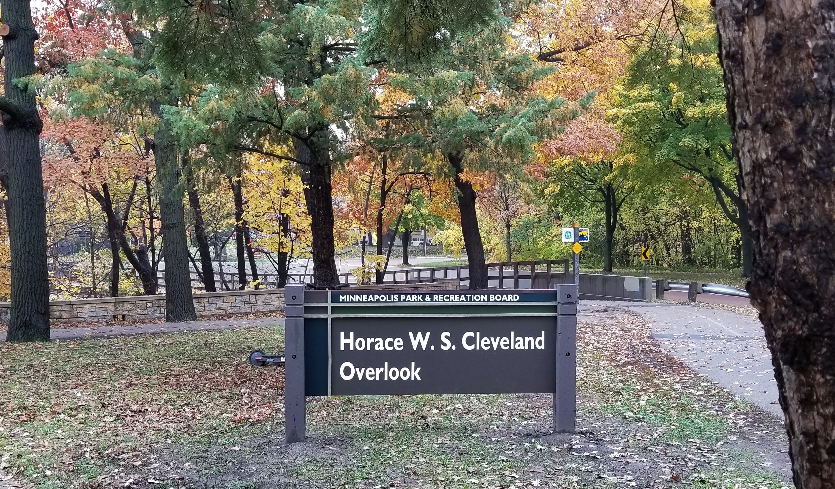
After Careful Consideration: Horace W. S. Cleveland Overlook
Filed under: Minneapolis parks, Mississippi River | Tags: H.W.S. Cleveland, Horace Cleveland, Mississippi National River and Recreation Area
Comments (7) The man who first suggested putting Horace William Shaler Cleveland’s name on something in the Minneapolis park system was William Folwell, the president of the Minneapolis Park Board in 1895. Folwell noted in the annual report of that year that due to Cleveland’s advanced age, then 81, he was no longer able to assist in the development of park plans. Folwell then recommended, “In some proper way his name should be perpetuated in connection with our park system.”
Last week the Minneapolis Park Board acted on Folwell’s advice and named a river overlook near East 44th Street on West River Parkway the “Horace W. S. Cleveland Overlook.”
Cleveland was already 58 years old when he was invited to come to Minneapolis from Chicago to give a public lecture at the Pence Opera House on Bridge Square in 1872. He spoke on how to improve the city through landscaping. He was a big hit and his advice was sought in St. Paul and Minneapolis on how to improve the cities. He wrote an influential book based on his lectures, Landscape Architecture as Applied to the Wants of the West. That began his association as an influential advisor to both cities. When the Minnesota legislature created the Minneapolis Park Board in 1883, one of its first acts was to hire Cleveland to give his advice on what needed to be done.
He produced a report complete with a map, which he called Suggestions for a System of Parks and Parkways for the City of Minneapolis. His map showed a continuous parkway connecting Lake Harriet with Loring Park, then north to Farview Park, directly east past Logan Park in northeast Minneapolis, then south back to the Mississippi River Gorge near the University. His parkway continued on both sides of the river from Riverside Park out to Lake Street and then all the way back west to what is now Bde Maka Ska. It was the brilliant original imagining of what would become the Grand Rounds. It helped instill the notion that parks are not isolated parcels of land but form a part of a “system” that is integral to the quality of life and well-being in a city.
Cleveland had seen the struggles of older Eastern cities such as Boston and New York to create parks in already crowded urban areas. He had worked in the park system in Chicago and saw the same struggles to create open spaces in built environments. He had long argued in Minneapolis and St. Paul to create parks while undeveloped land could still be acquired at reasonable cost and features of natural beauty could still be preserved for public enjoyment. That we have such wonderful open spaces and preserved nature in our cities today owes much to Cleveland’s vision.
It is especially appropriate that an overlook of the river gorge be connected with Cleveland’s legacy. He had an affection and admiration for the beauty of the unique river gorge above all other of “nature’s gifts” to Minneapolis and St. Paul. He argued eloquently for the preservation of the natural riverbanks, calling the heavily wooded, still-unscarred river gorge a setting “worthy of so priceless a jewel” as the mighty river. Both St. Paul and Minneapolis heeded his advice.
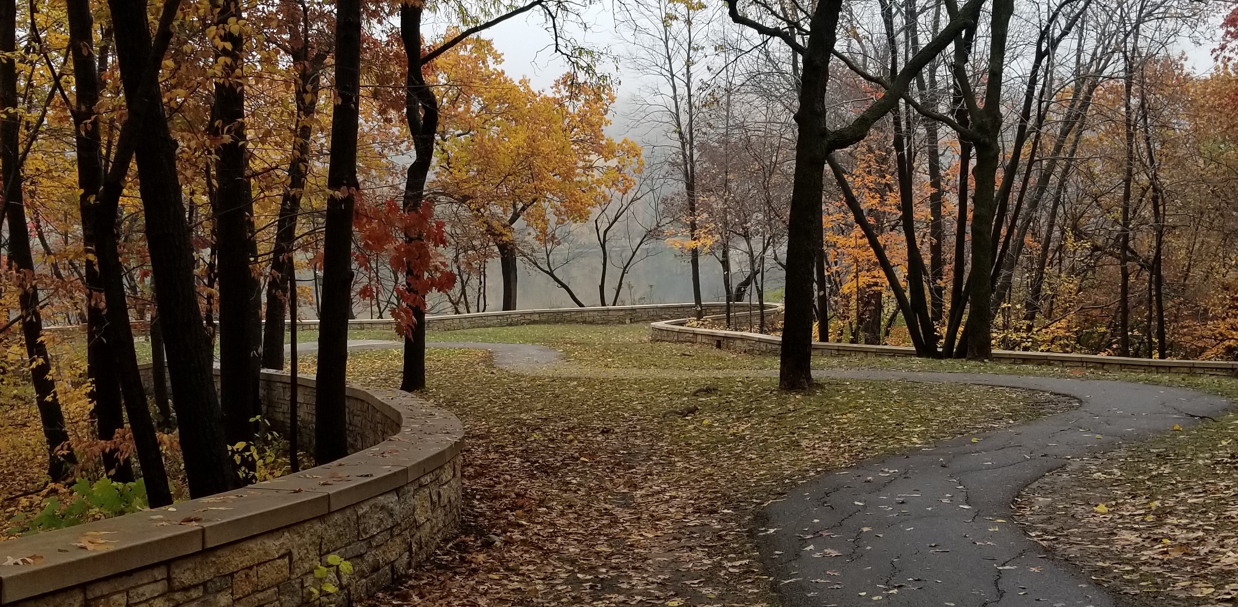
The setting is still worthy of the jewel. Even though most of the color is gone from the wooded river banks, you might want to visit the Mississippi River overlook. Or at least cross over one of the river bridges and marvel at the beauty that has been preserved in part due to the vision and persistence of Horace William Shaler Cleveland, which is finally properly acknowledged.
David C. Smith
Charles Spears Interview: In Memoriam
Filed under: Minneapolis parks | Tags: Charles Spears, Eloise Butler Wildflower Garden, Friends of the Wild Flower Garden, The Fringed Gentian, Theodore Wirth Park
Comments (1) I received an email today with news of Charles Spears’ death. Spears was superintendent of Minneapolis parks 1978-1980. Spears spent his life in park management. In addition to his time in Minneapolis, he worked for Nashville and New Orleans city parks, as well as state parks in Kentucky and West Virginia. Although his tenure in Minneapolis was short, I found a brief interview he gave to The Fringed Gentian, the newsletter of the Friends of the Wild Flower Garden. I found it interesting to note what has changed — and what hasn’t — in the last forty-four years of park management.
The interview below is reprinted with permission from the Friends of the Wild Flower Garden. I highly recommend a visit to their website and their newsletter using the links above. Their support of the Eloise Butler Wildlfower Garden in Theodore Wirth Park has been continuous since the “Friends” were established in 1952.
A CONVERSATION WITH CHARLES SPEARS — NEW MINNEAPOLIS PARKS
SUPERINTENDENT 7/13/79
Printed in The Fringed Gentian™ Vol. 27 No.3; Vol. 27 No.4 and Vol. 28 No.1. Interview with Lynn Deweese.
What do you see as the major strengths of the Minneapolis Park System?
The major strength is the legacy that has been left us by previous park boards and superintendents in providing both open spaces and recreational facilities for now and the future. Minneapolis has done an excellent job; in fact, I think it is the finest park system in the United States -because of the lakes, parkways, bikeways, and natural areas such as the Eloise Butler Wild Flower area at Theodore Wirth Park, the Robert’s Bird Sanctuary area at Lake Harriet, and the Diamond Lake area where plans of establishing nature trails around the lake by 1981 are under way.
What do you see as the major weaknesses of the Park System?
Well, I don’t see the weaknesses as being in the System as much as I see financial problems in the future. System-wise, we have property and buildings to do many things – but programing and peoples’ needs are changing fast. But it will change even more dramatically in the next few years due to the gasoline and energy shortages. It is already happening. People will be staying home more and taking shorter trips. They will be home more weekends, seeking more family recreation, more programming, more classes. They will be here to be served more -both city and suburban people. Regional parks will be used more than the state and national parks.
What moves are now being made to cooperate with suburban and county parks?
We are in process now of having meetings with the Hennepin County Park Reserve system, and are trying to plan together so that our cross country walking and biking trails from the city will tie into county and suburban extensions. For instance, the Shingle Creek system will tie in with one that is being built by Brooklyn Center and the Hennepin County Reserve system. This linking of the city with the suburbs by bicycle paths will be increasingly important as bicycles become a more important mode of transportation for
some people in the future. But there must be proper planning and co-ordination of these trails so they do not too often dead end at city boundaries. The regional park system idea is also being studied through the Metropolitan Planning Council which includes Ramsey and other metro counties as well aa Hennepin.
Knowing the special bias of the FRIENDS, what do you see as the place of the Eloise Butler Garden in the park system?
I see it as a very important function, Where else can city youngsters who possibly cannot afford to go to other places find the native plants. I think it is important that they have a place such as your Garden, or the Diamond Lake area, or the refuge at Lake Harriet, or getting back into some other areas that are not mowed so completely. In fact, we are looking at the possibility that we may be mowing too much. Maybe there are places we should not mow to encourage more wild life, for habitat and also maybe to save some money.
Do you see some changes that would be desirable at ELOISE?
I would be open to ideas from people such as the FRIENDS, who are active in that area, and would be guided by what they feel because they have been around it for some time. I think I would like to see a somewhat more active program for the inner-city youth, with perhaps a trained person, or persons, to help with guided walks and the development of wild life appreciation. Staffing and transportation costs have perhaps held back this development. We are starting that sort of programing in the Diamond Lake area, using our own staff -our horticulturist, Mary Maguire Lerman, and our new environmentalist, Mike Ryan.
What role do you see the FRIENDS having?
I see it as one of continuing protection of the area. Without it where would the Garden’s voice come from. There have been periods when lobbying was the only thing the FRIENDS represented. That is one of their strengths. Also, I would like them to work up special projects that might take certain amounts of money not available from the Park’s budget and be active in raising the money. The Garden is a wonderful place, it makes you feel far away from the city.
What sorts of projects do you see the FRIENDS being involved in?
I would see them helping to better interpret what is there – the educational end of the Garden. So people do know what they are seeing and the worth of it. They should come away from there with a better feeling of why it is there in the first place. There are possibilities for good self-guided touring – well signed, etc. I would like to see some evening programs in the Garden. A naturalist might give a night life program one night a week during the season. In some cases that could be on a volunteer basis with members of the group doing that. They’ve got expertise – but what they need to do is share it. Wouldn’t it be nice if some of the FRIENDS could relate experiences and knowledge to youth groups, and others! For instance, this year we’ve changed our day camp program considerably. Instead of taking them out to Hennepin County Park Reserve District and putting them through the programs there – we can’t afford the busing, we can’t afford the cost – so this year we decided to do it in Minneapolis. This year we’re taking them to the Diamond Lake Area on nature hikes, taking them down the Minnehaha Creek on canoe trips. We think they need to develop an appreciation of what we have in the city. I would like to see some of our recreation center staff go through some training that would be involved in some of these things. They would go out to places like the Wild Flower Garden (I’m talking about our staff people here) and be given some background about what it is and what it does. That is the sort of leadership training we are going into. We are starting that at Diamond Lake with guided tours — this has not made use of volunteers there – rather our own staff, our horticulturist – Mary Maguire Lerman and our environmentalist – Mike Ryan. This year we acquired a new environmentalist – Mike Ryan -. He is working on several projects. His main project will be on lake pollution control and the lake level study. Now he’s doing the Diamond Lake thing because of the considerable silting caused by the interstate into that area. A number of people want us to just go in there and dredge it out. That may or may not be the answer there. It depends what sort of wild life you want there. And so the people agreed that he should have an opportunity to look at that and explain to them their alternatives before we do anything.
You may go in there and destroy more habitat by taking something out than you want to destroy. It depends what sort of habitat you want and what you want a place to do. Those are the sort of things he is going to be doing.
Speaking of new programs, how is the development of the Riverfront Plan coming?
It’s coming great. It will probably be a developed park, though there will be areas that will always be protected because they are hard to maintain. Everything from the bluff down will be undeveloped. From the bluff up, it will be more developed. There will be a great river road, bicycle paths, walking paths. These will make the area accessible to more people. I believe the river is considerably cleaner than it was ten years ago. There are plans for boat launching facilities. There will be some zoning to allow for water skiing and
other similar activities – crewing. So that people with different interests will have a place that they can do something. The river is the most exciting thing that is going to be happening around here in the next ten years.
Has there been a recent change in deciding where park plantings are to be placed?
We’ve cut back on the flowers at Lake Harriet, for instance, in order to spread it over the city a little more. We are trying to spread it around more. We feel that all sections of the city have the right to have some. In some p]aces we are putting plantings around a park identification sign in the corner of a park. And people are appreciating this. Now we are going into a program which we will call Foster a Park; wherein we will hope to get some garden clubs and some groups that will adept a certain area, especially some triangles –
we have about 40 triangles in the city that we maintain – and have these neighborhood groups accepting the responsibility for cutting the grass, plant flowers and take care of the watering. These areas could then become oasis in the city. This of course, also gives this group some additional community exposure. And of course these pleasant breaks of green are what makes this city so special.
Has the budget gone down, or is it just that the city has more needs that the same money doesn’t go as far?
Its both. Well, not really; the money itself is not going down as fast as inflation is killing it. Because of inflation our actual spendable money after operating expenses has declined and so we have had to examine our priorities and in some cases make cuts. We don’t like to cut services, but we do have to cut something. This will be a continuing problem. Probably the greatest challenge is that we are going to have more demand because of energy and less money to do it with. And I don’t know how we will make those two meet. People are going to have to take on part of the burden if they want the level of services they have been used to.
We offer our condolences to the Spears family and our appreciation for his service to parks in Minneapolis and the nation. We owe so much to the dedicated and talented park professionals and citizen volunteers who have contributed so enormously to our quality of life.
David C. Smith

