Closing Parkways: Not a New Idea, or a Good One
The Minneapolis Park Board considered chopping up the Grand Rounds once before. That proposal was rejected, as I hope this one will be.
On May 30, the park board published a draft of its “preferred concept” for the Minnehaha Parkway Regional Trail from where Minnehaha Creek enters Minneapolis from Edina, east to Hiawatha Avenue near Minnehaha Park. I would encourage everyone to review the draft concept, especially page 7 of the linked document, which addresses “Parkway Vehicluar Circulation.” I believe that is where the plan fails, because it proposes to place roadblocks at some intersections that will force cars to leave the parkway, which creates in essence more “missing links” in the Grand Rounds. It will essentially end the practice of driving Minnehaha Parkway for pleasure.
With at least two intersections (at Lyndale and Nicollet Aves) where motorized vehicles will be forced off the parkway onto city streets, the plan will make it maddening if not impossible to navigate off the parkway, through neighborhoods, back to the parkway, then off again, then on again. If you like your parkways a few blocks at a time, you won’t mind the proposed traffic flow. And if you live on the parkway, you’ll love the new plan because you’ll enjoy private access to the creek without the annoyance of anyone but your neighbors driving by. It’ll be like having a private driveway along a beautiful creek that the rabble used to desecrate. For people who aren’t fortunate enough to live adjacent to the creek, who live too far away to walk or bike on creek paths, or who are physically unable to do either, it won’t be quite so nice as now—or as it has been since the creek was acquired by the park board beginning in the 1880s when it was still surrounded by farmland.
At a time when the park board professes to be focused on “equity,” it seems odd to tell people from north, northeast, central and southeast Minneapolis that access to Minnehaha Creek is being made more difficult for them so others, most of whom live nearby, can walk or ride bicycles on creek paths without being inconvenienced by traffic. “Tell ’em to get their own creeks!” Actually those neighborhoods once had creeks, but most were already ruined or gone by the time the park board was created in 1883 so they couldn’t really be preserved for recreation and beauty. Park commissioners then did what they could. They preserved the one creek—Minnehaha—far enough from town that it hadn’t been destroyed yet, which was long before sumptuous homes were built facing it.
And there was always that parkway separating land owned by a person from land owned by the people.
Uproar in 1970
Turn the clock back to August 1970. The park board had hired one of the leading landscape architects in the nation, Garrett Eckbo of San Francisco, to advise the board on updating Minneapolis’s parkway system. Most of the city’s parkways had been built from 1885 to 1925 and had never been built to modern road standards. Complaints of tire-bursting, car-devouring potholes were rife on editorial pages and the park board didn’t want just another cosmetic fix. The supposed concrete foundations for parkway pavements in some cases had turned to gravel. (Parkway paving efforts in the early days of automobiles were fraught with expensive failures.) So instead of simply patching unpatchable parkways, the park board wanted a more comprehensive evaluation of how modern parkways should be used. Laudable. And Eckbo was a logical choice as an advisor. He had long challenged the status quo in landscape architecture and had advised the park board in its against-all-odds successful battle with the state, city and county to prevent an elevated freeway from being built on Highway 55 within yards of Minnehaha Falls.
Trouble with a capital T and that rhymes with P and that stands for Parkways arose when a summary of Eckbo’s preliminary ideas was printed in the Minneapolis Tribune on Aug. 6, 1970. In general terms, Eckbo wanted to move parkways farther from water bodies and to the periphery of parks. One objective he said was to reduce the impact of cars on parks. An August 6 article in the Minneapolis Tribune headlined, “Lake parkway shift suggested,” didn’t arouse much opposition. Neither did a subsequent presentation by Eckbo to the park board that was reported on in the Tribune on August 20 under the headline, “Reduced Automobile Traffic Asked on City Parkways.” That article began, “The Minneapolis Park Board listened Wednesday to an urban designer tell how the impact of the automobile on the city’s parklands could be reduced in favor of recreational and esthetic enhancement. Preceded by a tape recording of automobiles noisily whipping past a point on the 68-mile Minneapolis parkway system, designer Garrett Eckbo summarized a study that recommends rerouting of parkways around parks that are presently split with driving routes.”
The measured rationale and the tone of the coverage did not foreshadow the more radical plans that Eckbo would introduce a month later. The bit of grumbling about an “outsider” telling us how to run our parks was nothing compared to what happened when Eckbo unveiled his specific plans for the parkway system.
First revealed to the public in the Minneapolis Star, an afternoon paper, on Monday, September 7 as people returned home from their Labor Day outings around the city’s lakes, Eckbo proposed closing most of the parkways around the Chain of Lakes.
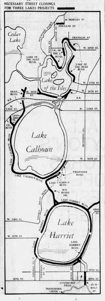
The proposed assassination of the Grand Rounds aroused immediate fury—and that was before most people learned of changes not only to Chain of Lakes parkways but similar dramatic alterations to other sections of the Grand Rounds: closing Victory Memorial Drive, rerouting traffic to Xerxes Avenue; closing Cedar Lake Parkway, rerouting traffic to Cedar Lake Avenue; moving Theodore Wirth Parkway to the east side of Wirth Lake; as well as changes to the River Parkways, Lake Nokomis Parkway and others.
Taken individually, many of the suggestions made sense—it was one of the few times that anyone had looked at the entire park system as a whole instead of all the pieces, both properties and programs, that had been cobbled together over nearly 90 years—but in one staggering reveal they were too much to take. Park board telephones were inunudated with calls when staff returned to work on Tuesday morning after the Labor Day weekend.
The outrage wasn’t just about parkways. It was also about islands and bays and peninsulas. The Star also published Eckbo’s detailed plans for the lake shores and access points to lakes. There was something for just about everyone to hate. And they did. With gusto.
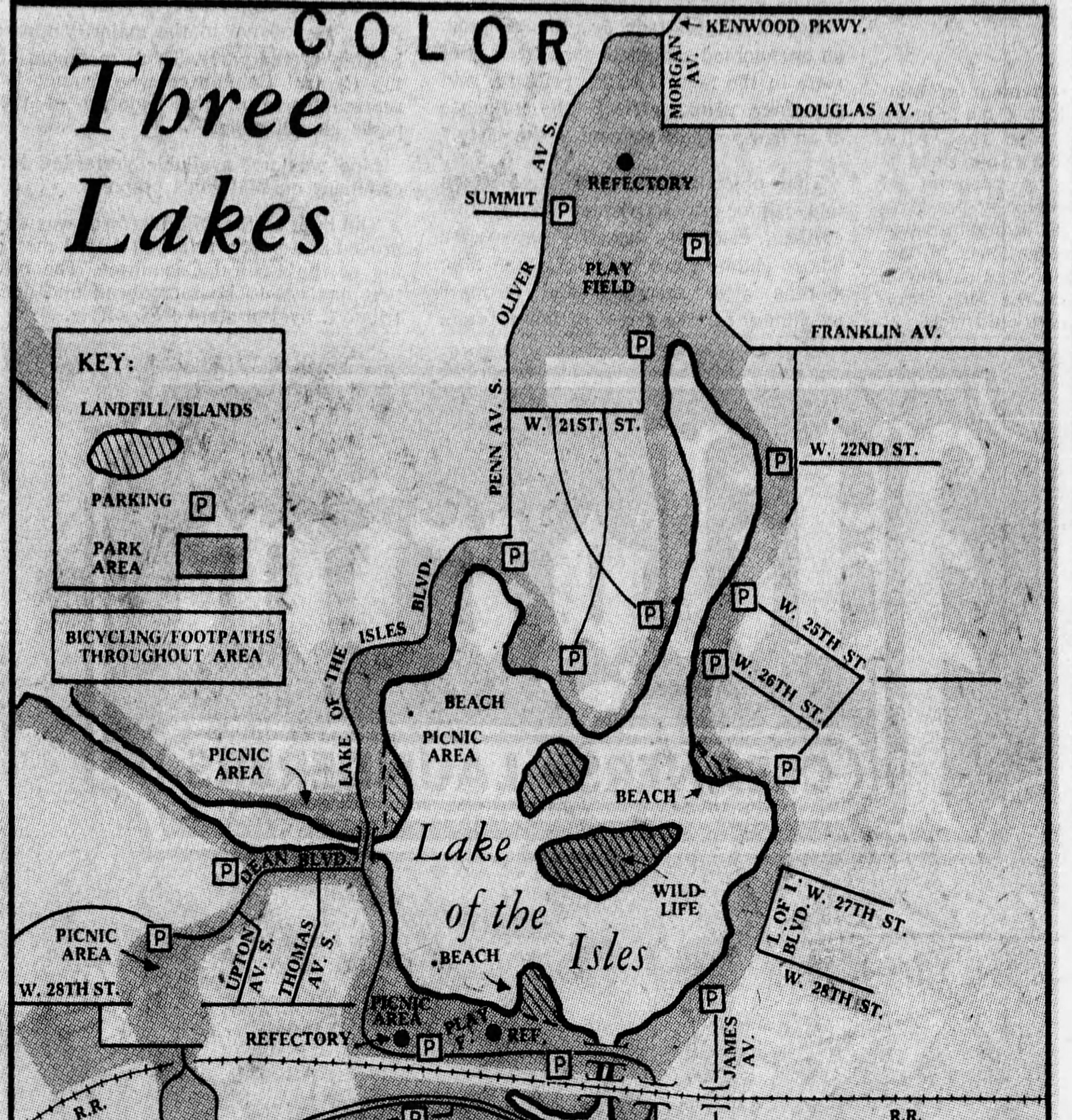


You can imagine the consternation of Minneapolitans as they viewed what was essentially Eckbo’s unpriced (but obviously scary expensive), blue-sky wishlist for alterations to the three lakes. Clearly, Eckbo’s priority was not just removing cars from parks, but creating more shoreline and changing sightlines. Eckbo’s proposal for a dredged bay on the northwest shore of Lake Calhoun and a peninsula on the west shore of Lake Harriet had both been proposed by Theodore Wirth and rejected 60 years earlier. Many critics of the plan, especially those who lived near the lakes, objected not only to the elimination of parkways but the addition of parking lots—mostly hidden behind those funky islands. They apparently considered parked cars a bigger eyesore than cars on the move.
Citizen Action
Citizens mobilized quickly and forcefully creating the Minneapolis Parkway and Lake Study Committee (MPLS) to fight Eckbo’s proposals. In an effort to contain virulent opposition to the plans and explain the options, none of which had been approved yet by the park board, the park board began holding meetings around the city and solicited invitations to present the issue to every civic, religious, fraternal, and social group imaginable. Park board president Walter Carpenter also took an unusual step which reverberates still in park deliberations; he appointed a citizens committee to study the issues and advise the park board. It wasn’t the very first time a group of citizens were asked to advise the board, but it was the direct forerunner of today’s practice of convening a Citizens Advisory Committee (CAC) for every major design project in parks. The first citizens’ committee to advise park commissioners was created in 1911 during the design phase of the Logan Park community center, the first one built by the park board, which was completed in 1913. Perhaps design advisory committees were not needed for many years after that because the park board did not build another community center until the 1960s.
MPLS was active in 1971 elections for park commissioners and city council members, but were not successful in overthrowing the leadership of the park board, which remained narrowly in the hands of the Repubican majority that supported superintendent Robert Ruhe. Yes, in 1971 there was still a Republican Party in Minneapolis that could contest elections and—in this instance, at least—it was the Republican commissioners who defended what were considered to be radical changes in the park system against the status quo Democrats.
Ruhe often was tarred with the same brush as Eckbo: an outsider who didn’t understand Minneapolis. Ruhe had come to Minneapolis from Illinois, and while he was arguably one of the most successful park superintendents in Minneapolis history, his domineering personality was not endearing to many. He had not only stepped on some toes, he had stomped on them. Despite Ruhe’s brusque manner both he and park board president Carpenter were attacked unfairly, in my opinion, by many opponents of the Eckbo proposal.
As has often been the case in Minneapolis park politics, policy differences became intensely personal.
What many of Ruhe’s critics failed to appreciate was that much of what was celebrated in Minneapolis parks had originally been created by two other “outsiders” who brought unique vision with them, H.W.S. Cleveland and Theodore Wirth. Praise be to outsiders!
Faced with such intense criticism, the park board issued instructions to Eckbo that his final report should not contain recommendations to close parkways and build islands and peninsulas in lakes. While awaiting the issuance of Eckbo’s final report, expected in the summer of 1971, the Minneapolis Star reported on May 24 the results of a Metro Poll that showed Minneapolitans had a narrow preference for retaining parkways as they were then configured. Eckbo’s proposals to close parkways for greater bicycle and recreational use was favored by the presumably more active and fit 19-29 year old cohort (baby boomers when they were young!), but more than 60 percent of poll respondents aged 50 and over opposed parkway closures.
Only a Shadow
Eckbo’s final recommendations, issued in July 1971, were “only a shadow,” wrote the Tribune, of his concepts from a year earlier. His most urgent recommendation was the paving of all parkways. He recommended closing only a few short stretches of parkway, although he did advise the park board to turn over to the city King’s Highway, The Mall and Linden Hills Boulevard. (That never happened.) He also recommended measures to slow traffic on parkways, such as narrower roadways, and converting parkways around Lake of the Isles, Lake Harriet and Lake Nokomis into one-way roads. Eckbo’s plans for narrower roadways were eventually implemented on most parkways and his recommendation of one way traffic was implemented at Lake of the Isles, sooner, and Lake Harriet, later. The park board also adopted Eckbo’s recommendation of closing double roadways on the southern shores of Lake Calhoun and Lake Harriet, although a segment of the lower parkway on the east side of Lake Harriet remains to this day.
One of Eckbo’s suggestions which was not acted on, which I support strongly even today, was to prune trees and brush along the River Parkways and at Deming Heights on St. Anthony Parkway to open up scenic views. I would advocate the same now for Minnehaha Parkway and Minnehaha Creek.
Full Circle Grand Rounds
Which brings us back to the present preferred concept for Minnehaha Regional Park. I appreciate thinking of ways to reinvigorate parks and to keep them relevant to changing populations and preferred activities. I also undertsand that changes in water levels and continuing adaptations to climate change are needed. Climate issues are especially challenging for a park system that is so heavily water-based. Lake, creek and river levels are critical for recreational activities and aesthetic enjoyment in Minneapolis.
Important aspects of the preferred concept harken back to earlier days of park history, especially to Theodore Wirth’s tenure as park superintendent (1906-1936), when lake shores and creek banks were being defined. Present creek management proposals would undo some of the creek straightening performed by Wirth. For the first century of Minneapolis history, the primary interest in Minnehaha Creek was to maintain enough water in the creek to present a steady flow over Minnehaha Falls. As early as 1892, before the park board owned Lake Nokomis, Lake Hiawatha or Minnehaha Creek east of those lakes to the Falls, the board considered diverting Minnehaha Creek into Lake Nokomis and damming the outlet in order to create a reservoir to ensure a flow of water over the Falls. After all, Minnehaha Falls was Minneapolis’s most celebrated landmark and it wasn’t nearly so charming without water. Visitors came from around the world to see the Falls that Longfellow made famous in Song of Hiawatha.
One solution to the problem was to shorten the creek by making it straighter and narrower, which Wirth did in the mid-1920s. That didn’t help much. Newspaper reports and park board records indicate that Minnehaha Creek was dry most summers from the 1920s to the 1950s. The park board also tried to address the problem by creating a lakelet above the falls and then by drilling an artesian well in 1927 to pump water over the falls. The Great Depresssion put an end to running that pump; it was simply too expensive. As late as the mid-1950s the park board offered to turn on the well pump for a price when conventions or special events brought visitors to town. The city famously opened fire hydrants to put water in the creek when President Lyndon Johnson made a campaign stop at Minnehaha Park in 1964.
The world has changed since then. Now the problem across South Minneapolis is not too little but too much water. The present preferred concept was developed to address that problem too—as it must. More meander, more channels, more wetlands, even underground flood storage, are at least a partial solution to more water.
The proposed diversion of traffic off Minnehaha Parkway to prevent circumnavigation of the Grand Rounds seems, however, to address none of these pressing issues. I have always considered part of H.W.S. Cleveland’s genius the simplicity of his approach: little or no artificial adornment in parks, use of native plants and trees, adapting parks to the natural contour of the land. The parkways he originally envisioned—elegantly simple—were meant not only to be longitudinal parks but easily accessible connections between larger open spaces. I think we lose some of those admirable qualities if we close off part of the park system to a large part of the population.
In recent weeks I have driven the parkway frequently to assist my parents who live on the opposite end of the parkway from me. At some times of day I find it faster and more convenient to take the Crosstown, at other times I take other city streets, especially 38th or 42nd, east and west, just to catch up with the ambience and changes in the neighborhoods in between. But often I do drive the parkway, because it is beautiful, rejuvenating, calming. An extraordinary place. And sometimes I take my Dad for a drive along the parkway, a route he used to walk daily but no longer can. Does he deserve his own parkway? Do I? No. But neither do those cyclists or walkers who are young enough, fit enough, able enough or near enough to enjoy pedestrian or bicycle trails. Also, I have been impressed in my near-daily drives along the parkway by the courtesy shown by drivers to walkers and riders, if their safety is the primary issue.
If you’re aching for a head rush and there is no Tilt-a-Whirl nearby (that might date me) take a look at the Portland and Parkway Focus Area of the preferred concept. Look at the arrows indicating traffic direction on the parkways and surrounding streets to figure out which way traffic will (or won’t) flow.
Any driver smart enough to figure out that flow should also be smart enough not to run over pedestrians and bicyclists.
The most surprising part in the preferred concept is that traffic is being forced off the parkway only on the western section of the parkway where “park access” is the primary use of the parkway. I would think that if park planners were intent on reducing traffic on parkways they would attempt to do so where parkways are used for commuting purposes rather than park purposes.
I hope there is a way to accommodate all park users and to facilitate the continuing circumnavigation of the Grand Rounds on foot, bicycle and automotive vehicle. I would much prefer that the Grand Rounds have only one “missing link”, and that, between St. Anthony Parkway and East River Parkway, only for a short time longer. It would be a pity for us to one day celebrate the completion of the Grand Rounds in east Minneapolis only to mourn that we have severed such a celebrated and valuable drive in other places.
If you have strong feelings one way or the other, visit the Minnehaha Parkway Master Plan page to find a schedule of June meetings—click on the “Get Involved” tab—at which you can express your opinion on the plan or take an online survey. The next meeting will be Thursday, June 13, 6:00 p.m. at Lake Nokomis Community Center.
David Carpentier Smith


Thank you so much for your thorough, thoughtful reporting on this issue so near and dear to me. I just ordered three copies of your book!
Thanks, Julie. I hope you enjoy the book.
Thanks so much for the article. I’m printing it out to take to Thursdays public meeting.
Well written and argued. I agree.
Thanks for reading, Phillip.