Ironing Out Minnehaha Creek’s Wrinkles
A reader checked in a few weeks ago with a question: Did Minnehaha Creek ever cross West 54th Street in the southwest corner of Minneapolis?
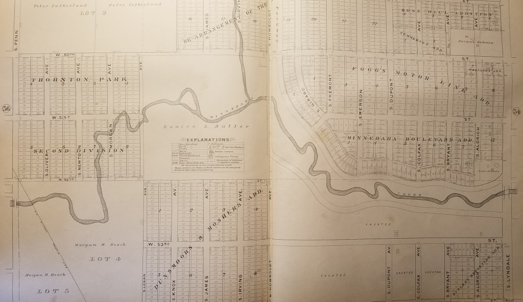
I pulled out my 1903 Minneapolis Real Estate Atlas and was surprised to find that the creek did cross what is now West 54th St. for a few hundred feet. At that time, 54th St. was the southern city limit of Minneapolis.

The park board didn’t acquire this section of Minnehaha Creek — from Humboldt to Zenith — until 1930, and graded and straightened sections of the creek in 1932. The creek would have been straightened here as elsewhere to avoid the expense of building bridges. (Read more about the acquisition and development of this section of Minnehaha Creek. Go to the “History” tab at the bottom of the page.)
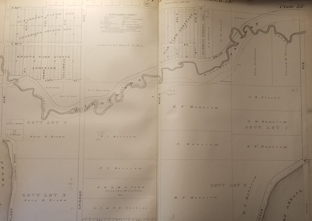
The section of Minnehaha Creek acquired in 1930 never had a parkway built along it as was done east of Humboldt. That was partly because some homes had already been built near the creek and also because the creek banks were much steeper here than to the east. But even if it had been perfectly flat and unoccupied, the Great Depression had set in so there was no money for new parkways.
According to Hennepin County property records the first house along this section of W. 54th St. was not built until 1942. That was a rarity because very few houses were built in Hennepin County during World War II due to a shortage of labor and materials. The rest of the houses along the street were built after the war, mostly from 1948 on.
What other changes were made to the course of Minnehaha Creek over the years? Here are three other sections of the creek from the 1903 atlas that you can compare to Google Maps to see what’s changed. Most of the changes were made in the 1920s partly to make it easier to improve the parkway to accommodate car traffic and partly to shorten the course of the creek to try to increase water flow over Minnehaha Falls in drought years — which was most years in the 1920s-1950s. No one seemed to like an empty creek and dry falls.

You can view many other early maps of Minneapolis — and spend hours and hours of COVID-avoidance free time — at the University of Minnesota’s John Borchert Map Library website. Countless maps — and aerial photography as well. You’ll be happier and smarter. Stay healthy.
David Carpentier Smith


Hi David,
Thanks for this and your number of posts on archival volumes concerning the MPRB. I am interested in the surrounding housing developments along the creek and was wondering if you’ve ever run across more info on the involvement of ‘improvement associations’ (also other names like homeowners associations, neighborhood improvement, property associations, etc.), which worked with the Parks Board or supported/opposed them in different ways? Such as around Lake Hiawatha and Lake Nokomis dating back to their initial planning and development? Or along the creek south of Lake Harriet for example? I am interested in learning more about the role of the local communities at the time in terms of how they related to Parks developments. Thanks again for this amazing resource!
Thanks, Daniel. I’m glad you’ve found some useful information here. You raise a very interesting issue, but one that I have not studied specifically. Park board proceedings record the receipt of many letters and “petitions” for various actions,, from acquisition to development of park properties. And I think in general the park board has been responsive to collective action. A study of those interactions would almost have to be done on a park-by-park basis — which I think could be done.
The best sources for further study would be those letters and petitions, many of which are preserved in park board papers in Special Collections at the Hennepin County Library downtown. The staff there are tremendously helpful.
I would be especially interested in the distinction, if possible to determine, between grass roots neighborhood activism — people campaigning for an amenity — and efforts initiated by real estate developers or agents trying to enhance the value of their holdings. That seems to me a critical distinction.
An example: in the Mapping Prejudice project undertaken a few years ago in Minneapolis, it is obvious in looking at racially restrictive housing covenants that they were not widespread on individual properties. In vast sections of the city few or no racial covenants have been identified. They were highly concentrated in specific areas, which suggests to me that they were the product of developers or home builders instead of individual home owners or sellers. In many instances those offensive — and illegal — covenants were on the deeds of every house on one block but none in adjacent blocks. Does that suggest that one developer or builder wrote those covenants into the deeds of the houses they built? It would seem a logical explanation. (In which case those builders/developers/agents should be named.)
I would ask the same questions of the initiation of requests from “improvement associations.” Did they orginate from a group of neighbors or a front for a developer or real estate agent? Let us know where your research takes you!
In addition to the earlier straightening of the creek, and the more recent re-meandering, I’m fairly sure that bulldozers have also leveled out the creek bed after the 50’s-60’s when we kids had deeper ‘swimming holes’ with swinging ropes. ‘My area’ of Harriet to Nokomis was a special playground for us young kids.
i used to pick watercress for my Mom from the creek by Lake Nokomis…..let’s see, that was about in the late forties…..