Archive for the ‘Minneapolis parks’ Category
The Statue of Liberty in a Minneapolis Park?
Filed under: Landscape Architects, Minneapolis parks | Tags: Charles M. Loring, H. W. S. Cleveland, Powderhorn Park
 Comments (2)
  If you could put a replica of this statue anywhere in a Minneapolis park, where would you put it?
One of the most intriguing “might-have-beens” in Minneapolis park history was the proposed construction of a Japanese Temple on an island in Lake of the Isles. (If you missed it, read the story of John Bradstreet’s proposal.) But that was not the only proposal to spruce up an island in a Minneapolis park.
On March 15, 1961 the Minneapolis Board of Park Commissioners approved the placement of a replica of the Statue of Liberty on an island in another body of water.
Park board proceedings attribute the proposal to a Mr. Iner Johnson. He offered to donate and install the 10-foot tall replica statue made of copper and the park board accepted the offer — as long as the park board would incur no expense.
I can find no further information on the proposal or why the plan was never executed — or if it was, what happened to the statue.
The intended location of the statue was the island in … Powderhorn Lake.
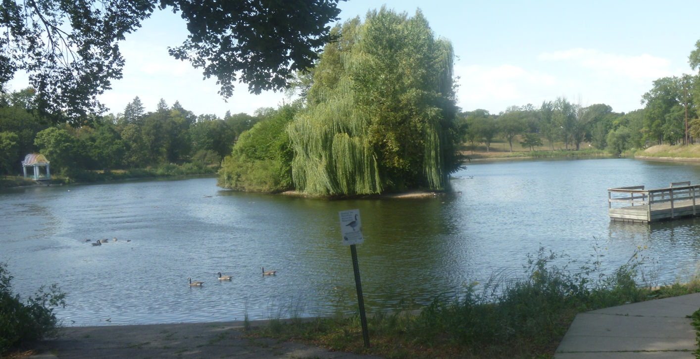
Island in Powderhorn Lake from the southeast shore, near the rec center in 2012. The willow gives the impression of an entrance to a green cave. (David C. Smith)
The Minneapolis Morning Tribune of March 16, 1961 reported that Lady Liberty was to be installed for the Aquatennial that summer. Was it? Does anyone remember it? I’ve never seen a picture or read a description.
Another park feature from H.W.S. Cleveland
The man-made island was first proposed in the plan created for Powderhorn Park in 1892 by H. W. S. Cleveland and Son. It is the only Minneapolis park plan that carried that attribution. Horace Cleveland’s son, Ralph, who had been the superintendent of Lakewood Cemetery since 1884, joined his father’s business in 1891 according to a note in Garden and Forest (July 1, 1891).
More on Garden and Forest. Horace Cleveland contributed frequently to the influential weekly horticulture and landscape art magazine through his letters to the editor, Charles Sprague Sargent. Sargent was also the first director of Harvard University’s Arnold Arboretum. Click on Garden and Forest to learn more about the magazine and its searchable archive. (Thank you, Library of Congress.)
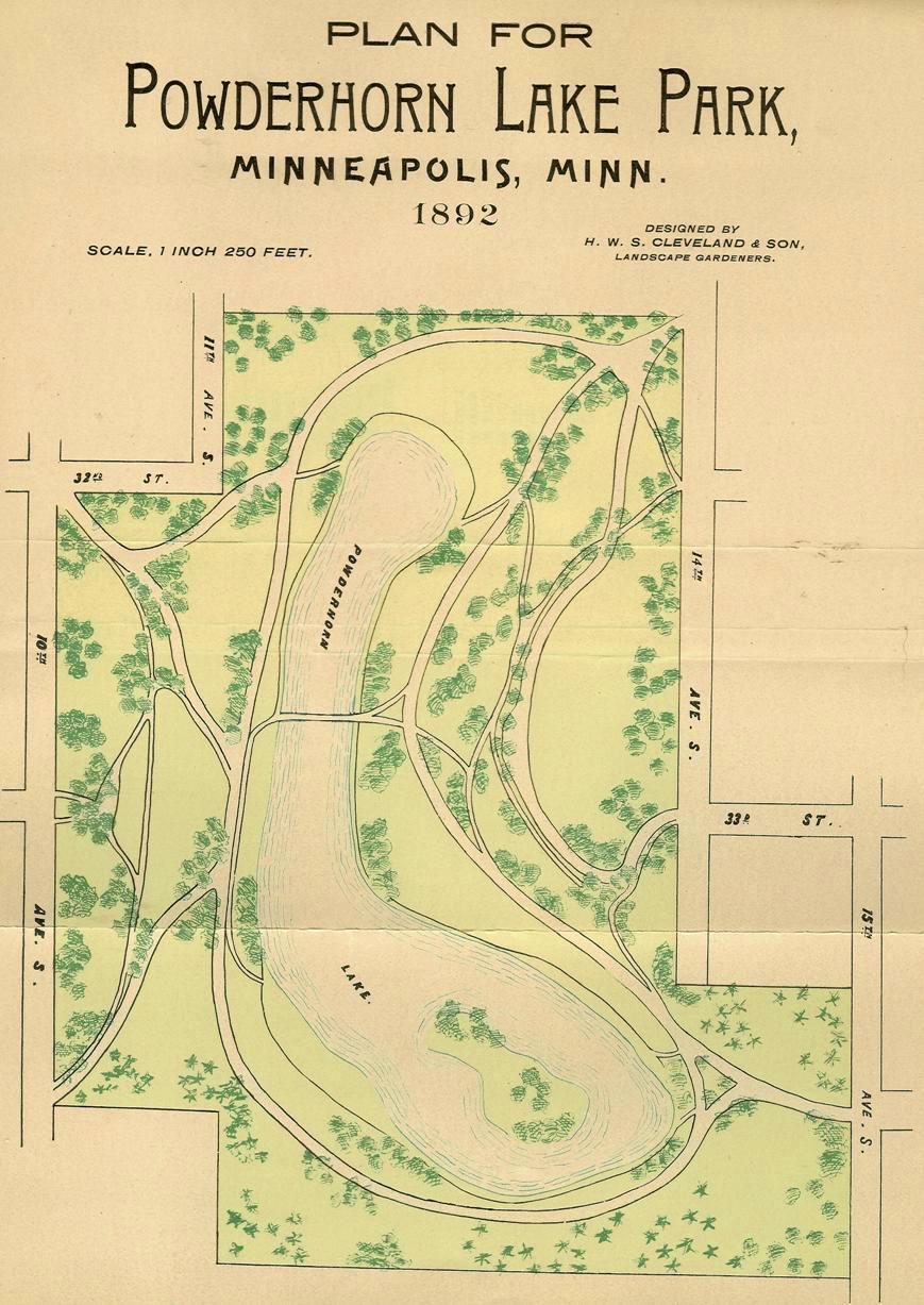
Cleveland’s plan for Powderhorn Park featured a bridge over the lake, about where the north shore is now, and an island. The plan was published in the park board’s 1892 annual report. (Horace W. S. Cleveland, MPRB)
Horace Cleveland was 78 and finding the field work of landscape architecture physically challenging when he and Ralph joined forces to produce a plan for Powderhorn. Only a year later his doctor prohibited him from working further. The Cleveland’s were paid $546 for their work at Powderhorn, but the park board didn’t implement parts of the plan for more than ten years.
Horace Cleveland had been a strong booster for making the lake and surrounding land into a park. Powderhorn Lake had been considered for acquisition as a park from the earliest days of the park board in 1883. However, the park board believed landowners in the vicinity of the lake were asking far too high a price for their land. To learn more of the park’s creation see the park board’s history of Powderhorn Park.
After I wrote that history, I found a transcript of a letter Cleveland had written to the park board (Minneapolis Tribune, July 26, 1885) encouraging the board to acquire about 150 acres from Lake Street to 35th Street between Bloomington and Yale avenues, which was, Cleveland claimed, the watershed for Powderhorn Lake. (I can find no Yale Avenue on maps of that time. Does anyone know what was once Yale Avenue?)
The letter repeated Cleveland’s frequent message about acquiring land for parks before it was developed or became prohibitively expensive. But he also claimed that due to the unique topography around the lake that if it were allowed to be developed it would become a nuisance that would be very costly to clean up.
I’ll quote a couple highlights from his argument for the acquisition of Powderhorn Lake and Park:
I am so deeply impressed with the value and importance of one section…I am impelled to lay before you the reasons …that you will very bitterly regret your failure to secure it if you suffer the present opportunity to escape.
The surrounding region is generally very level and the lake is sunk so deep below this average surface, that its presence is not suspected till the visitor looks down upon it from its abrupt and beautifully rounded banks. The water is pure and transparent and thirty feet deep, and its shape (from which it derives its name) is such as to afford the most favorable opportunity for picturesque development by tasteful planting of its banks…All the most costly work of park construction has already been done by nature.
Cleveland concluded his letter to the park board by writing,
I feel it my duty in return for the bounty you have done in employing me as your professional advisor, to lay before you this statement of my own convictions, and request, in justice to myself, that it may be placed on your records, whatever may be your decision.
On the day Cleveland’s letter was presented to the park board, the board voted not to acquire Powderhorn Lake as a park and Cleveland’s letter was not printed in the proceedings of the park board either. Still the lake and surrounding land—about 60 acres, or 40 percent of what Cleveland had initially recommended—were acquired in 1890-1891 and Cleveland was hired to create a design for the park. Cleveland’s proposed foot bridge over the narrow neck of the lake was not built, even though Theodore Wirth incorporated Cleveland’s bridge into his own plan presented in 1907. However Cleveland’s island was created in the lake in the ensuing years.
In a recap of park work in 1893, park board president Charles Loring noted in his annual report that a “substantial dredge boat was built and equipped and is ready to work” at Powderhorn Lake. “I hope the board will be able to make an appropriation large enough,” he continued, “to keep the apparatus employed all of the next season.”
Loring’s hope was really more of a wish because the depression of 1893 was already having drastic consequences for the Minneapolis economy, property tax revenues and park board budgets. Despite severe cutbacks in spending in 1894, however, the park board devoted about 20% of its $48,000 improvement budget to Powderhorn. Park superintendent William Berry reported that the dredge was active in the lake for 90 days. The result was about 1.7 new acres of land created by dredging and filling along the lake’s marshy shore. In addition, nearly 15,000 cubic yards of earth were moved from near 10th Avenue to fill low areas on the north end of the lake.
An island emerges
The next year, 1895, the island was finally created. The park board spent $10,000, one-third of its dwindling improvement budget, dredging the lake and creating the island. Another 7.3 acres of dry land were created along the lake shore and an island measuring just over one-half acre was created in the southern end of the lake.

An island being created by a dredge in Powderhorn Lake, 1895. Tram tracks were built on a pontoon bridge to carry the dredged material. The photo appeared in the 1895 annual report of the park board. Not a lot of trees around at the time. (Minneapolis Park and Recreation Board)
By 1897, the only activity at Powderhorn covered in the annual report was the “raising of the dredge boat,” which had sunk that spring, and watering trees and mowing lawns in the “finished portion” of the park. Two years later, Berry reported that the west side of the park was graded, another nine acres of lawn were seeded and 100 trees and 1600 shrubs were planted to a plan created by noted landscape architect Warren Manning. Horace Cleveland had left Minneapolis in 1896, moving with his son to Chicago, where he died in 1900.
It’s unlikely, due to his age, that Cleveland played any role in the actual creation of the island in Powderhorn Lake in 1895. And credit for the idea of an island may not be due solely to Cleveland either, but also to a coincidence in the creation of Loring (Central) Park in 1884. Cleveland’s original plan for Loring Park did not include an island in the pond then known as Johnson’s Lake. Charles Loring later told the story in his diary entry of June 12, 1884 (Charles Loring Scrapbooks, Minnesota Historical Society),
“In grading the lake in Central [Loring] Park the workmen left a piece in the center which I stopped them from taking out. I wrote Mr. Cleveland that I should be pleased to leave it for a small island. He replied that it would be alright. I only wish I had thought of it earlier so as to have had a larger island.”
The development of the island envisioned by Loring while supervising construction, then approved by Cleveland, proved to be a famous success. (The island no longer exists.) Four years later, on October 3, 1888, Garden and Forest published an article about Central (Loring) Park and concluded a glowing tribute with these words:
When it is considered that artificial lakes and islands are always counted difficult of construction if they are to be invested with any charm of naturalness, the success of this attempt will not be questioned, while the rapidity with which the artist’s idea has grown into an interesting picture is certainly unusual. The park was designed by Mr. H.W.S. Cleveland.
Given such praise, it is not surprising that Cleveland would be willing to try an island from the beginning in Powderhorn Lake. Between the time it was proposed by Cleveland and actually created three years later, decorative islands had also earned a faddish following on the heels of Frederick Law Olmsted’s highly praised island and shore plantings on the grounds of the 1893 Columbian Exposition in Chicago. One landscape historian wondered whether Olmsted’s creation and treatment of his island in Chicago could have been influenced by his 1886 visit to Minneapolis where he would have seen Loring and Cleveland’s island in Loring Park.
The success of islands in Loring Pond and Powderhorn Lake likely also influenced Theodore Wirth when he proposed creating islands in Lake Nokomis and Lake Hiawatha. Both of those islands were scratched from final plans.
The island in Powderhorn Lake is one of three islands that remain in Minneapolis lakes—and the only one that was man-made. Only two of the four original islands in Lake of the Isles still exist. The two long-gone islands were incorporated into the southwestern shore of the lake when it was dredged and reshaped from 1907 to 1910. The two islands that remain were significantly augmented by fill during that period.
A handful of islands still exist in the Mississippi River in Minneapolis, although many more were flooded when the Ford Dam was built. Another augmented island—Hall’s Island—may be re-created in the near future as part of the RiverFIRST plan for the Scherer site upstream from the Plymouth Avenue bridge.
Although Horace Cleveland died in 1900, when the Minneapolis economy finally boomed again the park board voted in April 1903 to dust off and implement the rest of the 1892 Powderhorn Lake Park plan of H.W.S. Cleveland and Son.
The lake was reduced by about a third in 1925 when the northern arm of the lake was filled. Theodore Wirth, the park superintendent at the time, contended that the lake level had dropped six feet for unknown reasons after his arrival in 1906. The filled portion of the lake was converted into ball fields — a use of park land that was unheard of in Horace Cleveland’s time. The lake that Cleveland estimated at 30 to 40 acres in 1885, when he recommended its acquisition as a park, is now only a little over 11 acres.
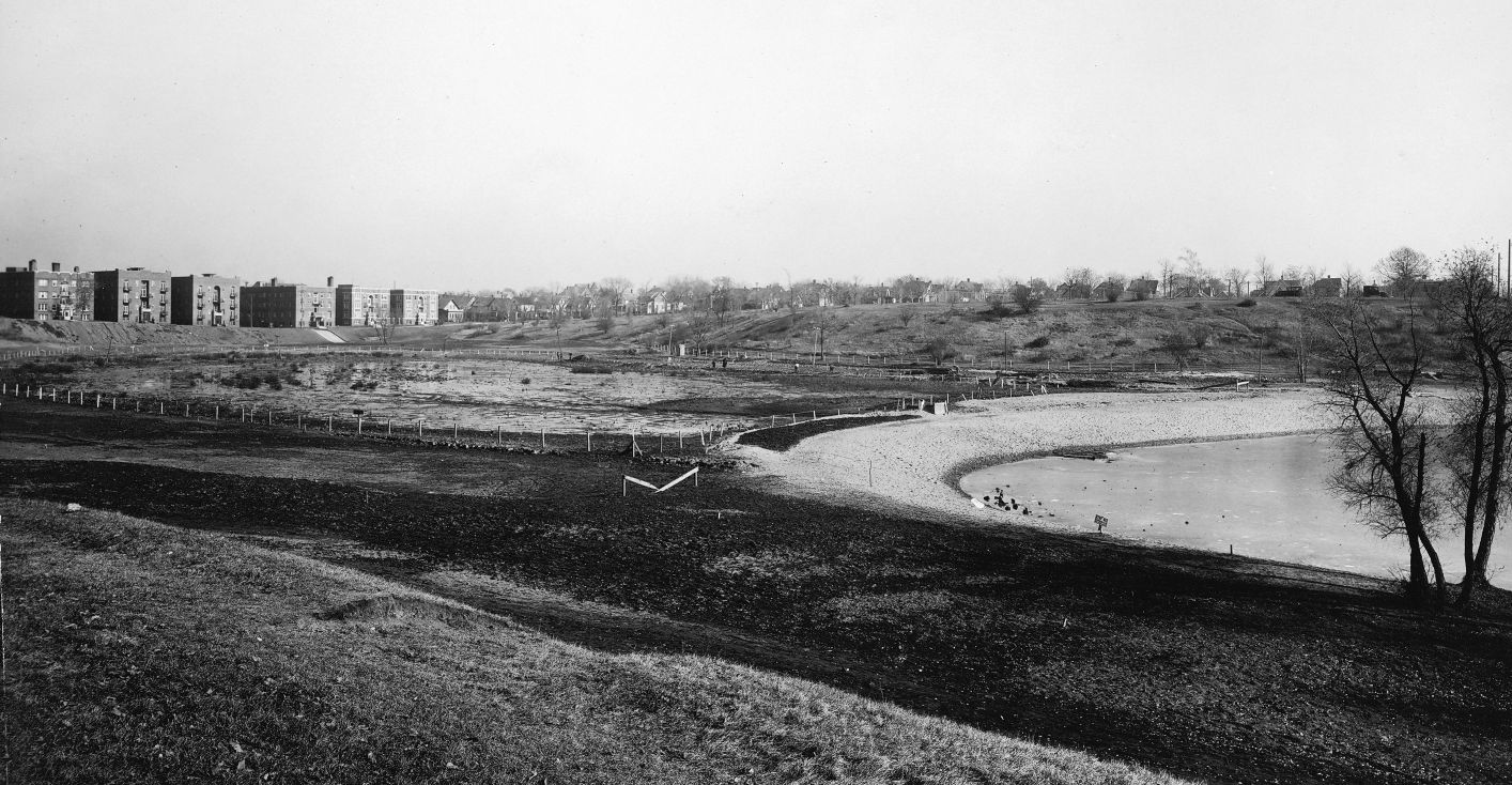
The northern arm of Powderhorn Lake was filled in 1925. I wonder if the folks who lived in the apartments on Powderhorn Terrace had their rent reduced when they no longer had lakeshore addresses? (City of Parks, MPRB)
Now about that Statue of Liberty. Does anyone remember it in Powderhorn Lake?
David C. Smith
© David C. Smith
Brownie Lake Long Ago
Filed under: Minneapolis Lakes, Minneapolis parks | Tags: Brownie Lake, Charles J. Hibbard, Theodore Wirth Park
Comments (2) As we look forward to improvements at Brownie Lake later this year and in 2013 I find it informative to look at photos of the area long ago. Of course the construction of the Prudential Building (now housing Target offices) next to the lake in 1954 changed the lake environs considerably. (See a photo of the building under construction here.) But the lake is also hemmed in by a freeway that keeps expanding on the north and a railroad/trail corridor that keeps shrinking on the south.
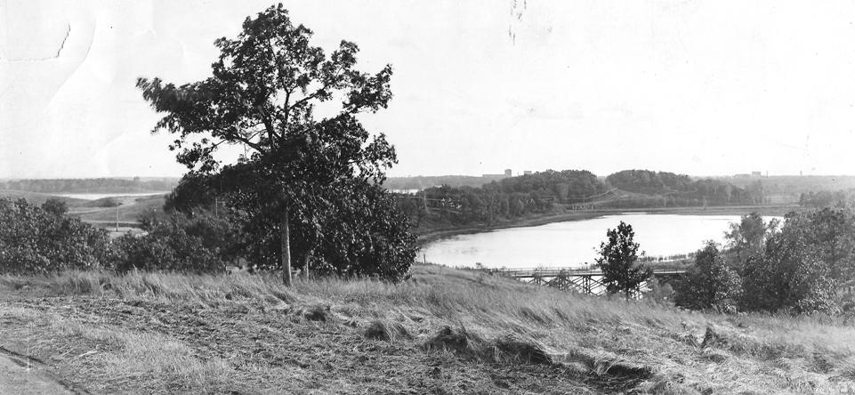
An undated photo labelled “Brownie Lake with Cedar Lake in the distance.” (C. J. Hibbard & Co., MPRB)
This photo puzzles me, however. If it is Brownie Lake what is the trestle on the near side of the lake in the photo? I’ve never seen that before. Can anyone enlighten me?
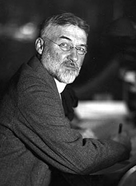
Charles J. Hibbard, 1916 (Minnesota Historical Society)
The back of the photo bears the stamp of C. J. Hibbard & Co. Charles Hibbard was an active photographer in Minnesota from about 1899 until his death in 1924. Those dates establish the range of years in which the Brownie Lake picture above could have been taken.
Hibbard wasn’t directly associated with parks, although many of his photos were taken in parks, but he deserves an entry of his own here some day. Based on the photos I’ve seen he was the preeminent photographer of the city. He chronicled many places and events in Minneapolis and the state. The detail and composition of his photos are remarkable.
Both of the photos below were taken at the intersection of Theodore Wirth Parkway and Highway 12 (I-394). In the first photo, a bridge is being built to carry Wirth Parkway traffic over the new four-lane highway. This photo shows the early stages of the construction of a wider highway. Notice how narrow Highway 12 was. Trees and telephone poles hug the edge of the road.
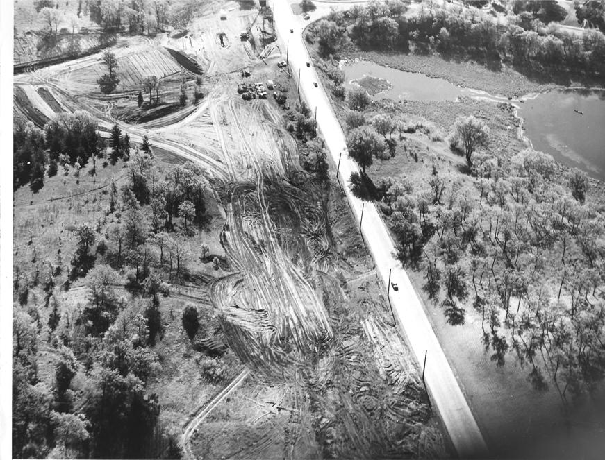
Highway 12 and Glenwood (Wirth) Parkway, 1949 (MPRB)
The second photo, also labelled as being shot in 1949, shows the progression in road building. Today’s I-394 is, of course, much wider than the four lane highway shown here. The wetland at the north end of Brownie Lake has also been filled in.

Highway 12 expands and eats into Wirth Park, 1949 (Minneapolis Star Journal, Minnesota Historical Society)
Expansion of Highway 12 into I-394 eventually took more of the parks. On the other side of the ledger, however, the wide swath of railroads in the upper third of the photo have been converted partly into bicycle trails.
David C. Smith
A Thank You Note from John J. Pershing
Filed under: Minneapolis parks | Tags: General John J. Pershing, Pershing Park
Comments (1) After the park board named a new park and playground in southwest Minneapolis, Pershing Field, December 5, 1922, it received a thank you note from the man it was named for—Gen. John J. Pershing.
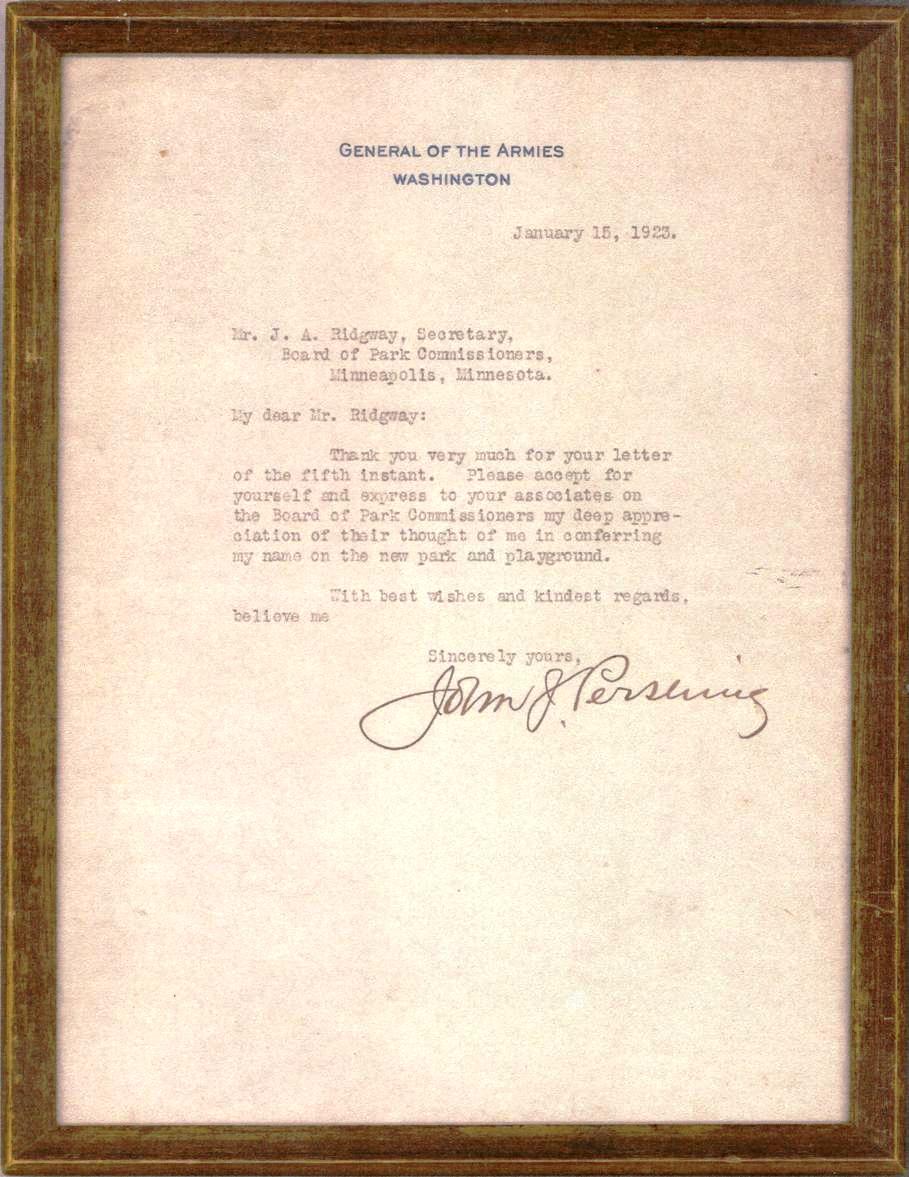
A thank-you note from General John J. Pershing to the park board for naming Pershing Field for him. (Minneapolis Park and Recreation Board)
I have a low resolution photocopy of the letter, which is in the display case in the commissioners room at park board headquarters, and I sent a scan of it to the two people who were the first to answer a question I posed in a posting earlier this week. But it’s so cool I thought everyone should see it.
One of the people I sent it to, Don Lehnhoff, provided this additional information on the letter—which makes it even cooler.
Thanks, Dave. That is very cool. I couldn’t help noticing the letterhead and, having once been an Army draftee myself, was trying to remember the significance. I was thinking of “General of the Army” (singular) which is a 5-star general … I believe there’s only one of those at any given time, and usually only during wartime. If Wikipedia is to be trusted, the Pershing rank of “General of the Armies” has only been conferred twice in history:
“Pershing is the only person to be promoted in his own lifetime to the highest rank ever held in the United States Army—General of the Armies (a retroactive Congressional edict passed in 1976 promoted George Washington to the same rank but with higher seniority.)” Pershing holds the first United States officer service number (O-1).
That’s pretty serious stuff, and puts him in pretty rarefied company … Pershing and G. Washington. Any way … many thanks for sharing that.
Thank you, Don.
David C. Smith
Lost Minneapolis Parks: Kenwood Triangle Photo Found
Filed under: Kenwood Park, Lost Minneapolis Parks, Minneapolis parks | Tags: Kenwood Park, Kenwood Triangle, Phelps Wyman
Comments (3) In a striking bit of good fortune, I found myself on an airplane last week with Rick Berglund. When Rick told me where he lived, I asked if he had ever seen a picture of Kenwood Triangle, which I had described in Lost Minneapolis Parks: Part II a few weeks ago. The triangle at the intersection of Penn and Oliver avenues next to Kenwood Park was paved over when Franklin Avenue was diverted slightly north in 1981 after Kenwood School was expanded. Rick told me that an old photo of his home included a view of Kenwood Triangle. He has generously shared a copy of the photo, which was taken in 1919.

Kenwood Triangle at the intersection of Penn and Oliver at Franklin next to Kenwood Park. (Lee Brothers, Rick Berglund.)
It was obviously not a triangle in which the park board invested much time, money or creativity. The overhead wire in the photo was likely for the trolley.
The most interesting revelation from my talk with Rick, however, was that he also has the original landscape designs for his property. The designs were created by Phelps Wyman in 1911. It must have been one of his earliest landscapes in Minneapolis. Wyman was the celebrated designer of Thomas Lowry Park and a Minneapolis park commissioner 1917-1924. (See also his marvelous, never-used plans for the Lyndale-Hennepin Bottleneck, Washburn Fair Oaks and Victory Memorial Drive.)
I suspect that many other photos of Minneapolis landmarks are stored away in files, vaults and boxes around town. If you have some, make copies and send them to us. We’ll post them here with attribution and any details you can provide.
David C. Smith
Let’s Tell Stories: Longfellow House, Sunday, July 22
Filed under: Minneapolis parks, Minnehaha Falls | Tags: Longfellow House, Minnehaha Park
Leave a comment The park board is turning back the clock at Minnehaha Park, Sunday, July 22 to have some fun with the way things used to be. As a part of the yesteryear theme, I’ll be at the Longfellow House 1-4 p.m to talk about the history of the park and sign copies of City of Parks. I believe the book will be for sale, too.
At 2:30 pm I’ll give a short presentation about the history of Minnehaha Park. I’ll tell you why Minneapolis asked the state legislature in 1885 for 1,000 acres in the vicinity of the park — and why the legislature only approved 200 — and didn’t pay for it anyway.
Please come by and introduce yourself.
David C. Smith
Minneapolis speedskating: Bearcat 8mm film from 1950s
Filed under: Minneapolis parks, Winter Sports | Tags: Powderhorn Park, Speed Skating
Comments (4) Adam Martin has posted some fun 8mm film footage of the Bearcat American Legion Post speedskating team in Minneapolis from the 1950s on youtube.

Bearcat American Legion Skating Team. Appears to have been taken at Powderhorn Park. (Adam Martin)
Adam’s father—John—and uncles—Jim, Tom and Michael—skated for the Bearcat team, as he related in a recent comment on my first speedskating post.
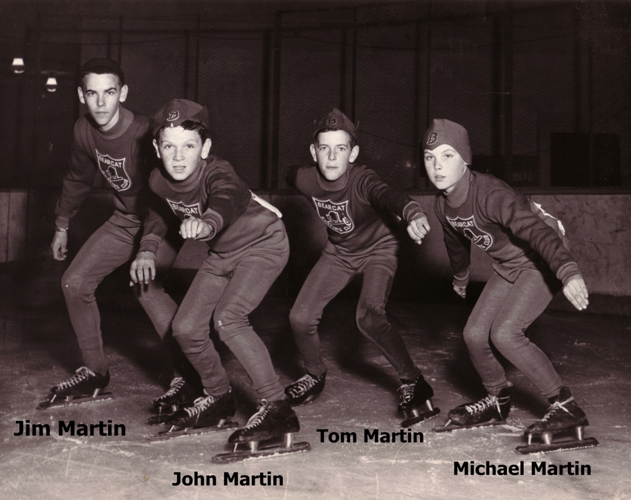
The Martin brothers who skated for the Bearcat team in mid-1950s. (Adam Martin)
Have a look at that post as well as others on speedskating, then click this link (or the youtube.com link in Adam’s comment): http://www.youtube.com/watch?v=c8ewShuJeEo
The first clips were shot at Powderhorn, I believe, but I don’t recognize where the clips at the end were from. Can anyone identify the other rinks featured — or tell us anything else about the clips Adam has provided?
Thanks, Adam.
David C. Smith
P.S. I just heard from Adam that his uncle identified the last clips as being shot in Winnipeg.
Toros Ready For Work
Bob Wolff from Toro provided three great old photos of Toro products at work in Minneapolis parks. (See previous stories here and here.)
The first two are tractors from 1939 on East Nokomis Parkway.

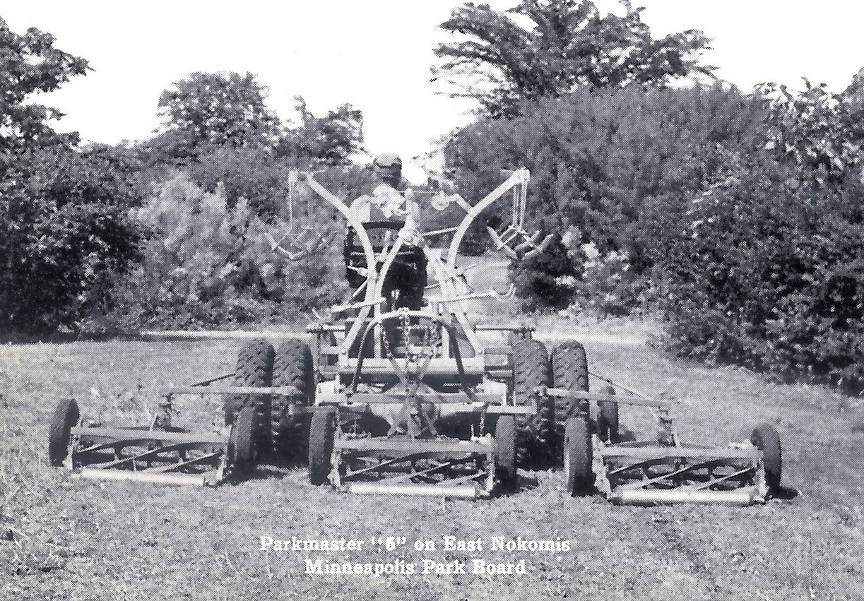
(Courtesy The Toro Company archives)
But best of all is this fleet of power reel mowers circa 1930. I love this picture. Can anybody identify any of the maintenance people in the photo? Every man wears a hat.
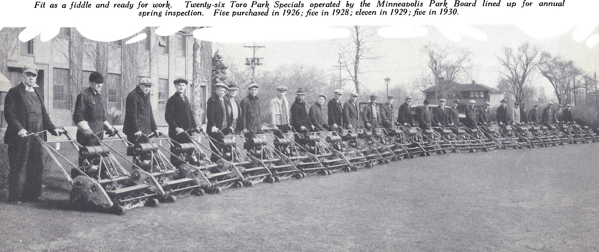
(Courtesy The Toro Company archives.)
Thanks, Bob
David C. Smith
The True Story of Sibley Triangle, by Robin Russell
Filed under: Minneapolis parks | Tags: Minneapolis parks, Northeast Minneapolis, Robin Russell, Sibley Triangle
Comments (3) I started tending this garden in 2006, but really took it on in 2007. In 2007, I was living in St. Anthony East neighborhood, and I lost my home to foreclosure. I didn’t want to leave my perennials behind, so I moved them to the triangle. In this same time period, another house in the neighborhood was demolished after a fire, and I was disappointed to learn that when that happens, any perennials or shrubs are ripped out, too. In 2007-2008 time period a lot of houses were being razed on primarily the North Side, so I got hold of the list of properties to be razed and went ‘plant rescuing’ before the bulldozers got in. I remember one afternoon it seemed like me and the bulldozers racing around the streets together! For awhile I kept a blog of my ‘guerrilla gardens’ (haven’t been able to keep up with it that past two seasons) and for the purposes of that blog, I dubbed Sibley Triangle “Foreclosure Park.” There are a number of really great specimens in the garden that I got from these rescue trips. Especially the ‘Hope for Humanity” rose. Well, maybe it’s not that variety, but I don’t want to hear about it. I like thinking it’s a Hope for Humanity. It seems fitting.
Before I took over the park, it had been abandoned for quite some time. Before that, St. Anthony East had a neighborhood garden group that installed the granite pavers and built the raised bed. The indigo baptisia is the plant that remains from this group. Water had been provided by ‘Phil,” a nearby homeowner, but after he either passed away or moved away, and there was no easy water access, the park was no longer cared for by this group. This is why I am such a pusher and shaker when it comes to making sure we continue to have affordable water for this space. Downtown in the water permits department I have been referred to as “the particular woman with the particular garden!” LOL. I am copying Kathy Kittelson on this e-mail as she was part of the aforementioned gardening group and she may have pictures.
I was told that when Our Lady of Lourdes parochial school was across the street from the Triangle (where the public housing building is now), that the Triangle had marble pits where the kids (probably boys) played marbles. I was told that if I kept digging, sooner or later I would find marbles, and in fact I have two that I have found there! If there is a way to get pictures of Our Lady of Lourdes School, maybe there would be pictures of the Triangle there. That would be a fun research project.
It is such an honor to take care of this space. It is really cherished by the neighbors, and is a destination spot that people now walk to. I learned that one neighbor even referenced it as a neighborhood amenity to a new tenant in the area!
My blog is guerrillagardensne[dot]blogspot[dot]com
Robin Russell

Another view of Robin’s garden from my May 30 visit. David C. Smith
NOTE: Thanks so much, Robin, for telling the story and for taking care of a space that we all can enjoy.
Does anybody have any photos of Our Lady of Lourdes school—or know of any? Let me know where I could find them, or send them to me and I’ll post them here.
David C. Smith
More Park Mysteries
I haven’t been able to write much here for the last month, because I’ve been working on other writing projects. Gotta make a living! I have plans to write very soon on the politics of the purchase of Minnehaha Falls, the philosophy of landscape architect and park commissioner Phelps Wyman (I promised more long ago!), two more remarkable people who donated land to the Minneapolis park system, and the extraordinary Minneapolis park commissioner who, among other things, wrote a book that was plagiarized by martial artist Bruce Lee. I’ll also publish my list of “Lost Minneapolis Parks.”
Excellent stories all. And all still part of our city’s life.
Until I get to it…
Adrienne was the only minneapolisparkhistory reader to correctly name a park property shown on the 1897 map of Minneapolis that is no longer a park. She named Meeker Island—an excellent find. Now she is enjoying a free subscription to minneapolisparkhistory.com.
The other two park properties depicted as parks in 1897 that are no longer were Hennepin Avenue South from Loring Park to 31st Street and Lyndale Avenue North from Western Avenue to Farview Park. Both were still parkways in 1897, but were turned over to the city in 1905 when it became evident that they would always carry too much traffic to be the parkways the park board had envisioned.
That was a tough question because the green in those parkways is a little hard to see on the map.
So I’ll give you three new questions, all based on photos.
Name the three park properties from which the following photos were taken. MPRB employees are eligible to win, too! All photos were taken May 30, 2012.
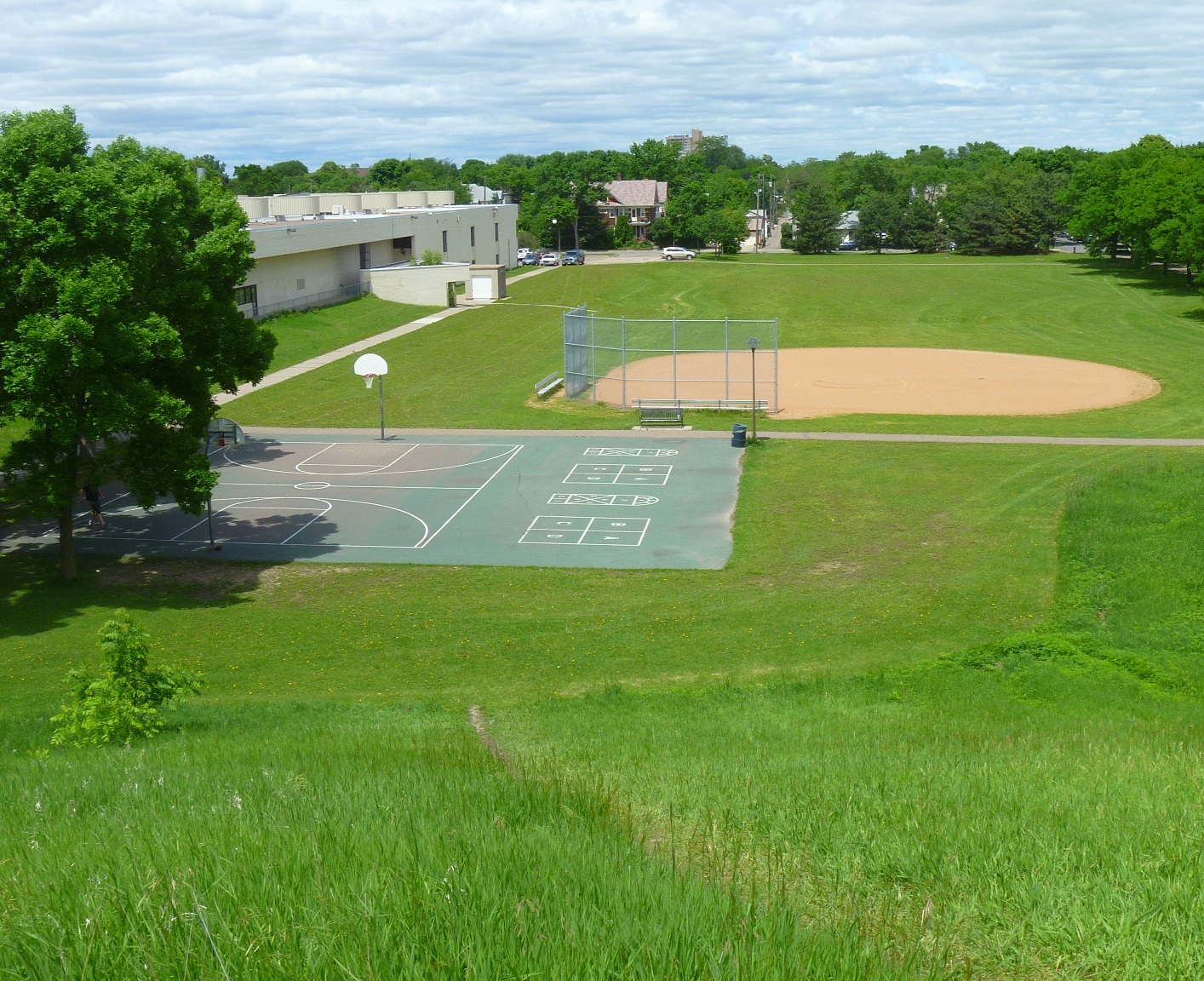
Bonus question: Where did all the dirt come from to make this hill?
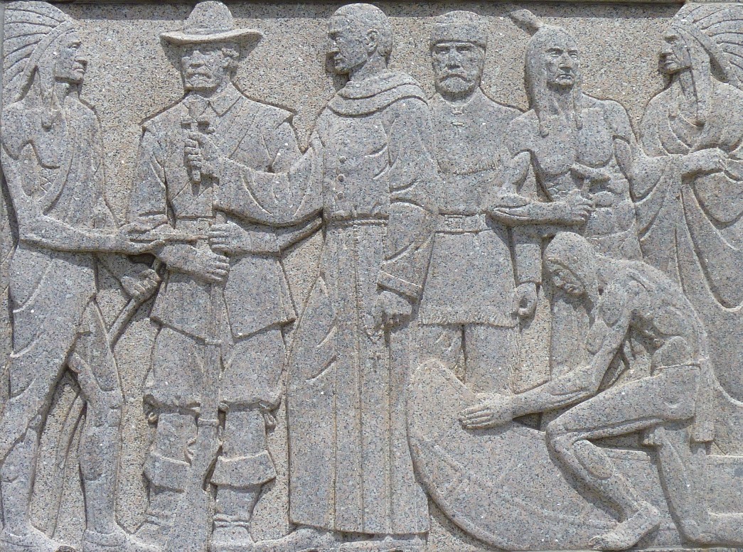
It’s not completely clear who the priest hopes to “save” here.

One of the best skyline views of Minneapolis.
Usual great prize of free subscription to minneapolisparkhistory.com for the first correct answers.
David C. Smith
Sibley Triangle in Full Bloom
Filed under: Minneapolis parks | Tags: Northeast Minneapolis, Sibley Triangle
Comments (4) Last fall I apologized to Robin Russell, the volunteer park steward who maintains the lovely Sibley Triangle in Northeast Minneapolis, for not getting a picture of her superb work. This is to make amends. These photos were taken on May 30 after a week of rain. Beautiful.

Sibley Triangle, May 30, 2012. Washington St. NE is on the right, 5th St. NE on the left.

Sibley Triangle from the east (Washington St. NE).
I’d love to hear from Robin and park stewards who beautify other parts of our park system. Tell us the story of your garden—and send photos.
David C. Smith
NOTE: Please see “Comments” for information on other gardens.
Bombers Over Lake Nokomis
Filed under: Minneapolis Golf Courses, Minneapolis Lakes, Minneapolis parks | Tags: Hiawatha Golf Course, Lake Hiawatha, Lake Nokomis, Wold Chamberlain Field
Comments (2) My favorite photo of Lake Nokomis was taken in 1932. The true subject of the photo was a squadron of Martin bombers visiting Wold-Chamberlain Field from Langley Field, Virginia, but beneath them is a fascinating scene of park developments.

The Martin Bomber was the first American airplane built specifically to carry bombs. First built during WWI, the biplane version of the bomber was replaced by a monoplane version designed in 1932. (Minnesota Historical Society)
The photographer isn’t listed in the Minnesota Historical Society’s database, but it may have been taken by J. E. Quigley Aerial Photography. Quigley produced most of the other aerial photos of Minneapolis from that era.
The bare ground at the left wingtip of the middle plane is the Hiawatha Golf Course under construction. The course didn’t open until 1934. Dredging in Lake Hiawatha had just been completed in 1931.
It doesn’t show up well at this size, but the Nokomis Beach is packed (beneath the front airplane). You can see the diving towers in the lake.
Also note how barren the Nokomis lakeshore is. It had been created from lake dredgings only 15 years earlier.
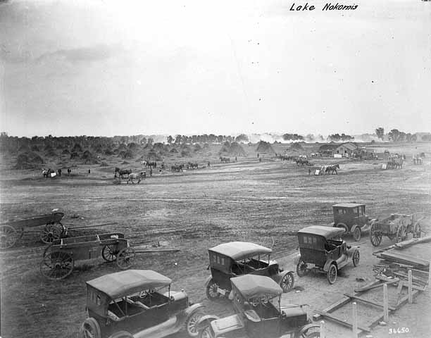
Four years after dredging was completed at Lake Nokomis and the dredge fill had settled, the park board cleared and graded the land. (Minneapolis Park and Recreation Board)
The dredge fill settled for four years before it was cleared of brush and willows that had grown up in the intervening years and the land was graded for athletic fields. The huge piles of brush in the background were burned. Of course the land was graded by horse teams. Even with that much time for the dredge fill to settle before it was graded, the playing fields continued to settle and were re-graded in the 1930s as a WPA project.
Even after ten years of tree growth, the lake shore doesn’t look very shaded in the 1932 photo.
The Cedar Avenue Bridge at the bottom of the aerial photo was the subject of great debate at the park board, Minneapolis City Council, the Hennepin County Board and Village Council of Richfield in the 1910s. Park superintendent Theodore Wirth’s plan for the improvement of Lake Nokomis in the 1912 annual report included rerouting Cedar Avenue around the southwest corner of the lake to eliminate a “very unsightly” wooden bridge over the edge of lake at the time. Even though the park board owned all the shores of the lake and the lake bed, the south end of the lake was then in Richfield, which is why the county and Richfield were involved in decisions on the bridge. Despite the park board position that building a bridge would be more expensive and less attractive, it was built—and paid for with Minneapolis bond funds—partly due to opposition by Richfield landowners to plans to reroute Cedar. By 1926 that line of opposition would have been partially removed when Minneapolis annexed about a mile-wide strip of Richfield that placed all of Lake Nokomis inside Minneapolis city limits.
David C. Smith
An Early Toro
Filed under: Minneapolis parks | Tags: Longfellow Field, Minneapolis Steel and Machinery Company, The Toro Company
Comments (1) I was just culling some old photo files and found a copy of an ad from Parks and Recreation magazine in 1921. I had clipped it thinking one day I might find a use for it. Well I already wrote the post I should have put it in — Longfellow Field — about the connection between Minneapolis Steel and Machinery Company and Toro and Toro’s shift from tractor engines to lawn care products. This must be one of the company’s earlier lawn mowers.
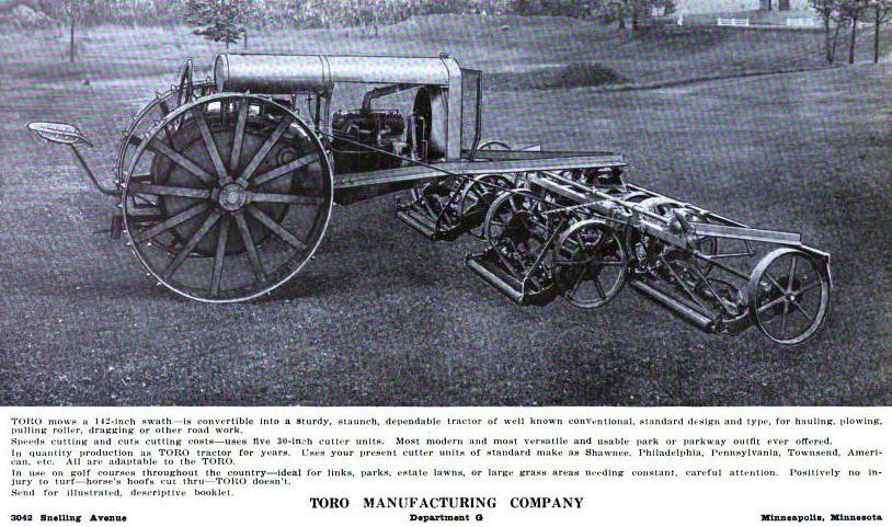
Toro was already selling lawn care tractors by 1921. (Parks and Recreation.)
But I forgot I had this image, so a month after it should have debuted, here it is. My favorite line in the ad copy is “Positively no injury to turf—horses hoofs cut through—Toro doesn’t.” Although those spikes on the big rear wheels look a bit destructive. Doesn’t offer all the modern-day comforts, does it?
Thanks again to Toro for contributing to improved baseball fields in Minneapolis parks.
David C. Smith
Note: Thanks to Bob Wolff for more history on The Toro Company, posted as a comment on David C. Smith page. Looking more closely at digitized Parks and Recreation magazines to respond to Bob, I discovered that the ad above appeared in 1921, not 1919 as I had originally posted.