Horace W. S. Cleveland’s Real Estate: Pleasant Avenue and West 44th Street
Filed under: Landscape Architects, Minneapolis parks | Tags: Frederick Law Olmsted, H.W.S. Cleveland, Horace Cleveland
 Comments (3)
 In a fascinating and sad letter to Frederick Law Olmsted, dated February 23, 1892, Horace W. S. Cleveland proposed that the two collaborate as writers on “professional themes.” (Frederick Law Olmsted Papers, Library of Congress.) Cleveland mentions that Olmsted had written in “complimentary terms” of Cleveland’s writing style and that Olmsted had also noted his own desire to write more, which was frustrated by many demands on his time and energy. (At the time, Olmsted was overseeing preparation for the grounds at Chicago’s Columbian Exposition and was about to take a six-month trip to Europe, in part, to regain his health.)
“Often the thought has come to me,” Cleveland explained, “that if I could join forces with you, we might together produce something that would be essentially serviceable to the public and your name would suffice to summon an audience who would not listen to me.”
Cleveland explained that his motive was primarily to make money.
“I have been able to do but little more than keep even with my expenses, but thank God I have done that and am entirely clear of debt, and own some real estate which I hope to dispose of whenever a new demand arises, and may be worth two or three thousand dollars. You perceive that in this situation it is impossible for me to fold my hands and wait the course of events. I am constantly trying to devise means to stave off the necessity of becoming dependent on others.”
There is no record of Olmsted’s response to Cleveland’s proposal, nor any evidence that the men ever did attempt to write anything together. The health of both men deteriorated rapidly over the next couple years. Witold Rybczynski in his biography of Olmsted, A Clearing in the Distance, notes that Olmsted was managing to save about $1,000 a year at the time.
The real estate Cleveland referred to was likely the two half-blocks of land northwest of the intersection of West 44th Street and Pleasant Avenue in south Minneapolis.

H. W. S. Cleveland is listed as the owner of 4.7 acres on West 44th Street between Pleasant and Harriet in the upper left corner of this section of an 1892 plat map of Minneapolis. (John R. Borchert Map Library, University of Minnesota. Go to http://map.lib.umn.edu/collections/digitizedplatbooks/minn1892index.htm for the complete map.)
If you know anyone who lives in the southern halves of the 4300 blocks of Pleasant, Grand and Harriet, they live on land once owned by one of the most important people in the history of Minneapolis.
The Washburn Park neighborhood at the bottom of the map above, often called “Tangletown,” was laid out by Cleveland.
David C. Smith
The Big Bowl: Seven Oaks Oval
It’s a steep descent into Minneapolis’s cheapest park, more than twenty-five feet down from the street. And it contains no river or creek bed; at least there’s no water in it anymore. It’s a huge bowl full of wild greenery one block west of West River Parkway and East 34th Street. There are many little parks in Minneapolis that no one but neighbors really knows about, like the triangles I wrote about earlier this summer. But this park covers more than two acres, more than half the size of a typical city block. And the only evidence that the park board has ever spent a penny on the interior of the park is the dreaded orange paint ring around the tree trunk in the picture: a park board forester has been here. Someone is watching.

Seven Oaks Oval: The cheapest park in Minneapolis, twenty-five feet below street grade
Seven Oaks Oval has to be the cheapest park in the city measured by the cost-per-acre to acquire and maintain the property during its life as a park. Seven Oaks Oval officially became a park in 1922, at least that’s when the park board accepted the property as a park. Park board proceedings claim it was platted as a park in the original plat of Seven Oaks River Lots in 1913, but that plat already shows up with a park in the middle on the 1903 plat map of the city. Regardless, it cost the park board nothing to acquire.
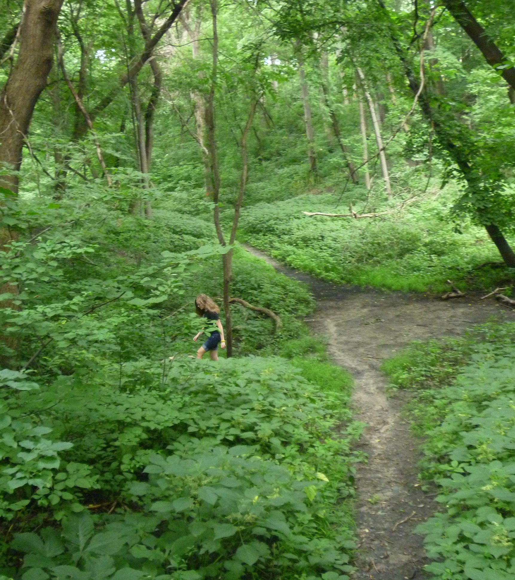
A young woman, maybe a phantom, darted through the green and disappeared.
The year the park was acquired, 1922, was such a busy one at the Minneapolis park board that the acquisition wasn’t even mentioned in the park board’s annual report for the year. Park superintendent Theodore Wirth included a modest plan for the park in the 1928 annual report, a few criss-crossing paths and two campfire sites for the Boy Scouts and Campfire Girls, but nothing ever came of it. Perhaps the park board placed the boulders in a small bit of grass border around the bowl, but what they cost to place there might have been the only money ever spent on the park beyond mowing the thin fringe of grass beside the curb.
It seems a place to exercise the imagination, a kind of spooky hideaway, the kind of I-dare-you place kids tell their visiting cousins scary stories about. When I visited, old branches had been stacked to form a crude shelter halfway down the hill, a pirate’s lair or the shelter of a shipwrecked sailor. I’m sure once inside that one would hear lions or tigers sniffing about the entrance. Perhaps someone who lived in the neighborhood can provide an account of the odd park. I’d love to know more. If any geologist out there could explain this topographical oddity to me, I’d also appreciate that.
Odd Shapes
What I know for sure is that Seven Oaks Oval is one of only two park properties named for shapes that don’t have angles. The other is Caleb Dorr Circle on the east end of the Franklin Avenue Bridge. Ironically, Caleb Dorr Circle has for many years actually been a triangle. There used to be other ovals and circles, but they’ve been lost to streets and traffic.
By my last count there are 33 “triangles” and 7 “squares” remaining in the Minneapolis park system. The squares are nearly evenly distributed throughout the city. How many can you name?
David C. Smith
Yes, there was a Clarence Triangle.
Filed under: Minneapolis Park Memory, Minneapolis parks | Tags: Clarence Triangle
Leave a Comment I just received this note from a reader who remembers Clarence Triangle in Prospect Park, which I wrote about recently. Thanks for the story.
Oh, there was a triangle there! I lived at 79 Bedford, across the street from the Triangle, at the foot of the hill that is Clarence. My parents bought the house in 1948, and sold it in 1975. Some time later, Dutch elm took most of the trees on Bedford, and they took out the curve at Bedford and Orlin (NOT an improvement in my opinion). I suspect when they modified the street, that is when they took out the triangle. I am guessing the late 1980’s?
It was a wonderful neighborhood to grow up in! As kids, we’d look out our living room window when it snowed, and watch the cars try to make it up the Clarence hill. They usually would, unless they met a car going downhill that would not move aside :) Cars were rear wheel drive then.
Lloyd Mann
Large Stone Fireplace in Minnehaha Dog Park?
Filed under: Minneapolis parks, Minnehaha Falls | Tags: Minnehaha Dog Park, Minnehaha Falls
Comments (7) Mary MacDonald recently wrote to ask for info on the large stone fireplace near the long path to the Mississippi River in the Minnehaha Dog Park off 54th and Hiawatha. She said she’s been unable to find any info on who built it and how old it is. Does anyone know? I don’t know anything about it. Leave a comment or e-mail me at the address below.
David C. Smith
Maybe it’s time for Puck to have a sniff.

Puck
Pioneering Minneapolis Landscape Architects: Wyman, Morell and Nichols, but not Wirth?
Filed under: Grand Rounds, Landscape Architects, Victory Memorial Drive | Tags: Anthony Morell, Arthur Nichols, Phelps Wyman, Theodore Wirth, Victory Memorial Drive, Warren Manning
Comments (4) I’ve been surprised at the interest generated by posts here about landscape architects who worked on Minneapolis parks, so I’ll add the latest info I have on a few landscape architects.
I once compiled a list of all the park designs and plans published in the annual reports of the Minneapolis Board of Park Commissioners for the first 60 years of its existence, 1883-1943. For the most part, that means the plans of Horace W. S. Cleveland, who designed the first Minneapolis parks, and Theodore Wirth, who was superintendent of parks 1906-1935.
From the time Cleveland stopped working, about 1893, until Wirth was hired in 1906, the Minneapolis park board did not have a landscape architect — nor the money to pay one following a severe economic downturn — except for hiring Warren H. Manning for various projects from 1899 to 1905. No Manning plans for Minneapolis parks have survived, although his in-depth written recommendations for Minneapolis parks were published in the 1899 Annual Report of the Minneapolis park board. More on Manning in a later post.
While Wirth was superintendent, he prepared nearly all park plans himself, although I believe he identified himself more as a gardener and engineer than a landscape architect. He listed himself as “Sup’t.” on most of his park plans until 1926 when he added “Eng’r.” He was an early and active member of the American Institute of Park Executives, but did not, to my knowledge, join the American Society of Landscape Architects. Wirth was not included in Pioneers of American Landscape Design, a compilation by Charles Birnbaum and Robin Karson of Americans who influenced the nation’s landscape. I think that is an oversight.
While Wirth gets too much credit from some in Minneapolis for creating the city’s park system, his omission from a list of more than 160 prominent landscape designers in the United States probably gives him too little credit for shaping one of the nation’s premier urban park systems.
Wirth’s omission from the “pioneers” list is more striking because three landscape architects who practiced in Minneapolis while Wirth was parks chief were profiled as pioneers: Anthony Urbanski Morell, Arthur Richardson Nichols and Phelps Wyman. I don’t believe it could be argued that any of the three had nearly as great an impact on the landscape of Minneapolis — and perhaps urban parks in general — as Wirth did, although they all worked in other locations as well.
I have already written about Wyman, but would like to add notes on Morell and Nichols’s involvement with Minneapolis parks and update info on Wyman.
Morell and Nichols
Morell and Nichols became partners in 1909 and relocated to Minneapolis to take advantage of connections they had made in Minnesota while working for a New York landscape architect on projects in Duluth — the Congdon Mansion and the Morgan Park neighborhood — according to Pioneers of American Landscape Design. Their names first appeared in Minneapolis park board documents in the park board’s annual report of 1910. They are cited as the creators of a design for Farwell Park in North Minneapolis for the David C. Bell Investment Company, one of the city’s most prominent real estate developers. The 1.2-acre park was platted in the Oak Park (not Oak Lake) Supplement in 1889, but it wasn’t until 1910 that the developer asked the park board to take control of the land and improve it as a park using a plan the developer provided. The plan itself was not unusual, but it was the first landscape plan to appear in an annual report that had not been commissioned by the park board. That Wirth chose to publish the plan in the annual report suggests his regard for Morell and Nichols. Wirth encouraged park commissioners to approve the plan, which they did. Wirth wrote in the 1910 annual report:
The proposed arrangement of lawns, plantings and walks, is very pleasing and appropriate to the surroundings and the present topography of the grounds, and the execution of the plan will not involve a very large expenditure.
Improvements to the park were begun in 1911 and completed in 1912. The Bell company originally paid for the work, but was reimbursed by the park board.
Regional Parks
The other references to Morell and Nichols in park board annual reports were in the 1930 and 1935 reports in connection with their work for Hennepin County, which includes Minneapolis, when they prepared a preliminary study for a county-wide park system in 1922 . Theodore Wirth referred to their plan in the 1930 annual report in his yearly words of encouragement for the Minneapolis park board to lead the effort to create a regional park authority. Wirth advocated including Minnehaha Creek, Bassett’s Creek and Shingle Creek, from their sources in Hennepin County lakes to the Mississippi River in Minneapolis, in a regional park system. In the 1930 report, Wirth included a map of the territory embracing the sources of Shingle Creek and Bassett’s Creek and highlighted park areas recommended by Morell and Nichols in their earlier report. Among the areas they had suggested for parks in northwest Hennepin County were portions of the shores of Medicine Lake, Bass Lake, Eagle Lake, Lime Lake, and all of Sweeney Lake adjacent to Glenwood Park. The map legend indicated that Robbinsdale planned to preserve the entire shorelines of Twin Lakes and Crystal Lake as parkland as well. Too bad that didn’t happen.
Five years later, in the 1935 annual report, Wirth’s last as park superintendent, he published his own “Tentative Study Plan” for a park district for the west metropolitan region. Wirth had been directed by the park board in February 1935 to undertake the study in hopes that the board could apply for federal work relief funds to begin to implement a metropolitan park plan. Although funds were not forthcoming for that project, the idea of a county park system eventually led to the creation of what is today the Three Rivers Park District.
Wirth submitted his report to the board in November 1935 and it was published in its entirety in that year’s annual report. Wirth noted that his plan had been created in collaboration with Arthur Nichols, who was then the consulting landscape architect to the Minnesota Highway Department. Wirth wrote that he and Nichols had spent one afternoon a week for two months touring possible park and parkway sites in suburban and rural Hennepin County and had completed their research with aerial reconnaissance of prospective parks.
These two events in which Morell and Nichols worked with Wirth on park design don’t tell us much about their practice, except that they seemed to have an effective working relationship with Wirth and were well-known to him and other decision makers, from developers to county commissioners. Phelps Wyman also knew Morell and Nichols. Morell was a consultant to the Minneapolis Planning Commission on which Wyman sat as the representative of the park board in the early 1920s. Wyman and Nichols had worked together for the US Housing Corporation in Washington, D.C. during the Great War. Moreover Nichols had been the first graduate in 1902 of MIT’s landscape architecture program, which Wyman completed a few years later. Having attended the same educational institution at a time when few academic programs in landscape architecture existed would have likely created some bond between them.
Phelps Wyman and Victory Memorial Drive
Of the three “pioneers” in landscape design, Wyman had by far the most input on park landscape architecture in Minneapolis due to his service as an elected park commissioner 1917-1924. In an earlier post I noted Wyman’s design of what is now Thomas Lowry Park, his proposed plan for Washburn Fair Oaks, and his suggestion of a traffic circle to relieve congestion at the Hennepin and Lyndale Avenue bottleneck. What I overlooked in that post was perhaps Wyman’s most creative park design, which Wirth included in the park board’s annual report of 1929 even though the plan had been created eight years earlier. (Phelps resigned from the park board and moved to Milwaukee in 1924, one reason I didn’t consider looking for Wyman’s influence on park designs in documents from the late 1920s.)
In the 1929 annual report Wirth included Wyman’s “Preliminary Sketch of Victory Memorial Drive” from 1921 to illustrate the need for grade separations between parkways and city streets in some locations. In Wyman’s sketch, Broadway Avenue West tunneled under a large plaza at the intersection of Victory Memorial Drive and Lowry Avenue North. Wirth provided no explanation of why Wyman created his “decorative scheme” for the parkway, but it is a fascinating design.

Phelps Wyman’s design for Victory Memorial Drive, 1921 (1929 Annual Report, Minneapolis Board of Park Commissioners)
Among Wyman’s more interesting ideas — in addition to putting Broadway underneath an extensive plaza:
- Three plazas would have anchored the drive: one at Camden (Webber) Park was labelled “America Mobilized,” the monument plaza and flag pole at the northwest corner of the drive was titled “Humanity,” and the Lowry Avenue Plaza was called “America at Peace.”
- Another plaza, “Freedom of Seas”, would have connected Victory Memorial Drive to Crystal Lake between 39th and 40th avenues north. The only connection I can imagine between a stretch of land along a Robbinsdale lake and a “Freedom of Seas” park is the sinking of the Lusitania, an important factor in the U.S. entry into WWI and the resulting dead young men and women who were honored along Victory Memorial Drive.
- The west side of Victory Memorial Drive from Lowry Avenue to 45th would have been reserved for “Public Institutions.”
David C. Smith
© David C. Smith
More Flying Merkel v. Horse: Depreciation
Filed under: Lake Harriet, Minneapolis Parks: General | Tags: Flying Merkel, Lake Harriet
Comments (1) Another element in the debate over whether a motorcycle or a horse is a more efficient means of conveyance for park police officers, which I introduced last week in a post about Flying Merkels, is the depreciation of each. I was forced to consider that by an entry in the Proceedings of the Minneapolis Board of Park Commissioners for February 5, 1919.
 In January of that year a hired horse pulling an ice scraper over the ice skating rink on Lake Harriet had plunged through the ice and drowned. The owner of the horse submitted a bill for $125 to the park board to compensate him for the loss, which the park board paid. But knowing that in 1911 a Flying Merkel had cost the park board $238.50, I wondered if the horse was maybe old and worn out. $125 doesn’t seem like much for a horse; the price must have reflected considerable depreciation. What would a used Flying Merkel have been worth? And were there children skating on the lake the day the horse broke through the ice? Did the ice crack like a pistol shot or simply submerge with a gurgle. Did the horse make a sound or did it confront death with equine-imity? The Flying Merkel would have sunk quickly and quietly—but wouldn’t have been worth a damn pulling an ice scraper.
David C. Smith
Linking the Lakes: Making Minneapolis the Venice of North America
Filed under: Minneapolis parks | Tags: Lake Calhoun, Lake of the Isles
Leave a Comment Happy Belated Centennial! Yesterday was the hundredth birthday of the channel that links Lake of the Isles with Lake Calhoun. It was the first of the navigable lake connections that later extended to Cedar Lake and Brownie Lake. Some background on those lake connections was featured in an earlier post on Lake Calhoun and Lake Harriet.
The “Linking of the Lakes” was turned into a civic celebration that lasted nearly a week. The event was conceived and planned by the Minneapolis Publicity Club. The idea for a civic celebration was apparently hatched in November 1910 at the Minneapolis Harvest Dinner, a more modest one-evening event. While the central event of the civic celebration was the linking of the lakes, it appears to have been pretense for a party.
“It is argued by the business men that in no better way can the city merchant get in more personal touch with his country customers than through the Civic celebration when, under the spirit of merrymaking and jollity, they come together.”
Minneapolis Morning Tribune, July 2, 1911
The park board knew exactly what the intent was when it passed a resolution on December 5, 1910 that “irrespective of the benefits which may accrue to the city through such a celebration, the occasion is of such peculiar interest and significance to this board, that every effort should be made to do its full part…”
The construction of a channel between Lake Calhoun and Lake of the Isles was not a particularly challenging or imaginative endeavor. As noted in the earlier post, the project had been considered for many years and treated as a done deal as early as 1899 by landscape architect Warren Manning in his recommendations for the Minneapolis park system. In engineering terms it was simpler than the dredging that had been going on for years at Lake of the Isles, both in the 1880s and 1900s. The only construction needed for the project were bridges over the excavated channel, which were not more challenging to plan and build than bridges elsewhere in the city — although the park board’s 1909 annual report included the admission that bridge construction estimates were 50 to 100 percent over budget.
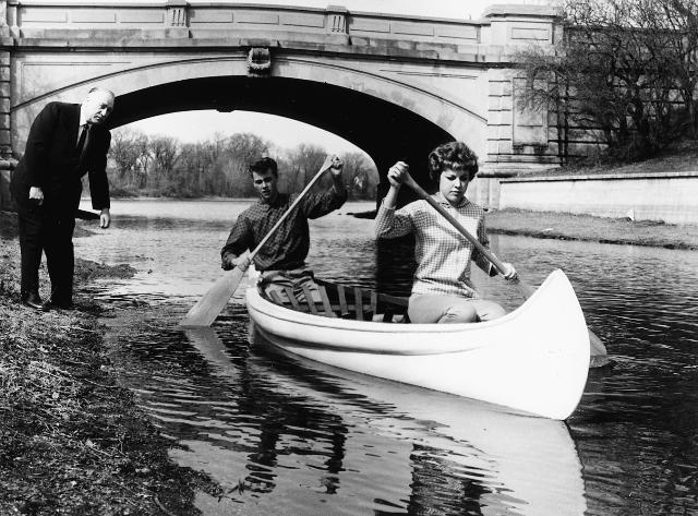
Park superintendent Howard Moore helps launch a canoe in 1960 to celebrate navigable water once again after a few years of a dry channel between Lake of the Isles and Lake Calhoun. (Minneapolis Park and Recreation Board)
Even the design competition for bridges, with a top prize of $800, had been disappointing. Park Superintendent Theodore Wirth wrote in the 1909 annual report, “With a few exceptions the designs submitted were not of the high-class character which it was thought the competition would bring forth.” The third prize was not even awarded. To make matters worse, the bridge over the channel from Lake of the Isles to Cedar Lake had to be partially torn down and rebuilt because it began to settle as soon as it was built, which delayed the connection of Isles and Cedar.
The connection of Lake of the Isles to Cedar Lake was finally completed in 1913, and Cedar Lake was linked to Brownie Lake in 1917. That final connection made possible a new feat of municipal athletic endurance: the swimming of the Chain of Lakes. The Minneapolis Morning Tribune, August 8, 1918 reported the setting of a new record when Dan Bessessen, the new captain of the University of Minnesota swim team and a life guard at Lake Calhoun, swam from the north end of Brownie Lake (off Superior Avenue then) to Thomas Avenue on the southern shore of Lake Calhoun in one hour and thirty-eight minutes. The swim was supervised by Frank Berry, the park board’s recreation director, who accompanied Bessessen in a boat that also carried four time keepers.
Despite the $125,000 price tag to link Isles and Calhoun, the park board appeared not to be profligate with funds. When Wirth submitted plans and an estimate for a park board float for the water parade during the celebration, it was defeated by a vote of 10-1 even though the City of Minneapolis was spending $500 for a float. Another request from Wirth to spend $200 to buy evergreen trees to temporarily cover the “unsightly” railroad embankment adjacent to the lagoon during the celebration was defeated by a vote of 11-0.
I think it’s debatable if the “Linking of the Lakes” was even the park board’s biggest role in municipal or state history in the spring and summer of 1911. I’d give top billing to another event that the park board didn’t initiate, but went along with: the donation to the park board by Clinton Morrison of the land for an art museum. The result of that transaction was the eventual construction of the Minneapolis Institute of Arts in Dorilus Morrison Park.
I love the channels that connect the lakes, which Jesse Northrop said would make Minneapolis the “Venice of North America,” but I think the construction of what has become an excellent art museum, while it might not make Minneapolis the “Florence of North America,” is still of greater importance to our city today. Even without the channels between lakes Minneapolis was still blessed with exceptional natural attributes. The art museum filled an otherwise unmet need at the time, despite Thomas Barlow Walker’s incredible art collection.
David C. Smith
Prospect Park Garden Club wins Triangle Award; Orlin Triangle is smallest park.
Filed under: Bryn Mawr, Minneapolis parks, Prospect Park | Tags: Bryn Mawr, Elmwood Triangle, Laurel Triangle, Orlin Triangle, Prospect Park, Rollins Triangle
Comments (1) An update on the smallest park triangles:
The beautiful triangles in Prospect Park are maintained by the Prospect Park Garden Club. I learned that in the delightful backyard of Mary Alice Kopf last Saturday during the Annual Garden Walk and Plant Sale sponsored by the Prospect Park Garden Club. Nobody I talked to in Prospect Park knew, however, why some triangles were taken over by the park board and others weren’t. So if you know…
I am certain now that Orlin Triangle is the smallest of the street triangles in the Minneapolis park system.

Orlin Triangle in Prospect Park is the smallest park in Minneapolis.
The second smallest is Elmwood Triangle at Luverne and Elmwood just north of Minnehaha Creek near Nicollet. Basic grass and tree — and two dead end signs. Seems a bit ominous.
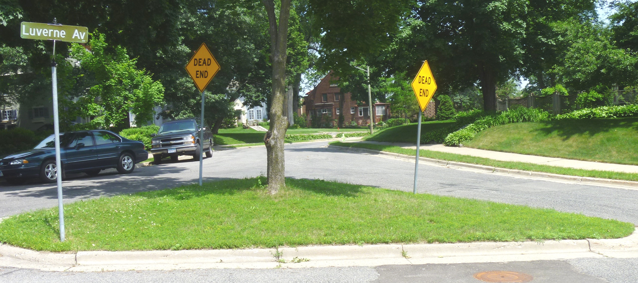
Elmwood Triangle, the second smallest park in Minneapolis, listed at 0.01 acre. Based on my rough measurements, bigger than Orlin Triangle.
The most attractive triangle park outside of Prospect Park is Laurel Triangle in Bryn Mawr. My next task is to find out who takes care of this park. Laurel Triangle was purchased by the park board for $700, most of which went to pay back taxes, in 1911, so it’s a little older park officially than the Prospect Park triangles.

Laurel Triangle, at Laurel and Cedar Lake Road, is beautiful too, in a wilder way than the Prospect Park triangles. So big it has two sidewalks and two stop signs. There’s a little stone bench next to the tree that I’d love to sit on with a cup of coffee.
Another of the smallest triangles is Rollins Triangle at Minnehaha and E. 33rd St. across from Peace Coffee. Quite a different environment on a busy thoroughfare and considerably larger than the smallest. Farther south, Adams Triangle on Minnehaha and 42nd, is one-third-acre, one of the larger triangles.

Rollins Triangle has a newspaper stand, a bus bench, vent pipes and a bit of a garden that’s overgrown. Definitely larger.
Most triangles are named for streets, but Rollins was named for the real estate development, Rollins Addition, in the neighborhood. It was taken over by the park board at the request of the city council in 1929 and officially named in 1931.
Someday soon I’ll visit the two remaining triangles listed at 0.01 acre in the park board’s inventory, Sibley and Oak Crest in northeast Minneapolis. But judging by their images on Google maps they are both larger than triangles shown here.
I purchased several plants for my yard at the Prospect Park Garden Sale at Pratt School. This whole business of planting triangles inspired me. And that was one objective of early park planners — to encourage us to replicate the pretty little public gardens on our own property.
David C. Smith
The Flying Merkel: Minneapolis Park Police Motorcycles
Filed under: Minneapolis Parks: General | Tags: Flying Merkel, Minneapolis Park Police
Comments (2) When the Minneapolis Board of Park Commissioners decided to purchase motorcycles they went with the best. On March 20, 1911 the park board approved the purchase of four “Flying Merkel” motorcycles. The specifications included “four horsepower with magneto and belt drive” at a cost of $238.50 each.

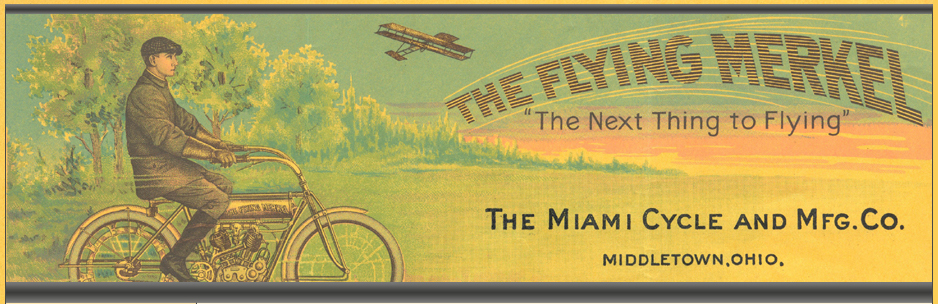
Almost like flying. This image is from theflyingmerkel.com, a web site loaded with info on one of the premier early motorcycles. Jos Ritzen, the administrator of the web site, reports that the image is from the company’s letterhead in 1912.
The Merkel Company was established in Milwaukee, Wisc. in 1902 by Joseph Merkel, a bicycle maker. His company was purchased by the Miami Cycle and Manufacturing Co. in 1911. An interesting history of the motorcycle is here, including the stories of Margaret Gast, early motorcycle racer and stunt driver, and Maldwyn Jones, a national champion racer who helped establish the Flying Merkel as a premiere speed machine. The Flying Merkel was apparently known for its bright orange color.

The 1911 Flying Merkel. The Minneapolis park board purchased four. (Photo auto.howstuffworks.com)
How did the park board use the Flying Merkels? We know the first recreation director, Clifford Booth, had used a motorcycle in previous years to speed from one playground to another, so he may have gotten one. Also in April 1910 the park board approved the purchase of a motorcycle or a horse — with a “recommendation” for the horse — for the park board’s forester. Perhaps the forester got the horse in 1910 and it was upgraded in 1911. But this photo from the 1912 annual report of the park board shows how at least two of the Flying Merkels were used.
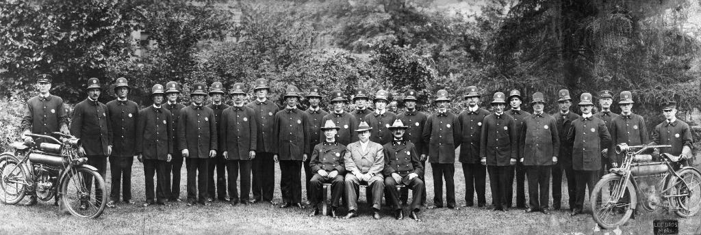
Minneapolis park police in the 1912 annual report of the Minneapolis Board of Park Commissioners. At least two “Flying Merkels” were used by the police. An independent park police force has often been cited as one reason for the great success of the Minneapolis park system. (Minneapolis Park and Recreation Board)
Park police chief Burton Kingsley, seated at the center of the photo, who later was elected as a park commissioner, asked to have the motorcycles replaced by horses. He argued that horses could be used in any weather, but motorcycles were useless in Minnesota for much of the year. He also claimed that police officers got more respect on horses. Perhaps orange wasn’t the best color for police work. But no horse could have had a cooler name.
Despite Kingsley’s preference for horses he reported that the police force logged 50,000 miles on their Flying Merkels in 1912. That’s a lot of oats.
David C. Smith
Did You Know? Tower Hill is not named for the “Witch’s Hat” tower.
Filed under: Minneapolis Parks: General | Tags: Prospect Park, Tower Hill Park, Witch's Hat
Comments (5) The park was named “Tower Hill” in 1909 four years before the water tower with the tall roof was built.
After purchasing the land for the park in 1906, the park board named the park “St. Anthony Heights.” Residents of the area petitioned the board to change the name to “Tower Hill,” which it did finally in 1909. The name was based on a long-gone observation tower built on the hill by an entrepreneur: for a dime anyone could climb the tower.
In the annual report for 1908 park superintendent Theodore Wirth presented his plan for improving the park, which included a suggestion to build an observation tower on what he called the “small plateau” at the center of the park. He continued: “This tower should be built of stone or steel and ought to be from 50 to 60 ft. high.” The park board never built that tower, but gave permission to the Minneapolis water department to build a water tower in the park in 1913 — the Witch’s Hat tower that still stands.
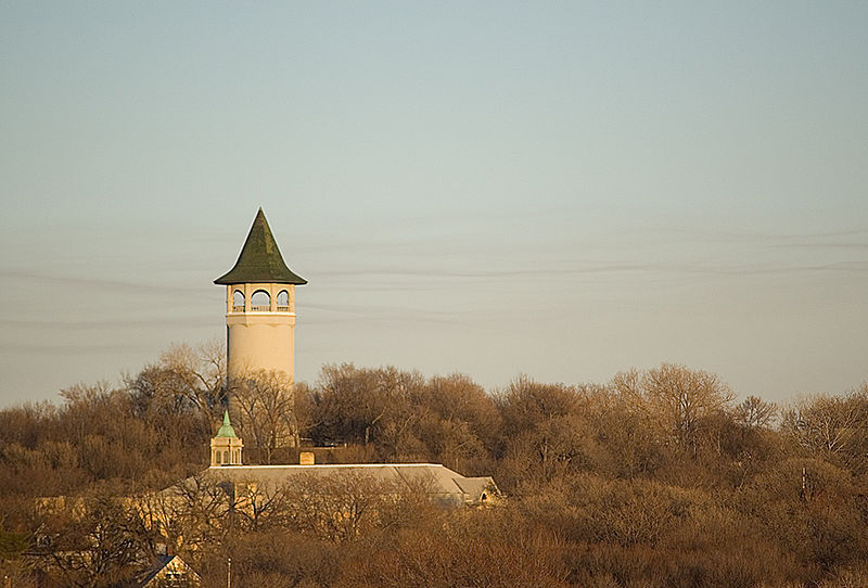
The Witch’s Hat photographed beautifully from Stadium Village by April M. King, aka Marumari. Pratt School is in the foreground.
The expansive viewing area at the top of the tower certainly fulfilled Wirth’s desire for an observation tower, although park board records do not indicate that it was a condition for granting permission to build the water tower in a park. In 1914 the city council asked the park board to provide a caretaker for the park, so people could climb the tower. The park board complied, providing a caretaker who opened the tower to the public five days a week.
As with so many park programs over the years it is easier to pinpoint when a service or program began than when it ended. There is no indication in park board records of when it stopped providing a caretaker to open the tower to the public.
David C. Smith
Lost Minneapolis Parks: A Fifth Prospect Park Triangle
Filed under: Lost Minneapolis Parks, Minneapolis parks | Tags: Midway Triangle, Prospect Park, Tower Hill Park, Witch's Hat
Comments (1) A fifth Prospect Park triangle was added to Minneapolis parks inventory in 1919 when the City Council turned over a 0.03-acre triangle at the intersection of Bedford Street and University Avenue S.E. The Minneapolis Board of Park Commissioners (BPC) instructed the superintendent to plant shrubbery on the triangle and to maintain it. It was named Midway Triangle. The City Council must have forgotten that it gave the land to the BPC—or ignored the fact—because in November 1944 the BPC adopted a resolution that “inasmuch as the intersection of University Avenue and Bedford Street, including what was formerly Midway Triangle, has been paved,” it was turning over the land to the City Council. There is still a remnant of the triangle at the intersection, just enough curbed space to hold a traffic signal, a light post and some signs.
The entire neighborhood might have looked quite different if the Minneapolis park board had acted on John Pillsbury’s proposal in 1887. Pillsbury was the former Governor of Minnesota and former Minneapolis park commissioner and still the president of the University of Minnesota’s Board of Regents at the time, who had just donated a $150,000 building to the University. He proposed that University Avenue be made a parkway from Central Ave. to the county line (the boundary with St Paul) and that from Oak Street east the parkway be 120 feet wide, or more than 50% wider than it is now.
That might have been spectacular, but it is also possible that a parkway on University Avenue would have suffered the same fate as early parkways on Hennepin Avenue from Loring Park to Lakewood Cemetery and Lyndale Avenue North from Loring Park to Farview Park. They were eventually abandoned by the BPC as parkways and returned to the control of the City of Minneapolis, because they carried too much traffic to be true parkways. I suspect the same would have happened to a parkway on University Avenue; it was a major thoroughfare. But it’s fun to speculate and try to picture a beautiful wide boulevard approaching the University of Minnesota from the east—in the shadow of Tower Hill.
David C. Smith
The Award for Prettiest Triangles Goes to….Prospect Park!
Filed under: Minneapolis Parks: General | Tags: Bryn Mawr, Prospect Park, Tower Hill Park, Witch's Hat
Comments (5) The prettiest little parks in Minneapolis are in Prospect Park.
I visited that neighborhood recently — it’s not a place you pass through conveniently on your way to anywhere else — to see what kind of damage the Emerald Ash Borer had done to Tower Hill Park.

The view from Tower Hill. One of three “overlook” views of the city from parks that you should check out. The others are Deming Heights Park and Theodore Wirth Park. (All photos: Talia Smith)
Last year nearly 80 diseased ash trees were removed from the park in which the green beetle had staked its first claim in Minneapolis. I anticipated seeing the Witch’s Hat on a bald head. Not so. Other species, especially the old oaks, make the absence of ashes barely noticeable. Several new trees had been planted, but the vegetation around the hill and tower is very dense. Given the weather of the last few months, the park, as well as the rest of the neighborhood, had the feel of a rain forest. The gentle mist at the time exaggerated the effect.
While in the neighborhood I wanted a closer look at the street triangles that are owned as parks by the MPRB. My recollection from visiting them a few years ago was that they were among the smallest “parks” in the city and the MPRB inventory lists Orlin Triangle (SE Orlin at SE Melbourne) as one of six triangles that measure 0.01 acres. The other one-hundredth-acre parks are Elmwood, Laurel, Oak Crest, Rollins and Sibley, all triangles; however, all but Elmwood appear to the naked eye to be considerably larger than Orlin.
Orlin Triangle measures roughly 30 feet per side. What’s remarkable about the triangle though is that it is a little garden. The unifying element of the little triangle gardens in Prospect Park is that each has one, two or three boulders.

Orlin Triangle, the littlest and one of the prettiest parks.
The first record I can find of requests to have the park board take over Prospect Park street triangles was in 1908. In response to a petition from the Prospect Park Improvement Association, the park board agreed on September 7, 1908 to plant flowers and shrubbery on the triangles and care for them if the neighborhood would curb them and fill them with “good black soil,” and “obtain the consent of the City Council to the establishment of such triangles.” The triangles were apparently at that time just wide and probably muddy spots in the roads.
The association reported in November of that year that the triangles were ready for planting. There is no indication in park records of how many triangles were involved or exactly where they were. Nor is there any record of whether the park board planted the flowers and shrubs as promised, or cared for them.
The next time I can find those properties mentioned in park board proceedings is 1915 when the City Council officially asked the Board of Park Commissioners to take control of four triangles in Prospect Park, which the park board agreed to do in October, 1915. In November the board named the four after the streets on which they were located: Barton, Bedford, Clarence and Orlin. Bedford was at some point paved over and no longer exists.

The mystery triangle at Clarence and Seymour. Love the maple tree. That’s Tower Hill Park in the background.
As for Clarence Triangle, its official address is listed in the middle of a block of houses and there is no traffic triangle at the corner of Bedford and Clarence where it is supposed to be. There is a triangle, however, at Clarence and Seymour, which is considerably smaller than the 0.02 acre that Clarence Triangle is listed at. If this were a park triangle it would easily be the smallest in the park system, measuring only 20 feet per side.
Somebody must mow the grass around the little maple tree. Did MPRB plant the maple tree or did someone else? Was it the same someone elses who maintain the other triangles in Prospect Park?
The other impressive non-park triangle in Prospect Park is at Orlin and Arthur. This is a three-boulder triangle blooming with gorgeous flowers. I’m sure the rest of the park system would be honored if this, too, were an official triangle park.
These little gems of gardens are what the park founders had in mind for the park system. They didn’t imagine giant sports complexes or ball fields in parks. They imagined parks to be little places of beauty — civilizing natural beauty — which is why they agreed to make parks of small odd lots at street intersections anyway. When you see the triangle parks of Prospect Park, you will understand better the intentions of the founders of Minneapolis parks.
Somebody deserves an award for maintaining those beautiful triangles, I just don’t know who to give it to. If you do, let me know.
The runner-up for prettiest triangle is Laurel Triangle at the intersection of Laurel Ave. and Cedar Lake Road in Bryn Mawr. Whoever planted and tends that garden deserves praise too.
David C. Smith
 Minneapolis Park History