Archive for the ‘Minneapolis parks’ Category
Minneapolis Park and Recreation Board Annual Reports and Proceedings Online
Filed under: Minneapolis Park History Resources, Minneapolis parks | Tags: Hathitrust, Hennepin County Library Minneapolis Collection, Minneapolis Park and Recreation Board, Minnesota Digital Library, Warren Manning
 Comments (4)
 Something I’ve been meaning to do for some time: publish a list of and links to the annual reports and proceedings (minutes) of the Minneapolis Park Board that can be found online. These were scanned and published by Hathitrust and Google Books.
Here’s the really great news: the Park Board, Hennepin County Library and Minnesota Digital Library are talking seriously about scanning and publishing online more of the annual reports, even beyond those that are in the public domain (pre-1923). If that is done, it could include many of the maps, plans and images that have been skipped or scanned poorly in already published efforts. It could also include the informative and insightful reports of the 1880s and 1890s not yet scanned and listed below. That would be a marvelous service to historians interested in local parks as well as those investigating national and international park developments.
The list below corrects some labeling errors on the various sites. If you find any errors remaining in this list or know of any other sites that provide additional information, please send it to me and I will post it in comments or as a follow-up.
| Year | Document | Site |
| 1883 | 1st Annual Report | Hathitrust |
| 1888 | 6th Annual Report | Hathitrust |
| 1890 | 8th Annual Report | Hathitrust |
| 1892 | 10th Annual Report | Hathitrust |
| 1893 | 11th Annual Report | Hathitrust |
| 1895 | 13th Annual Report | Google Books |
| 1895-1902 | 13th-20th Annual Reports | Hathitrust |
| 1896 | Proceedings | Hathitrust |
| 1897 | 15th Annual Report | Hathitrust |
| 1897 | Proceedings | Hathitrust |
| 1898 | Proceedings | Hathitrust |
| 1899 | 17th Annual Report | Hathitrust |
| 1899 | Proceedings | Hathitrust |
| 1900 | 18th Annual Report | Google Books |
| 1900 | Proceedings | Hathitrust |
| 1901 | 19th Annual Report | Hathitrust |
| 1902 | 20th Annual Report | Hathitrust |
| 1903 | 21st Annual Report | Hathitrust |
| 1903-1909 | 21st-27th Annual Reports | Hathitrust |
| 1905 | 23rd Annual Report | Hathitrust |
| 1906 | 24th Annual Report | Hathitrust |
| 1907 | 25th Annual Report | Google Books |
| 1907 | Proceedings | Hathitrust |
| 1908 | 26th Annual Report | Hathitrust |
| 1909 | 27th Annual Report | Hathitrust |
| 1910 | 28th Annual Report | Hathitrust |
| 1910-1913 | 28th-31st Annual Reports | Hathitrust |
| 1910 | Proceedings | Hathitrust |
| 1911 | 29th Annual Report | Hathitrust |
| 1912 | 30th Annual Report | Hathitrust |
| 1913 | 31st Annual Report | Hathitrust |
| 1913 | Proceedings | Hathitrust |
| 1914 | 32nd Annual Report | Hathitrust |
| 1914-1916 | 32nd-34th Annual Reports | Hathitrust |
| 1914 | Proceedings | Hathitrust |
| 1915 | 33rd Annual Report | Hathitrust |
| 1915 | Proceedings | Hathitrust |
| 1916 | 34th Annual Report | Hathitrust |
| 1916 | Proceedings | Hathitrust |
| 1917 | 35th Annual Report | Hathitrust |
| 1917-1921 | 35th-39th Annual Reports | Hathitrust |
| 1918 | 36th Annual Report | Hathitrust |
| 1919 | 37th Annual Report | Google Books |
| 1920 | 38th Annual Report | Hathitrust |
| 1921 | 39th Annual Report | Hathitrust |
| 1922 | 40th Annual Report | Hathitrust |
Observation: these reports come from many libraries, but my favorite stamp is in the 1919 Annual Report from the library of landscape architect Warren G. Manning. Manning’s work around the country included several projects for the Minneapolis park board. Look in the 1899 annual report for Manning’s recommendations on the Minneapolis park system.
A note on using the annual reports and proceedings: search the annual reports first to find the years of acquisitions or improvements in specific parks, then go to the proceedings from those years to find more detail. Using the multi-year reports list above can speed general searches, but it’s easier to find specific references in the single-year reports.
Perhaps within this year many more park board records and images will be available online. Research will be so much easier!
David C. Smith
© 2015 David C. Smith
Frozen Falls: Minnehaha in Winter
Filed under: Minneapolis parks, Minnehaha Falls | Tags: Charles Zimmerman, Minnehaha Falls
Comments (8) A frozen Minnehaha Falls has always intrigued people. Many photos exist of the falls in winter, including those published recently in the StarTribune that created a ruckus. Several shots of the ice wall were popular as postcards in the early 1900s, such as the one below.
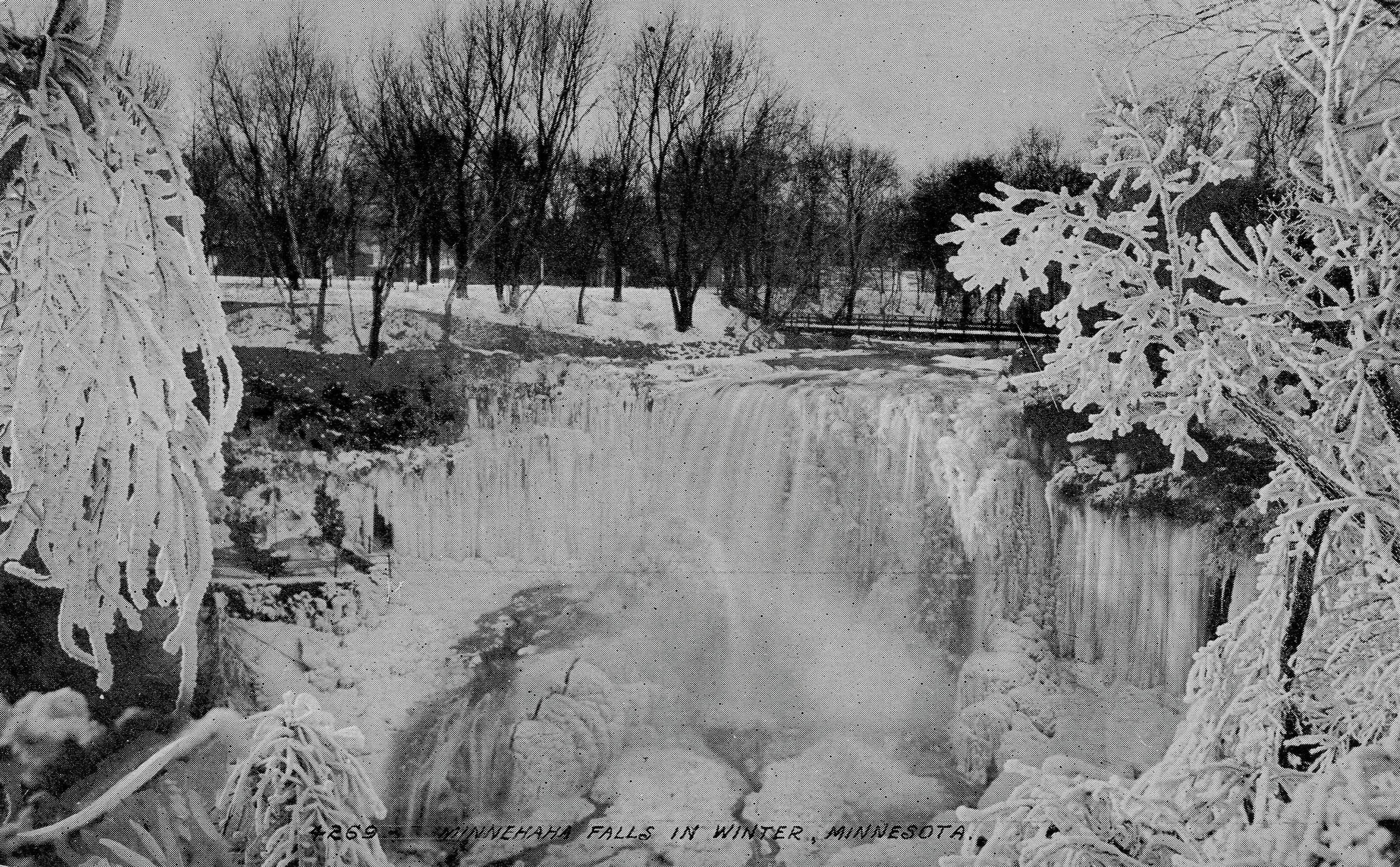
Minnehaha Falls on a postcard around 1910.
I recently received a photo from Edward Tobin Thompson of Maple Grove that I like as well as any.

Minnehaha Falls in January, 1899. (Photo courtesy Edward Tobin Thompson)
The photo, dated January 15, 1899, comes from an old family photo album. Ed doesn’t know who is standing at the foot of the falls, but it is likely the same man pictured on the park bench below, a photo that carries the same date and inscription on the back.

Resting on a bench in Minnehaha Park, January 1899. Judging from the hat, this may be the same man posing in front of the falls. (Photo courtesy Edward Tobin Thompson)
Ed guesses that the man is one of his Tobin ancestors. The Tobins immigrated from Ireland and settled in Wisconsin about 1846, he says. They later lived in the Upper Peninsula of Michigan before moving to Montana.

An imitation Minnehaha Falls? Date and place unknown. (Courtesy Edward Tobin Thompson)
Ed also sent this photo of a waterfall without a label from the same album and he wondered if it could be Minnehaha Falls as well. I don’t think so because in hundreds of pictures I’ve never seen the lip of the falls or the pattern of falling water like this, or the pool of water below the falls so large. Any opinions? Are you watching, Karen Cooper? (Karen has to be the world’s leading authority on images of Minnehaha Falls.) If not Minnehaha Falls, what falls? Any other cataracts in Wisconsin or Minnesota like this? Send in your guesses.
Danger Under the Falls
When photos appeared in the StarTribune recently of people behind the frozen falls, it brought to mind a story from Frank Leslie’s Illustrated Newspaper dated December 25, 1869, which was featured in Minnesota History, the magazine of the Minnesota Historical Society.

An engraving of photographer Charles Zimmerman being knocked unconscious by an icicle, November 28, 1869.
The article described a near tragedy when the falls wasn’t completely frozen. The article was illustrated by the engraving at right. This is how the events involving well-known photographer Charles Zimmerman were originally described in the newspaper:
“Wishing to obtain winter views of a place Longfellow has immortalized in his classic verse, Mr. Zimmerman passed under the falls. An hour later, a Mr. Haines, while exploring the rocks, happened to look behind the curtain of water as it leaped from the edge of the precipice to the abyss beneath and was startled by what he saw. A large icicle weighing between two and three hundred pounds, loosened by the thaw, had severed its connection with the roof above, and had fallen on Mr. Zimmerman, crushing him down, and leaving him insensible beneath it. Mr. Haines quickly relieved the prostrate artist, whom he found nearly frozen. Indeed, had succor been delayed half an hour longer, the unfortunate man would have most certainly died.”
The photographer conked on the head by the giant icicle, Charles Zimmerman, became one of the most prolific shooters of scenes in St. Paul and Minneapolis in the late 1800s. Most of his photographs were sold as stereoviews, the side-by-side photos that took on a 3D appearance when viewed through a stereoscope. If Zimmerman had perished that day under the ice of Minnehaha Falls we would not have nearly so thorough or enjoyable a record of life in Minneapolis in the 19th Century.
Don’t Be Left Insensible
I’d recommend that you not climb up under the falls either. (It is illegal!) Maybe you will do something memorable someday, as Charles Zimmerman did, if you live a little longer.
David C. Smith
© 2015 David C. Smith
1911 Minneapolis Civic Celebration: Junk Mail
Filed under: Minneapolis Lakes, Minneapolis Park Board, Minneapolis parks | Tags: 1911 Minneapolis Civic Celebration, Cedar Lake, Chain of Lakes, Kenilworth Lagoon, Lake Calhoun, Lake of the Isles, Southwest LRT
Leave a comment I have neglected these pages in recent months, yet I have so many good park stories to tell, some of them from readers. I will get to them soon I hope. In the last eight months I have discovered more fascinating information about Minneapolis parks and the people who created them than at any time since my initial research for City of Parks. But until I can get to those stories, I wanted to show you one of the more interesting bits of history I’ve encountered recently. Garish, but oddly charming.
The images below are of a promotional envelope used by a Minneapolis merchant in advance of the July 1911 Civic Celebration that was conceived primarily to celebrate the digging of the channel that connected Lake Calhoun with Lake of the Isles — as is noted at the bottom of the envelope. I found these images on an Ebay auction site and use them with permission of the seller of the envelope who sells mostly postal history under the name of “gregfree”. This envelope is for sale at an opening bid of $150 — more than I can pay. I appreciate gregfree’s willingness to let me share the image with you. Maybe you should buy it. If you do, thank him for me.

A promotional envelope used by a Minneapolis merchant. One of the objectives of the Civic Celebration was to give businesses an opportunity to contact, perhaps entertain and certainly solicit business from their clients throughout the region.
I love the background in green, a photo of the Stone Arch Bridge and Mill District, laid over a map of the city that shows the Chain of Lakes and Minnehaha Creek meeting the Mississippi River in the lower right corner.

The back of the envelope is an advertisement for Minneapolis, and from my perspective the lede is not buried — “Public Park System Unequalled.” That puts the emphasis exactly where it should be!
It’s nice to know that Minneapolis also had the lowest death rate in the United States. How that was measured, I’m not sure.
The coincidence of me finding this image now has a bit of Ouija-Board spookiness to it, because the lake connections have been on my mind — and in the news — a good bit lately. The channel that was celebrated 103 years ago between Isles and Calhoun has been in the news because the developer of a residential building at Knox Avenue and Lake Street has been pumping millions of gallons of water from a flooded underground parking garage into that channel, which has prevented it from freezing and caused considerable increase in phosphorous levels in the lake. More phosphorous means more algae. The Park Board and the City have sued to stop the pumping. Good! Such negligence on the part of a developer is astonishing. Hmmm, what do you think might happen if you put a parking garage below the water table between two lakes? I’m no engineer, but I think I’d be a tad suspicious of anyone who told me, “Hey, no problem.” The next time you hear people complaining about too much government regulation, ask them if it’s cases like this that they have in mind? I hope the Park Board uses every weapon at their disposal in this case to protect our lakes.
The other lake connection issue is not so clear-cut, but may be more important. That is the issue of tunneling under or bridging over the Kenilworth Lagoon that connects Lake of the Isles and Cedar Lake in order to build the Southwest LRT.
The history of other interests, public and private, wanting to take a little park land here or there for this or that good idea is long and sordid. For decades the park board has had to fight those who wanted just an acre or a little easement across park property. If the Park Board had acquiesced, all we’d have left of a magnificent park system would be a couple triangle parks. The reasons for taking park land have often been legitimate. For instance, I’m strongly in favor of better mass transit in Minneapolis and the entire Twin Cities metro area, but only if it doesn’t harm parks — or even the notion of parks. Is a tunnel or a bridge over Kenilworth channel better for the LRT? That question and a hornets nest of others, isn’t the right place to start. The only place to start in my very prejudiced opinion is with “Will it harm park property?” If the Park Board determines that the answer to that question is “Yes,” it is obliged to oppose those plans with all its might — regardless of how small the “harm.” Because in historical terms, “harm” seems more than precedent, it is invitation.
I have more to write about the issue. Did you know that the Park Board once went to the United States Supreme Court to prevent the State of Minnesota from taking Minneapolis parkland? True story. Til then quite an interesting envelope. Thanks again gregfree.
David C. Smith
© 2014 David C. Smith
More Edith Cavell School and Park
Filed under: Minneapolis Park Memory, Minneapolis parks | Tags: Cavell Park, Edith Cavell School
Comments (3) Virginia (Dregger) Dantona sent a note a few weeks ago about my post on Edith Cavell Park and School. She included two photos and a recollection of the school and playground that I thought other readers would appreciate.
Virginia wrote: “I could not resist sending you two pictures of my classmates who enjoyed the playground before it became a park. The one taken on the steps of the school dates to 1944 or 1945, the other, by the side of the school, a few years earlier.”
![An informal class photo at Edith Cavell School from 1944 or 1945. (Photo courtesy of Virginia [Dregger]Dantona)](https://minneapolisparkhistory.com/wp-content/uploads/2014/11/cavell.jpg)
Edith Cavell School classmates in 1944 or 1945. (Virginia [Dregger] Dantona)
![Edith Cavell class in early 1940s. (Virginia [Dregger] Dantona)](https://minneapolisparkhistory.com/wp-content/uploads/2014/11/cavell-early-40s.jpg)
Some of the same kids a few years earlier. (Virginia [Dregger] Dantona)
Hardly a man is still alive, who remembers this catch in ‘45.
Bad weather meant indoor recess, held in Edith Cavell’s long hallway. We were playing volleyball, and the ball struck the ceiling fixture! As it fell, the fixture turned over, so the light bulb was on top, with its open glass shade beneath. It fell safely into my waiting hands, and became a vivid memory.
Thanks for the memory, Virginia. Other readers have commented on the original post, so you might check there to see more recollections of former Cavell students.
If you have memories of your favorite park or playground—or school playground that became a park—send me a note.
David C. Smith
Minneapolis Speed Skating Update
Filed under: Minneapolis parks, Winter Sports | Tags: 1952 Winter Olympics, Powderhorn Park, Speed Skating
Comments (1) The articles I’ve posted on speed skating have been among the most widely read of all topics I have covered. Many readers also have added comments that are full of interesting information and reminiscences. So I would encourage anyone interested in the history of speed skating in Minnesota, especially at Powderhorn Park, to revisit those posts to catch up on the latest info. (Click on “Speed Skating” under “Popular Tags” at right for a list of articles.)
Along those lines, I got a recent note from Patrick Fitzgerald that the description of the photo of the 1948 Olympic team was correct even though it was taken in February, 1947. The 1948 team was selected based on results of the National Championships the year before.
Bob Fitzgerald was the first man named to the 1948 team as a result of his winning the Senior Men’s National Championship in January, 1947, a repeat of his 1946 title. Both times he edged out Ken Bartholomew, another Minneapolitan, for the title.

Who is this Bearcat skater?
A reader sent me a copy of the 11 x 14 photo above of an unknown skater, which he had found at a local garage sale. He purchased the photo as well as the size 10 Riedell skates the man in the photo was wearing. We believe he is wearing the uniform of the Bearcats from around 1950. Can anyone identify the skater?
I hope to have more recollections of the Powderhorn skating scene from the 1940s sometime this fall.
David C. Smith
© 2014 David C. Smith
The Last of the Deluge: Minnehaha Creek Floods Meadowbrook Golf Course
Filed under: Minneapolis Golf Courses, Minneapolis parks, Minnehaha Creek | Tags: Hiawatha Golf Course, Meadowbrook Golf Course, Minnehaha Creek, Theodore Wirth Golf Course
Leave a comment Ok, enough about flood waters—but I had to post a couple more shots of water winning. These were taken at Meadowbrook Golf Course, the Minneapolis park course located in St. Louis Park and Hopkins on Excelsior Boulevard. (Click here to learn why the Minneapolis Park Board owns a golf course outside city limits. In fact, it owns four courses outside of Minneapolis: Theodore Wirth, Francis A. Gross, Fort Snelling and Meadowbrook.)

Meadowbrook Lake! Meadowbrook Golf Course — seen here from Excelsior Boulevard in St Louis Park — usually doesn’t have a lake in the middle of it. A pond on Minnehaha Creek on the eastern edge of the course — several hundred yards from this scene — was created in the late 1920s shortly after the course opened, because high water in the creek flooded part of the course. The pond was dredged to hold potential flood water and the earth dredged for the pond was used to raise the level of the course around it. That has worked pretty well through the history of the course — but not when Minnehaha Creek rises this much. This photo was taken more than a week after the heavy rains of June 19. (David C. Smith)
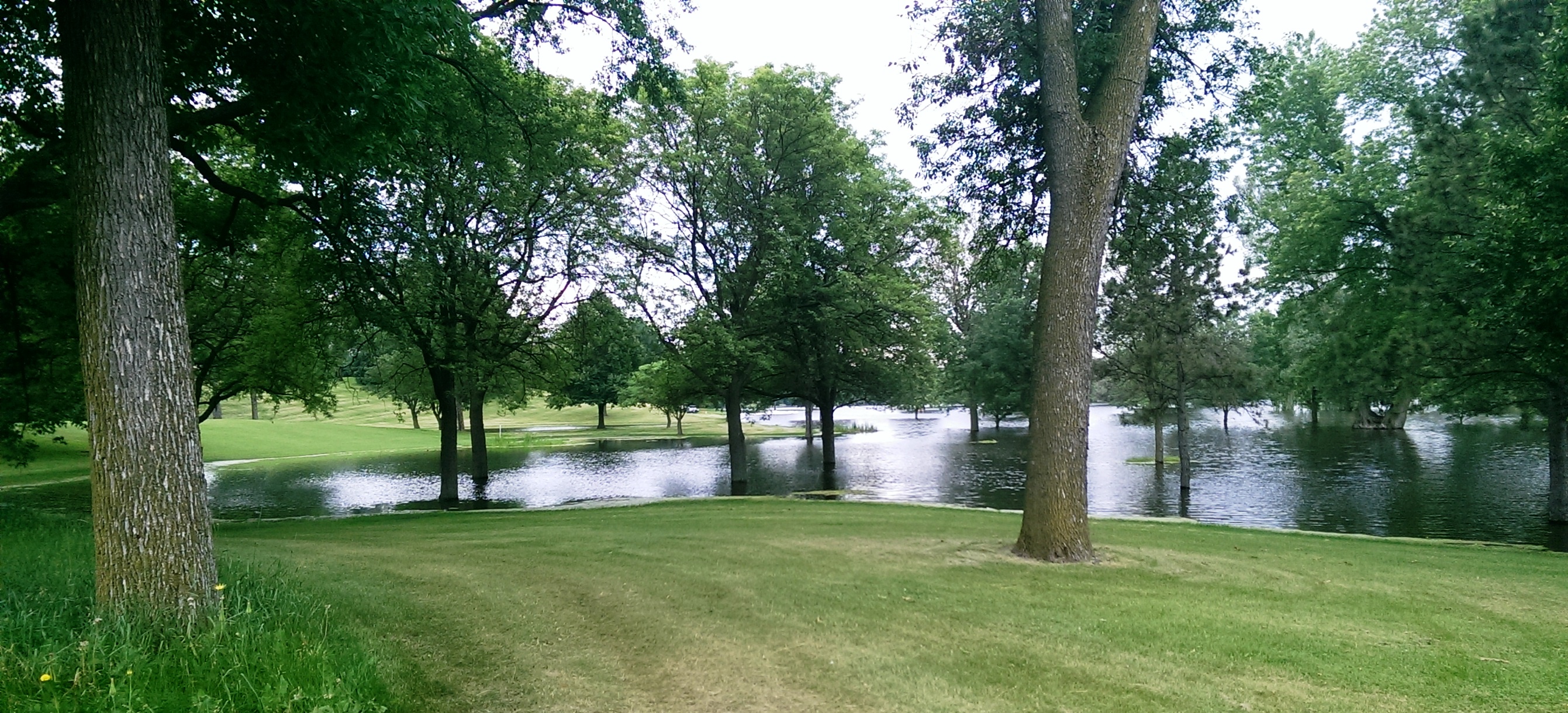
Another shot of the new lake in Meadowbrook Golf Course taken from near Excelsior Boulevard. (David C. Smith)

A different “lake” view, this looking east from Meadowbrook Road through the heart of the golf course. The 14 water hazards the course normally features appear to have merged into one. (David C. Smith)
As of this afternoon, the only Minneapolis public courses that remain closed due to flooding are Meadowbrook and Hiawatha. Only this afternoon, Theodore Wirth began allowing the use of carts again. There is no target date for when the two closed courses will reopen, but it’s likely to be awhile—especially with another 2-4 inches of rain forecast for this weekend.
Not only will cleanup and repair of these courses be expensive, but the revenue they typically generate will be lost to the Park Board for much of the summer.
David C. Smith
© 2014 David C. Smith
Mississippi River flood
Filed under: Minneapolis parks, Minnehaha Creek, Minnehaha Falls, Mississippi River | Tags: Ford Dam, Minnehaha Falls, Mississippi River
Leave a comment Saturday afternoon I spent a bit more time looking at high water around the city. On that gorgeous afternoon, Minneapolis parks were heavily patronized, partly because of the beautiful day and partly because people were curious about the effects of our summer deluge.
The banks of the Mississippi River that I helped clean in April were under water again. Maybe when these flood waters subside, Friends of the Mississippi River should sponsor another trash pick up. Or we could each take a trash bag along when we go out for riverside hikes.
More evidence of high water on the big creek at the Ford Dam.

High water over the Ford Dam, June 21, 2014. Late last summer, there was no water flowing over the dam and below the dam was mostly dry land. (David C. Smith)

Last summer you could walk from the locks to the island where the submerged trees are now. The Ford Dam is just to the left of this photo. (David C. Smith, June 21, 2014)
Both photos were taken from the bluff at Minnehaha Park and the Soldiers Home. Water levels in Minnehaha Creek had subsided little, if at all, from Thursday to Saturday. Water was still thundering over Minnehaha Falls.
David C. Smith
Minnehaha Falls and Creek: Flood Stage
Filed under: Minneapolis Lakes, Minneapolis parks, Minnehaha Creek, Minnehaha Falls | Tags: Hiawatha Golf Course, Minnehaha Creek, Minnehaha Falls, Minnehaha Parkway
Comments (10) As we await another early evening thunderstorm, I will post a few historic photos of Minnehaha Creek and Minnehaha Falls taken earlier this afternoon. I call them historic because I’ve never seen the creek this high. One man I encountered on my explorations claimed it was a record water level for the creek. I’ll have to look that up.
The entire length of the creek was flooded, of course, even a few hours after the rain had stopped, but these three photos establish landmarks.

The bridge to nowhere. The creek normally flows under the bridge near the top of the photo. Minnehaha Parkway at Humboldt Avenue South, south of the Lynnhurst Recreation Center. (David C. Smith)
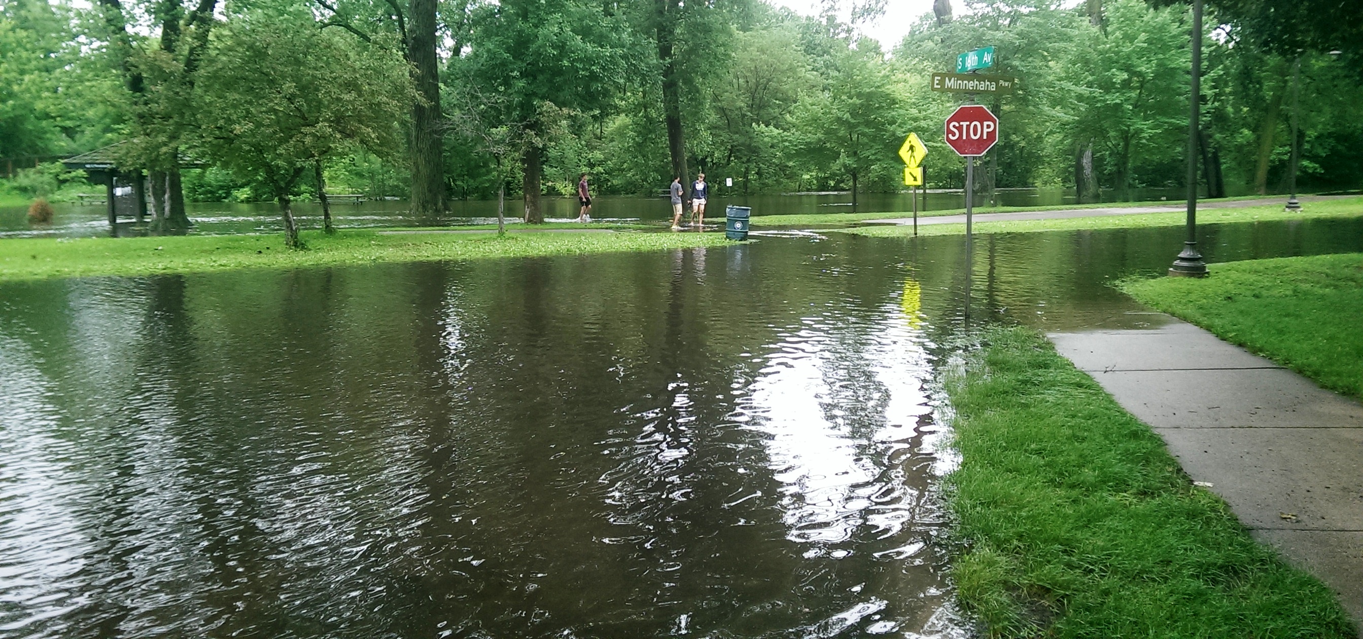
Minnehaha Parkway at 16th Avenue South. (David C. Smith)

Looking west on Minnehaha Parkway at Cedar Avenue South. (David C. Smith)
A man I met near Cedar Avenue claimed that the water reached a similar level after a 1988 thunderstorm, but the water subsided very quickly. Today it didn’t. Minnehaha Parkway was barricaded at many points east of Lake Harriet.

More than a water hazard. Hiawatha Golf Course looking south from E. 43rd Street near Standish. That is not Lake Hiawatha in the foreground. (David C. Smith)

A romantic interlude at the famous rapids of Minnehaha Creek! This is only a few yards upstream from the Hiawatha statue. (David C. Smith)
Some early descriptions of the Falls mentioned the heavy mist generated by the falls. That was true today. There was no rain falling while I was taking the pictures below, but I could feel the water in the air. Not quite as dramatic as Victoria Falls, where the cloud of mist over the falls is visible for miles — it’s called Mosi-o-Tunya, the Smoke that Thunders — but still impressive for this normally modest stream in mid-summer.
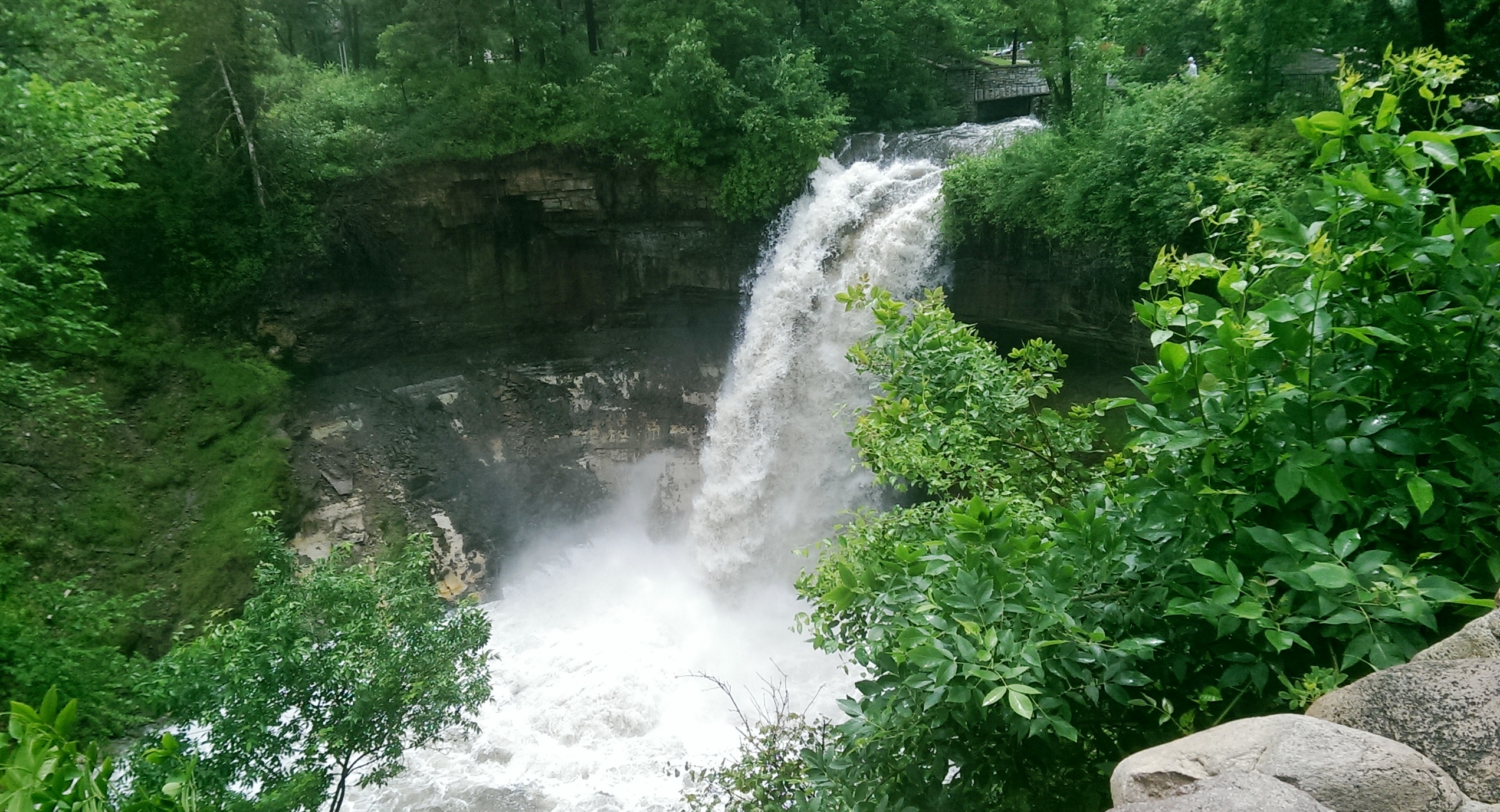
The falls made famous by Henry Wadsworth Longfellow. I recently discovered startling early plans for the park at the falls that I am waiting for permission to reveal. Stay tuned. (David C. Smith)
Unfortunately such high water levels, like the strong winds of recent years, require expensive cleanup efforts from the park board, stretching already tight park maintenance budgets. Kudos and thanks to the park board crews that will put our water-logged parks in beautiful condition yet again.
David C. Smith
© David C. Smith
Does anyone have any pictures to post of Bassett’s Creek in Theodore Wirth Park or downstream to Bryn Mawr before it dives underground? Is Shingle Creek any better?
Lake Harriet: The Heart of the Minneapolis Park System
Filed under: Lake Harriet, Lyndale Park, Minneapolis parks | Tags: H.W.S. Cleveland, Horace Cleveland, Lake Harriet, Lake Harriet Pavilion, Lyndale Park, William Berry Park
Comments (2) NOTE: The following outline and photos introduce the important role of Lake Harriet in the creation and growth of the Minneapolis park system. While much of this information is familiar to Minneapolis residents, I prepared this presentation for students visiting Minneapolis today from University of Wisconsin Eau Claire. I thought other readers of minneapolisparkhistory.com might enjoy the images and information as well. For more in-depth info visit the history pages of the Minneapolis Park and Recreation Board. For a more complete picture of the parks surrounding Lake Harriet see the history of Lake Harriet, but also of William Berry Park and Lyndale Park.
If the prized Minneapolis park system were a living thing, Lake Harriet would be its heart. The Grand Rounds — 60 miles of parkways threaded through the city — would be the rest of the circulatory system of veins and arteries. The analogy holds more for the creation of the park system, with parkways radiating out from Lake Harriet and back, than for the current function of Lake Harriet in the system.
Lake Harriet and Lake Calhoun had always been primary targets of people in Minneapolis and St. Anthony who believed the growing towns needed parks. For decades, residents of the small towns beside St. Anthony Falls had taken Sunday excursions to the shores of the lakes for picnics and relaxation. As early as 1869, the Board of Trade, a chamber-of-commerce type organization, had voted to acquire the shores of Lake Calhoun for a “pleasure drive” and had secured commitments from all landowners around the lake except one to donate their shoreline for that purpose. That one unnamed holdout must have torpedoed the entire plan.
When the Minneapolis park board was created by an act of the Minnesota Legislature and ratified by Minneapolis voters in 1883, it was well-understood that the lakes would become part of a new park system. Proof was easy: the legislature expanded the city limits of Minneapolis to include Lake Harriet at the same time it created the park board. One went with the other.
One of the park board’s first acts was to hire landscape architect and park advocate H. W. S. Cleveland to advise the board on the creation of parks. About a month later Cleveland presented his “Suggestions” to the broad for a new park system featuring interconnected parkways rather than just a couple large parks. The map that accompanied his suggestions, below, shows in red the parkways he recommended. Note that only Lake Harriet is fully encircled by parkway, the “heart” of this circulatory system.

Horace Cleveland proposed this system of parks and parkways in 1883. (Minneapolis Park and Recreation Board)
The map provided a blueprint for a park system that the park board tried to implement. Although the board failed to acquire many of the specific routes proposed by Cleveland — and added others — the concept of a system of parkways encircling the city eventually became the Grand Rounds parkway system of today.
Cleveland used another anatomical metaphor in the park system he proposed that focused on what was most important to him. He called the Mississippi River gorge and parkways on both sides the “lungs” of the city. He meant that a corridor of green on both sides of the river — the “jewel” of the city — would provide a flow of fresh air through the city north to south, which would help prevent pollution and disease. It was not a coinage that originated with Cleveland, but had been used to advocate city parks in the dense and squalid urban cores of Paris and London since early in the century.
In fact, however, the Grand Rounds parkway system had its start at Lake Harriet and the rest of the parkways followed. It was the first parkway the park board attempted to acquire. A first appraisal of the shores of the lake put the cost at $300,000, much more than the park board could legally spend. Then landowners Henry Beard, Charles Reeve and James Merritt approached park board president Charles Loring with an offer: they would donate to the park board a strip of land 125 feet wide that nearly encircled the lake. The park board gratefully accepted that offer in 1885. (Ownership of a portion of that land was being contested at the time in court and a court ruling returned much of the land to William S. King, then a park commissioner. He honored the deal already struck with the other landowners and the park board owned a strip of land for a parkway around most of the lake.)
The park board’s other parkway projects revolved primarily around creating routes from other parts of Minneapolis to Lake Harriet. Hennepin Avenue was acquired to be a parkway connection from Central (Loring) Park to Lake Harriet. But when heavy traffic on that road dimmed its prospects for ever being a parkway, an alternative route to Harriet was found. Land was donated for Kenwood Parkway from Central Park to Lake of the Isles, then around Lake of the Isles, which hadn’t figured at all in Cleveland’s plan, to Lake Calhoun. The park board purchased the eastern shore of Lake Calhoun, at what Loring considered an exorbitant but necessary price, to reach the southern tip of Lake Calhoun. From there, Linden Hills Boulevard, also acquired from Henry Beard, would carry traffic to Lake Harriet.
Cleveland conceived of another major circulatory connection to Lake Harriet as a parkway east from Lake Harriet to the Mississippi River. He envisioned that to be Lake Street, but that thoroughfare already was home to a concentration of businesses that made it too expensive to acquire. The route east from Harriet that later emerged, largely due to free land, was Minnehaha Creek. Although much farther south and far from the central city neighborhoods that Cleveland thought would need a parkway, Minnehaha Parkway became the park connection to Minnehaha Falls and the river parkways.
Even the parkways from the Lake District into north Minneapolis were really arteries directly from the north side to Lake Harriet. When it became evident that Lyndale Avenue could not be converted into a parkway from Central Park north, the park board looked to the west to connect Lake Harriet via Cedar Lake and what eventually became Theodore Wirth Park and Parkway to north Minneapolis. Once again the appeal, at first, was the prospect of free land along that route from William McNair, a friend of the parks and several park commissioners.
Further supporting the Lake Harriet-as-heart metaphor is that the northern half of the Grand Rounds was inspired by what had already occurred in the southern half of the city connecting lakes, river, and creek to Lake Harriet. William Folwell, former University of Minnesota president, park commissioner and Cleveland’s close friend, urged the park board in a special report at the end of 1890 to return to the vision of Cleveland. In his report, he urged the board to resurrect and finish the system of parkways throughout the city that Cleveland had suggested. Folwell even gave that system of parkways, which began and ended at Lake Harriet, a name for the first time: Grand Rounds.
To the Water’s Edge
The parkway at Lake Harriet also established another critical precedent in the history of Minneapolis parks. In keeping with Cleveland’s plan for an interconnected system of parkways, the park board wanted a parkway around the lake instead of just a large park beside it. The parkway acquired encircled the lake on its shoreline. That meant the park board owned the entire lake and it established that precedent for later acquisitions at Lake of Isles, Lake Calhoun, Minnehaha Creek, even the Mississippi River gorge. Nearly everywhere in Minneapolis, the park board owns the water front. The only places that is not true today is the banks of the Mississippi River above the falls, and that is in the process of being acquired piece by piece, and those parts of Bassett’s Creek that had been tunneled below ground even before the park board was created.
The unique and defining feature of Minneapolis today is not only the lakes and creeks and river running through it, but that almost all land abutting those bodies of water is publicly owned and preserved as parkland. We aren’t restricted to a glimpse of water between mansions built on lakeshores; the people own the lake shores. The effect on the prosperity of the city has always been significant. As Minneapolis park board studies have shown, property values are increased not only adjacent to the lakes, creeks and river but up to several blocks away from those amenities because they are publicly owned and freely accessible.
Donation of Land
Another reason for the centrality of Lake Harriet to the development of the Minneapolis park system was the means by which the park board acquired the Lake Harriet shoreline: it was donated. That also established a precedent that Charles Loring, in particular, was very successful in replicating. Loring secured other land donations in the few years after the donations at Lake Harriet by Beard, Reeve, Merritt and King: Kenwood Parkway, most of Lake of the Isles, half of Lake Calhoun, part of Cedar Lake, much of Minnehaha Creek, Stinson Parkway, Lyndale Park and The Parade. Even much of the river gorge was sold to the park board well below market value.
Let Us Entertain You
Lake Harriet was also the heart of park board expansion into new areas, especially providing entertainment and recreation. Entertainment at the lake began at a pavilion built by the street railway company on private land beside the lake, but became one of the most popular destinations in the city after the park board allowed the street railway company to build a pavilion on the shores of the lake in 1892. The park board didn’t provide the entertainment directly, but did exercise considerable control over the types of entertainment the railway company was allowed to present. That entertainment did not always meet the approval of all park commissioners, but it continued because people liked it and turned out by the thousands. It is one of the first examples of the nature of parks being adapted to what people wanted.

The first pavilion built on the Lake Harriet shoreline in 1892. The pavilion was designed by Harry Wild Jones. This view is from the streetcar station in about 1895. (Minnesota Historical Society.)
Another important attraction at the Lake Harriet Pavilion were row boats. One of the donors of land around the lake, Charles Reeve, offered in 1887 to pay the park board $1,000 for the right to rent boats and sell refreshments at the lake. Competitive bidding pushed the price up to $1,250, a large sum in the day, before Reeve gained concession rights. But by 1889 the park board realized it could make a nice profit running the boat and refreshment concessions itself and purchased Reeve’s boats.

The park board’s boats for rent next to the Lake Harriet pavilion in 1895. (Minnesota Historical Society)

When the first lakeside pavilion burned down, it was replaced by another Harry Wild Jones-designed structure that extended into the lake in 1904. At the new pavilion, musical performances took place on the roof. The bandshell pictured had terrible acoustics and was replaced after one year. The bandstand was moved to the east side of the lake at 46th Street as a lookout. The boat rental business continued to thrive. (Minnesota Historical Society)

View from the bandstand on top of the Lake Harriet Pavilion in 1905. Notice how far down the shore the boat dock stretches. A seat on the roof for a concert cost 25 cents. (Minnesota Historical Society)

The crowd at a concert on the pavilion roof in 1912, photographed from the stage. (Charles J. Hibbard, Minnesota Historical Society)
The Bicycle Craze
Active recreation–physical exercise–began at Lake Harriet with boating and canoeing, but then along came the bicycle craze of the 1890s and the park board continued what has become a long tradition of accommodating what people wanted from their parks.
Bicycling was so popular that the park board built a bicycle path around the lake in 1896. So many people rode bicycles to the lake that the park board built an enclosure where people could check their bicycles while they were at the pavilion or renting a boat. It was built to hold 800 bicycles. Soon after, the park board built bicycle trails along Minnehaha Creek as well.

One of my favorite Minneapolis park photos shows the bicycle path around Lake Harriet in 1896. This was the first bicycle path in Minneapolis. The layout of walking path, bicycle path and carriage road is almost identical to today. (Minneapolis Park and Recreation Board)
These are just the beginning of the accommodation of public desires at Lake Harriet and then other park properties. What began at Lake Harriet, like the parkways radiating out from it, quickly extended to other parts of the park system even as new amenities were added at Lake Harriet. From the picnic shelter at Beard Plaisance on the west side of the lake in 1904 to the Rose Garden created on the east side of the lake in 1907, the throngs drawn to the lake were regularly provided new attractions.
David C. Smith
© 2014 David C. Smith
Minnehaha Park Fireplace Mystery Solved
Filed under: Minneapolis parks, Minnehaha Falls | Tags: Folwell Park, Keewaydin Park, Marv Nelson, McRae Park, Minneapolis Veterans Hospital, Minnehaha Dog Park, Minnehaha Park
Comments (3) The mystery of the fireplace in the dog park at Minnehaha Park has been solved thanks to reader “Tom.” Many people have followed this issue or expressed an interest in it and I know that many readers don’t check back to see comments on posts, so I wanted to bring this comment to your attention.

The fireplace surrounded by picnic tables in 1935. (Minnesota Historical Society)
This is the photo of the fireplace that Tom found in the collection of the Minnesota Historical Society, which includes more than 230,000 photographs. As I’ve noted many times, that collection is invaluable and immensely enjoyable. The picnic ground belonged to the Minneapolis Veterans Hospital according to the photo description. Tom further notes that the park board acquired this land in 1959. Thanks for your comment, Tom. Does anyone want to tell us when the fireplace and picnic ground were built?
Excellent Comments
I would suggest that you check back on your favorite park subjects occasionally to see recent comments, or subscribe to comments on any post. Especially interesting in recent months have been
Chuck Solomon’s comment in which he named all of the coaches and nearly every player from a McRae Park football photo
Another tribute to Marv Nelson, a youth football coach at Folwell Park in the 1960s and 1970s
Memories of Keewaydin Park, especially kids’ games and hockey.
These are just a few of the comments in recent months. Thanks to everyone who has commented on the articles here or has contacted me personally with more stories. I appreciate them all. Stories: that’s what this web site is all about.
David C. Smith
© 2014 David C. Smith
Logan Park Field House Centennial: Public Input, Public Outrage
Filed under: Minneapolis parks | Tags: Lebert Weir, Logan Park, Logan Park Field House
Comments (2) With dazzling talk of new parks along the river in northeast and downtown Minneapolis in 2013, an important anniversary slipped my attention. You probably missed it too: the Centennial of the first Logan Park Field House. The Logan Park Field House was arguably the most important building the Minneapolis park board has ever constructed. It opened in February 1913 amid a national movement to open “social centers” for burgeoning urban populations.
The population of Minneapolis in 2013 was about the same as it was in 1920: 380,000.
In 1940, the population exceeded 492,000; it peaked at about 550,000 in the mid-1950s.
The remarkable story of the Logan Park Field House includes the first extensive citizen input on the design of a park building—the first Citizen’s Advisory Committee (CAC), if you will—and the first park building targeted by neighborhood groups protesting “immoral” behavior. The objects of this indignation were the turkey trot, bear hug, and other dances that involved “hugging” or “wiggling.” The protestors might have collapsed dead on the spot if they had seen “grinding” or “twerking”, the cause of high school dance controversy these days.

Kids bursting out of the Logan Park Field House for the annual Easter egg hunt. (Minnesota Historical Society)
The importance of the Logan Park Field House is obviously my opinion. (I’d like to hear yours!) You could make a case for the club houses at Wirth and Columbia golf courses, which were not really recreation buildings, but were used year round for community gatherings. I consider the pavilion/bandstand at Lake Harriet and the bath houses at Webber Pool, Lake Calhoun or Lake Nokomis in a different category because they were seasonal structures, with open walls or roofs. The Webber community center did include a branch library, but it was not designed to be a multipurpose recreation facility.
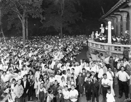
A community sing at Logan Park. The band performed from the partially covered veranda of the field house. (City of Parks, Minneapolis Park and Recreation Board.)
The field house at Logan Park was the first multi-purpose, all-season recreation center in a Minneapolis park. There had been other recreation buildings in parks — and more would soon follow — but most were little more than glorified warming houses for ice skaters until the 1960s and 1970s. A good example is the one built at North Commons in 1910, which consisted of a furnace room, toilets, an office and one large room. One of the only exceptions to this standard was the shelter in Loring Park, Charles Loring’s gift to the city when he retired from the park board (for the last time) in 1906, which featured two “kindergarten” rooms on a second floor.
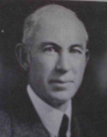
Lebert H. Weir knew Minneapolis parks well. He first conducted a survey of Minneapolis parks beginning in 1914 and repeated the process in greater depth in 1944, when he was the National Field Secretary of the National Playground Association. He also served in 1917 as the recreation director for officer training at Fort Snelling during mobilization prior to U. S. entry into World War I.
Lebert Weir, a leading figure in the national playground movement, wrote in 1944 that the recreation buildings in Minneapolis parks (other than the one at Logan) were “too large for merely shelter houses and too small for use as a general recreation building. When the central room is used as a warming room for skaters, no other, or little, use can be made of the building for recreational activities.” (Recreation Survey, 1944.) In another study of recreational needs in Minneapolis, conducted by F. S. Staley in 1915 for the Civic and Commerce Association, Staley reported that the recreation shelters in parks, other than Logan and Webber, were little more than “comfort stations”, the polite term in the day for toilets. Although Weir did not lump the Logan Park Field House with other recreation shelters in his 1944 report, he had no praise for it either, recommending that it needed to be razed or remodeled. It wasn’t replaced for another 27 years, in 1971, at a time when nearly every recreation center in the city was replaced. Weir also recommended a new center for Loring Park in 1944, supporting suggestions to preserve the original shelter, too, and make it into a clubhouse for “older men.”
Social Center Movement
The importance of the Logan Park Field House rested in the explicit recognition by the park board that it had a role in addressing social issues beyond recreation, whether passive or active. The national social center movement saw facilities such as field houses in parks as essential to weaving the fabric of community. They had much in common with settlement houses. They provided gathering places, places for self-improvement, even places where hygiene could be taught or improved. They became places for assimilation and Americanization, especially in the crowded urban cores. The social centers were truly the melting pots. They were also seen as providing an alternative social venue to saloons in a society that had been struggling for decades with what many believed was excessive liquor consumption.
The new social centers were ultimately places where an Alice Dietz could emerge as Director of Community Centers for Minneapolis parks and be seen as a friend not only to neighborhood children, but to their mothers. Dietz’s office in the 1920s, of course, was at the Logan Park Field House. In Minneapolis, as elsewhere, the construction of recreation centers was the beginning of neighborhoods being identified with—and often named for—the neighborhood park.
Park superintendent Theodore Wirth credited Chicago’s South Park District as the model for his first plans for a building at Logan Park. In his 1908 annual report he wrote:
I have been so much impressed with the immense amount of benefit derived by the entire population of good-sized districts in Chicago through some of their play parks that I could not deny myself the pleasure of working out on paper and in thought, what could be done along similar lines with our Logan Park.
Wirth’s choice of Logan Park for a new center is not surprising. It was one of the first four parks acquired by the Minneapolis park board when it was created in 1883 and it was still one of the few parks in the city that offered no distinguishing landscape features, neither lakes, streams, nor hills. That was likely the reason that the Minneapolis park board’s first landscape architect, H.W.S. Cleveland, proposed the fountain that stood at the middle of the park.
Logan had also been one of the first two Minneapolis parks to have playground equipment installed in 1906, when the park board took its first timid steps into the park and recreation era. (Riverside Park was the other.)
In his 1908 report,Wirth provided two photos of the field house at Sherman Park in Chicago to accompany his “Suggestive Plan for the Transformation of Logan Park into a General Recreation Ground”. The most prominent feature of his plan for Logan Park was a “General Recreation Building” along 13th Avenue NE. He proposed a building far, far grander than was eventually built. His proposal included an indoor swimming pool, gymnasium and lunch counter, as well as an assembly room, office and multiple club rooms. He even provided a sample of a budget for improvements at Armour Park in Chicago, which was similar in size, he said, to Logan Park. There the building, improvements and equipment had cost $170,000. As was often the case in Wirth’s proposals for Minneapolis parks, he significantly overshot what the park board would spend or neighborhoods would agree to pay in property assessments. The eventual cost of the Logan Park Field House was $40,000, with $8,000 of that chipped in by the Library Board in exchange for space to operate a branch library in the building.
While it would take another four years before the Logan Park field house was built on a reduced scale, the park board in 1908 had begun to appreciate and anticipate the larger social role it would play throughout the city. At the same time, the park board recognized its increasing role in city life, it also demonstrated that it valued the increasing role that citizens would play in the board’s decision-making.
Incidentally, it’s not likely that Wirth was among those who saw the new park field house as a weapon in the war against alcohol. When Wirth helped design a house for himself at Lyndale Farmstead later that year he would build in a hidden liquor cabinet and he would be censured later by the park board for serving alcohol to visiting dignitaries at the Lake Harriet Pavilion, where liquor was forbidden.

The new field house shortly after it opened in 1913. (Charles J. Hibbard, Minnesota Historical Society)
Citizens Advisory
The Logan Park Field House provided another first in Minneapolis park history; the park board solicited the views of the neighborhood on the architectural plans for the field house. A jury examined designs from twelve architects who submitted plans for the field house and selected those of Minneapolis architect Cecil Bayless Chapman. Designs by Downs and Eads and A. R. Van Dyke placed second and third. Based on input from a committee of the Logan Park Improvement Association on the style of building, materials, and interior arrangements, the park board’s improvement committee modified Chapman’s plan “considerably”, according to the Morning Tribune.
“This is the first time we have invited the people of any neighborhood to help us choose plans for a park building,” said President [Wilbur] Decker, “but this is the first time the park board has ever contemplated erecting a building in a park to serve neighborhood recreation purposes.” (Minneapolis Morning Tribune, Dec. 28, 1911)
The Tribune’s coverage of park board deliberations on the issue concluded with the claim that the building would have “a large assembly room that can be used for neighborhood gatherings, including dances or similar entertainments.” That would prove to be somewhat sticky.
Dance Fever
Logan Park’s field house was the focus of great controversy shortly after it officially opened February 1, 1913.
The Minneapolis Tribune wrote the next morning, “The formal exercises marked an era in Minneapolis, the beginning of the movement to open social centers in all parts of the city.” The objective, the paper wrote, was “social development and civic betterment furnished by recreational environment.”
It took barely three months for some neighborhood residents to challenge the “development” and “betterment” because of one aspect of the environment. A rumor rippled through neighborhood churches that on Saturday night, May 3, a “dance” had been held at the field house. It mattered little to the pastors of the eight churches within a block of the park that the dance had been part of a private wedding anniversary celebration. The ministers claimed that they had opposed construction of the field house the previous year until they had been assured that the facility would not be used for dances.
Park superintendent Wirth contested that such an assurance had ever been made and added that he had been assured that the only dancing at the event would be a few “old folks” dances.
At the time, dancing was a hot-button issue. In a poll of 10,000 families the week before the field house opened, the Tribune found a close correlation between those who opposed social centers and those who opposed dancing. About 21% of those polled opposed dancing and about 24% opposed social centers.
Efforts to outlaw dances, even school dances and charity balls, had passed the city council the previous year, but was vetoed by Mayor Haynes. At the time of the controversy, a bill was being introduced in the Minnesota legislature that would dramatically curtail public dance halls through licensing and prohibition of serving alcohol in them. The bill also banned “immodest” dancing and required bright lighting in rooms where dances were held. The bill eventually passed the House, but not the Senate.
The debate over dancing, like that over alcohol, was not restricted to Minnesota. In the spring of 1913, Chicago was considering an ordinance that would have mandated that dancers maintain a distance between them of no less than six inches.
The protest to the park board over dances at Logan Park didn’t get far. When a committee hearing was held on the issue, all but one park commissioner expressed himself, in the words of the Tribune, “heartily in favor of public dances, properly supervised, in the parks.” Commissioner David Jones, chair of the committee, was particularly outspoken in his defense of dancing at the parks, claiming that park dances offered a positive alternative to young people frequenting public dance halls where mixed crowds gathered without supervision. When a trustee of Emanuel Swedish Lutheran Church accused the park board of building the field house at Logan Park to “set up a worship of dancing,” Commissioner Jones demanded and received a retraction. Jones reportedly said that dancing was not a religious or even an ethical issue, but one only of “decent comportment” and he refused to allow those who opposed dancing to impose their standards on the rest of the city. The park board did concede, however, that “rag” dancing shouldn’t be permitted at dances on park property.
That was not the end of the issue. A year later, representatives of five churches returned to the park board with a new resolution to restrict dancing, and this time they had the support of the park commissioner who represented that part of the city, Portius Deming. Dancing had become too popular. The opponents claimed that the field house was booked six to eight weeks in advance for dances. They asked that dances be limited to three a week and only from October 1 to April 1. Deming’s support for the measure and his former legislative skill was evident in the wording of the resolution: it applied only to park field houses that also housed a branch library. As Logan Park had the only facility to fit that description, the restrictions wouldn’t apply in any other city park.
The neighborhood was not, however, unanimous in its opposition to dances. E. J. Comstock presented a petition from those who lived in houses that faced the park. Thirty-one of thirty-seven park neighbors favored the use of the field house for dancing.
Ultimately, the park board agreed to prohibit dances at Logan Park for the summer of 1914 while a new ordinance was written that would set stricter conditions for dances at all parks. In exchange for that compromise, Deming withdrew his resolution that applied only to Logan Park. After a summer of study, the park board passed a new dance ordinance in October that restricted dances to Tuesday and Saturday nights from 9 to 11:45 pm. Girls younger than 18 could not to be admitted and only residents of the neighborhood could attend. The question of smoking at dances was to be “tactfully handled” by park employees, whatever that meant. Curiously, while the Minneapolis Tribune reported the new policy on dancing at Logan Park on October 7, 1914, those restrictions were never part of the officially published “Proceedings” of the park board.
I can find no indication that dancing in parks was an issue of policy debate after 1914, although I wouldn’t be surprised if the issue came up at individual parks. One reason it may not have been an issue after 1914 was that despite the enormous success of the Logan Park Field House, the park board never built another like it anywhere in the city for the next fifty years. I did find an article in the Tribune about a winter carnival at Logan Park in 1920 that mentioned there was dancing both indoors and outdoors for the ten thousand people who attended. They must not have objected to dancing. Along the way, however, in 1917 the Minnesota Senate did pass a law that prohibited dancing to the Star Spangled Banner. That’s a bit surprising because the song isn’t exactly a toe-tapper — not to mention the fact that the song didn’t officially become the national anthem until a Congressional resolution passed in 1931.
The most significant lesson of the Logan Park Field House story is that, as always, the people of Minneapolis determined how parks would be used. At Logan Park, neighborhood residents first had input into how a building was designed and constructed and then, through considerable, often noisy, public debate, how it was used. One hundred years later, we still do things much the same way.
That’s worth celebrating a centennial. Here’s to the original Logan Park Field House.
David C. Smith
© 2014 David C. Smith
Another Elite Powderhorn Park Speedskater
Filed under: Minneapolis parks, Winter Sports | Tags: Powderhorn Park, Roger Mosiman, Speed Skating
Comments (2) I’ve written before about the world-class speedskaters who skated at Powderhorn Park in the 1940s and 1950s and the high-level competitions held there. Now reader Gayle Mosiman Meadows has shared more information about speedskating at Powderhorn in the 1930s, especially involving her late father, Roger Mosiman.
She sent this image of a program from a meet in 1938 that featured her father who was then 14.
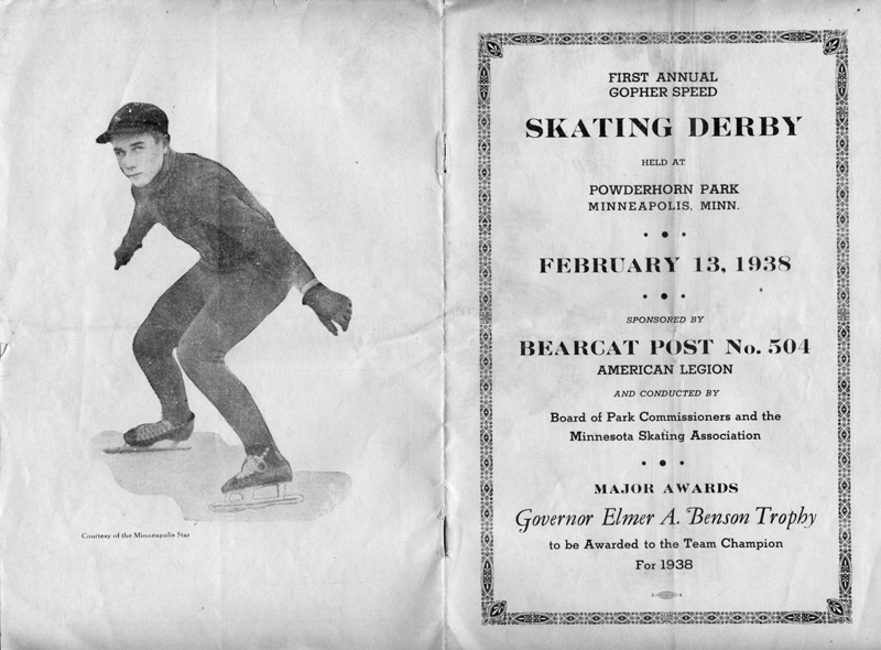
Program from 1938 speedskating event at Powderhorn Park, featuring photo of Roger Mosiman. (Gayle Meadows Mosiman)
Mosiman was likely featured on the program because at the time he held the juvenile boys national record for the fastest time in the 220 yard sprint. The national record for intermediate boys at the same distance was held at that time by Roger’s older brother, Earl Mosiman. The Bearcat American Legion Post was one of four posts that featured prominently as sponsors of speedskating teams.
Gayle also sent a copy of photo of Roger boarding a train for a skating competition in New York, likely the 1940 North American Speedskating Championship in Schenectady, NY. He is being seen off by his mother, Lillie, and his younger sister, Bernice.

Roger Mosiman boarding a train for the 1940 North American Speedskating Championship in Schenectady, NY. (Photo courtesy of Gayle Mosiman Meadows)
Roger, who attended Marshall High School in Minneapolis, finished the multi-event competition for the junior boys championship tied with Art Bulrice of Saranac Lake, NY. In a one-sixth mile race to determine the title, Roger fell and had to settle for second place. Winning the men’s title that day was future Olympian Leo Freisinger of Chicago.
After Marshall High School, Roger attended the University of Minnesota and became a navy pilot in WWII. In the 1960s, he moved to Gig Harbor, Washington. Roger died there in December 2011 at age 87.
Many thanks to Gayle for the program, the photo and the memories.
David C. Smith
© 2014 David C. Smith

 Minneapolis Park History